Bunker Hill Topo Map Mississippi
To zoom in, hover over the map of Bunker Hill
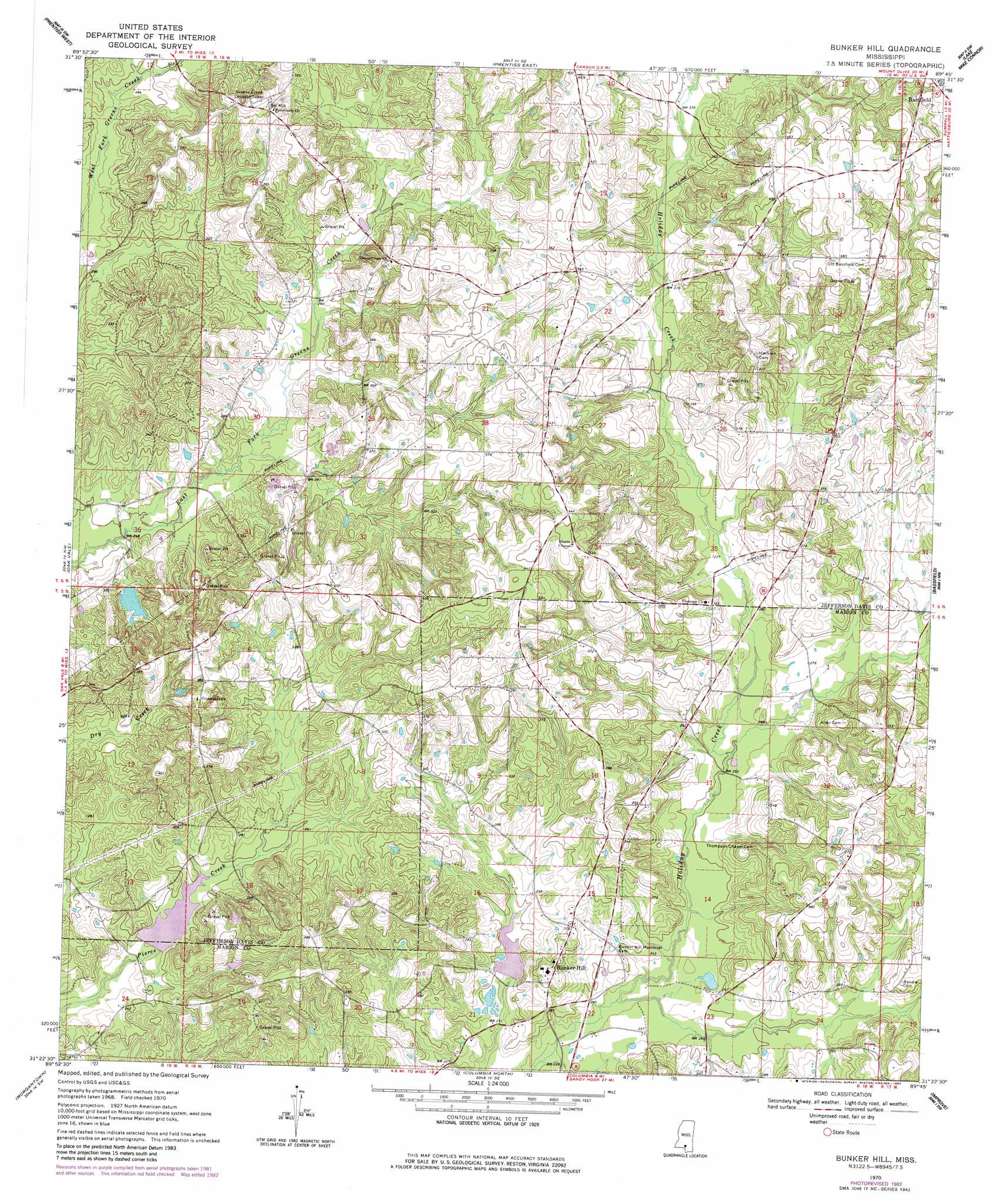
USGS Topo Quad 31089d7 - 1:24,000 scale
| Topo Map Name: | Bunker Hill |
| USGS Topo Quad ID: | 31089d7 |
| Print Size: | ca. 21 1/4" wide x 27" high |
| Southeast Coordinates: | 31.375° N latitude / 89.75° W longitude |
| Map Center Coordinates: | 31.4375° N latitude / 89.8125° W longitude |
| U.S. State: | MS |
| Filename: | o31089d7.jpg |
| Download Map JPG Image: | Bunker Hill topo map 1:24,000 scale |
| Map Type: | Topographic |
| Topo Series: | 7.5´ |
| Map Scale: | 1:24,000 |
| Source of Map Images: | United States Geological Survey (USGS) |
| Alternate Map Versions: |
Bunker Hill MS 1970, updated 1972 Download PDF Buy paper map Bunker Hill MS 1970, updated 1982 Download PDF Buy paper map Bunker Hill MS 2012 Download PDF Buy paper map Bunker Hill MS 2015 Download PDF Buy paper map |
1:24,000 Topo Quads surrounding Bunker Hill
Monticello Ne |
New Hebron |
Mount Carmel |
Lone Star |
Collins |
Monticello |
Prentiss West |
Prentiss East |
Lake Mike Connor |
Williamsburg |
Tilton |
Oak Vale |
Bunker Hill |
Bassfield |
Sumrall |
Darbun |
Morgantown |
Columbia North |
Improve |
Oloh |
Kokomo |
Sandy Hook Nw |
Columbia South |
Pinebur |
Baxterville Ne |
> Back to 31089a1 at 1:100,000 scale
> Back to 31088a1 at 1:250,000 scale
> Back to U.S. Topo Maps home
Bunker Hill topo map: Gazetteer
Bunker Hill: Dams
Dean Griner Lake Dam elevation 107m 351′Floyd Dyess Lake Dam elevation 109m 357′
Holiday Creek Structure 4 Dam elevation 73m 239′
Holiday Creek Watershed Structure 3 Dam elevation 74m 242′
Shaw Ponds Dam elevation 86m 282′
Bunker Hill: Populated Places
Bunker Hill elevation 99m 324′Ebenezer elevation 97m 318′
Old Bassfield (historical) elevation 131m 429′
Bunker Hill: Streams
Choctaw Creek elevation 108m 354′Bunker Hill digital topo map on disk
Buy this Bunker Hill topo map showing relief, roads, GPS coordinates and other geographical features, as a high-resolution digital map file on DVD:
Gulf Coast (LA, MS, AL, FL) & Southwestern Georgia
Buy digital topo maps: Gulf Coast (LA, MS, AL, FL) & Southwestern Georgia
 & Southwestern Georgia map DVD")