New Hebron Topo Map Mississippi
To zoom in, hover over the map of New Hebron
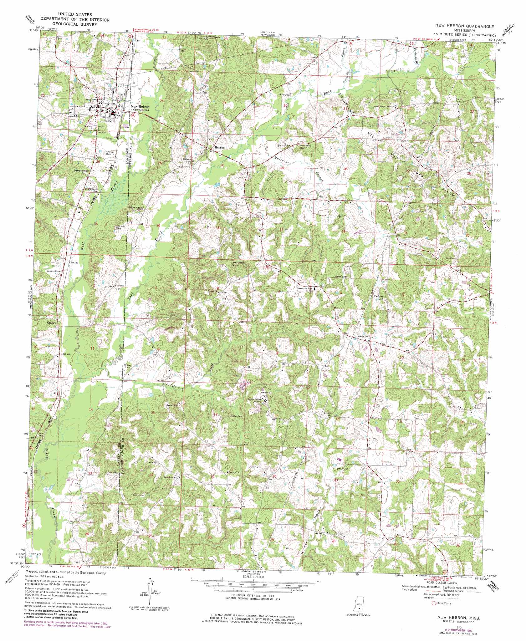
USGS Topo Quad 31089f8 - 1:24,000 scale
| Topo Map Name: | New Hebron |
| USGS Topo Quad ID: | 31089f8 |
| Print Size: | ca. 21 1/4" wide x 27" high |
| Southeast Coordinates: | 31.625° N latitude / 89.875° W longitude |
| Map Center Coordinates: | 31.6875° N latitude / 89.9375° W longitude |
| U.S. State: | MS |
| Filename: | o31089f8.jpg |
| Download Map JPG Image: | New Hebron topo map 1:24,000 scale |
| Map Type: | Topographic |
| Topo Series: | 7.5´ |
| Map Scale: | 1:24,000 |
| Source of Map Images: | United States Geological Survey (USGS) |
| Alternate Map Versions: |
New Hebron MS 1970, updated 1972 Download PDF Buy paper map New Hebron MS 1970, updated 1982 Download PDF Buy paper map New Hebron MS 2012 Download PDF Buy paper map New Hebron MS 2015 Download PDF Buy paper map |
1:24,000 Topo Quads surrounding New Hebron
Hopewell |
Harrisville |
Mendenhall West |
Mendenhall East |
Magee North |
Georgetown |
Schley |
Shivers |
Mendenhall Se |
Magee South |
Oma |
Monticello Ne |
New Hebron |
Mount Carmel |
Lone Star |
Nola |
Monticello |
Prentiss West |
Prentiss East |
Lake Mike Connor |
Topeka |
Tilton |
Oak Vale |
Bunker Hill |
Bassfield |
> Back to 31089e1 at 1:100,000 scale
> Back to 31088a1 at 1:250,000 scale
> Back to U.S. Topo Maps home
New Hebron topo map: Gazetteer
New Hebron: Dams
R G Bilbo Lake Dam elevation 128m 419′New Hebron: Populated Places
Hebron elevation 112m 367′New Hebron elevation 113m 370′
New Hebron: Streams
East Prong Silver Creek elevation 88m 288′Fiddlers Creek elevation 89m 291′
Gwinville Branch elevation 111m 364′
Hutchens Branch elevation 106m 347′
Partman Branch elevation 116m 380′
West Prong Silver Creek elevation 88m 288′
New Hebron digital topo map on disk
Buy this New Hebron topo map showing relief, roads, GPS coordinates and other geographical features, as a high-resolution digital map file on DVD:
Gulf Coast (LA, MS, AL, FL) & Southwestern Georgia
Buy digital topo maps: Gulf Coast (LA, MS, AL, FL) & Southwestern Georgia
 & Southwestern Georgia map DVD")