Shivers Topo Map Mississippi
To zoom in, hover over the map of Shivers
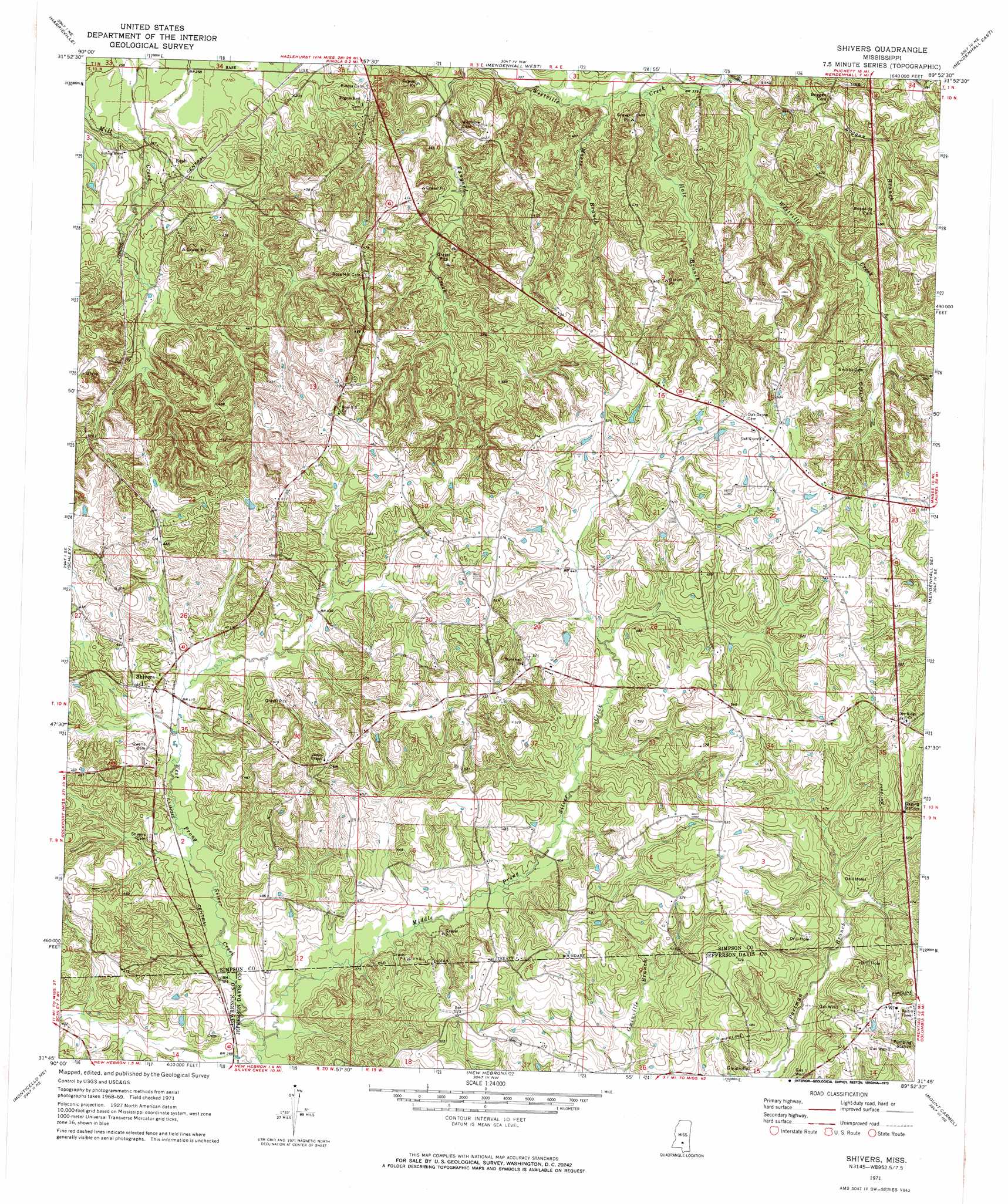
USGS Topo Quad 31089g8 - 1:24,000 scale
| Topo Map Name: | Shivers |
| USGS Topo Quad ID: | 31089g8 |
| Print Size: | ca. 21 1/4" wide x 27" high |
| Southeast Coordinates: | 31.75° N latitude / 89.875° W longitude |
| Map Center Coordinates: | 31.8125° N latitude / 89.9375° W longitude |
| U.S. State: | MS |
| Filename: | o31089g8.jpg |
| Download Map JPG Image: | Shivers topo map 1:24,000 scale |
| Map Type: | Topographic |
| Topo Series: | 7.5´ |
| Map Scale: | 1:24,000 |
| Source of Map Images: | United States Geological Survey (USGS) |
| Alternate Map Versions: |
Shivers MS 1971, updated 1973 Download PDF Buy paper map Shivers MS 1971, updated 1973 Download PDF Buy paper map Shivers MS 2012 Download PDF Buy paper map Shivers MS 2015 Download PDF Buy paper map |
1:24,000 Topo Quads surrounding Shivers
Whites |
Star |
Braxton |
Puckett |
White Oak |
Hopewell |
Harrisville |
Mendenhall West |
Mendenhall East |
Magee North |
Georgetown |
Schley |
Shivers |
Mendenhall Se |
Magee South |
Oma |
Monticello Ne |
New Hebron |
Mount Carmel |
Lone Star |
Nola |
Monticello |
Prentiss West |
Prentiss East |
Lake Mike Connor |
> Back to 31089e1 at 1:100,000 scale
> Back to 31088a1 at 1:250,000 scale
> Back to U.S. Topo Maps home
Shivers topo map: Gazetteer
Shivers: Dams
Hank Harris Lake Dam elevation 163m 534′Shivers: Populated Places
Boggan elevation 164m 538′Bush elevation 96m 314′
Gwinville elevation 130m 426′
Shivers elevation 131m 429′
Westville elevation 129m 423′
Shivers: Streams
Buck Branch elevation 102m 334′Hale Branch elevation 100m 328′
Middle Prong Silver Creek elevation 109m 357′
Moore Branch elevation 97m 318′
Shivers digital topo map on disk
Buy this Shivers topo map showing relief, roads, GPS coordinates and other geographical features, as a high-resolution digital map file on DVD:
Gulf Coast (LA, MS, AL, FL) & Southwestern Georgia
Buy digital topo maps: Gulf Coast (LA, MS, AL, FL) & Southwestern Georgia
 & Southwestern Georgia map DVD")