Pearl Topo Map Texas
To zoom in, hover over the map of Pearl
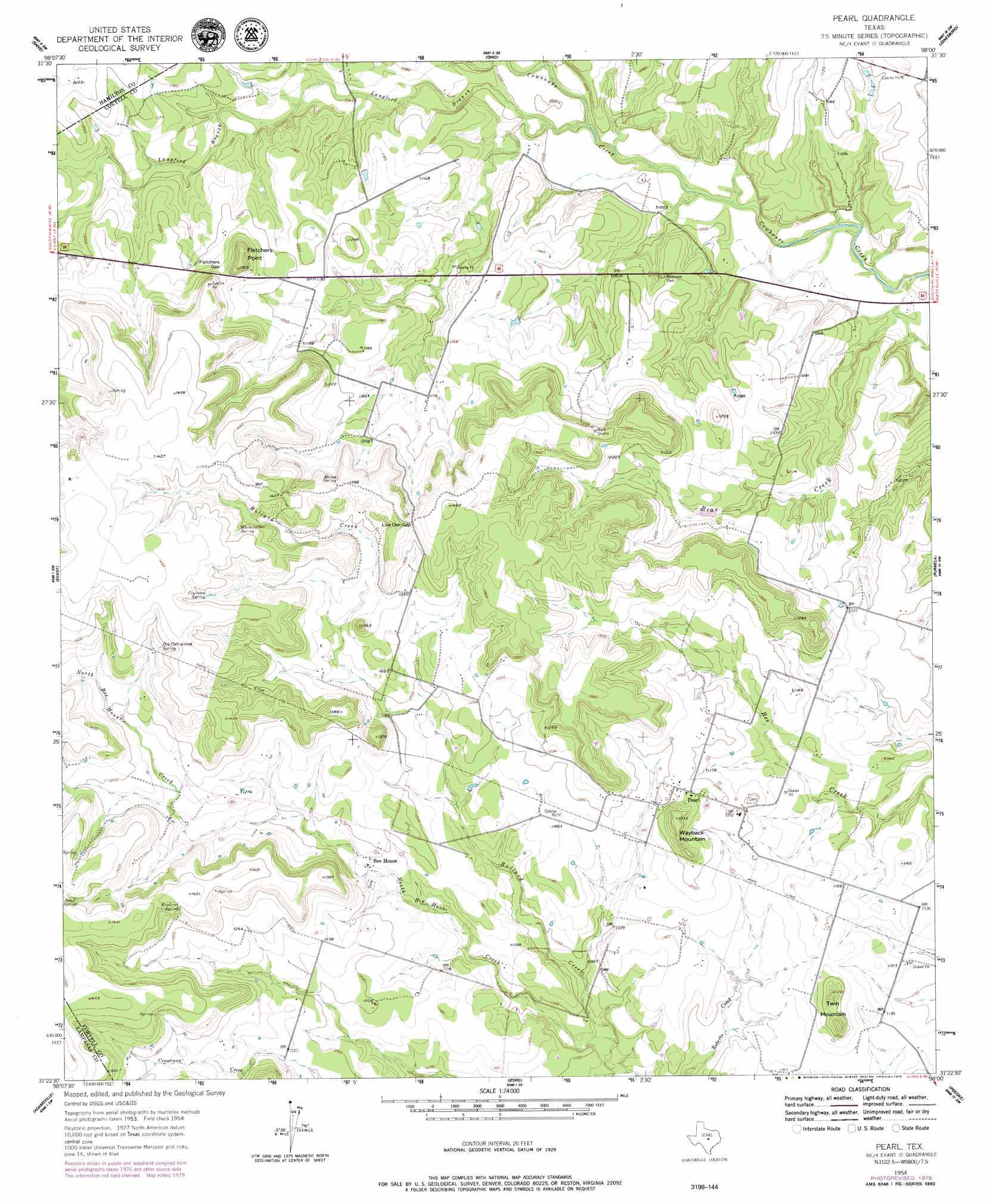
USGS Topo Quad 31098d1 - 1:24,000 scale
| Topo Map Name: | Pearl |
| USGS Topo Quad ID: | 31098d1 |
| Print Size: | ca. 21 1/4" wide x 27" high |
| Southeast Coordinates: | 31.375° N latitude / 98° W longitude |
| Map Center Coordinates: | 31.4375° N latitude / 98.0625° W longitude |
| U.S. State: | TX |
| Filename: | o31098d1.jpg |
| Download Map JPG Image: | Pearl topo map 1:24,000 scale |
| Map Type: | Topographic |
| Topo Series: | 7.5´ |
| Map Scale: | 1:24,000 |
| Source of Map Images: | United States Geological Survey (USGS) |
| Alternate Map Versions: |
Pearl TX 1954, updated 1957 Download PDF Buy paper map Pearl TX 2010 Download PDF Buy paper map Pearl TX 2012 Download PDF Buy paper map Pearl TX 2016 Download PDF Buy paper map |
1:24,000 Topo Quads surrounding Pearl
Pottsville |
Hamilton West |
Hamilton East |
Cutoff Mountain |
German Valley |
Pecan Wells |
Shive |
Ohio |
Jonesboro |
Ater |
Star |
Evant |
Pearl |
Purmela |
Gatesville West |
Castle Peak |
Adamsville |
Izoro |
Pidcoke |
Shell Mountains |
Ogles |
Flat Top Peak |
Rumley |
Twin Mountains |
Fort Hood |
> Back to 31098a1 at 1:100,000 scale
> Back to 31098a1 at 1:250,000 scale
> Back to U.S. Topo Maps home
Pearl topo map: Gazetteer
Pearl: Gaps
Fletchers Gap elevation 386m 1266′Live Oak Gap elevation 410m 1345′
Pearl: Populated Places
Bee House elevation 359m 1177′Pearl elevation 372m 1220′
Pearl: Springs
Crownest Spring elevation 420m 1377′Jones Spring elevation 427m 1400′
Kendrick Spring elevation 422m 1384′
Manos Spring elevation 407m 1335′
Old Cottonwood Spring elevation 418m 1371′
Whitewalker Spring elevation 418m 1371′
Pearl: Streams
Bear Creek elevation 279m 915′Bullard Creek elevation 317m 1040′
Cromeans Creek elevation 319m 1046′
Langford Branch elevation 290m 951′
Pearl: Summits
Fletchers Point elevation 415m 1361′Twin Mountain elevation 398m 1305′
Pearl digital topo map on disk
Buy this Pearl topo map showing relief, roads, GPS coordinates and other geographical features, as a high-resolution digital map file on DVD: