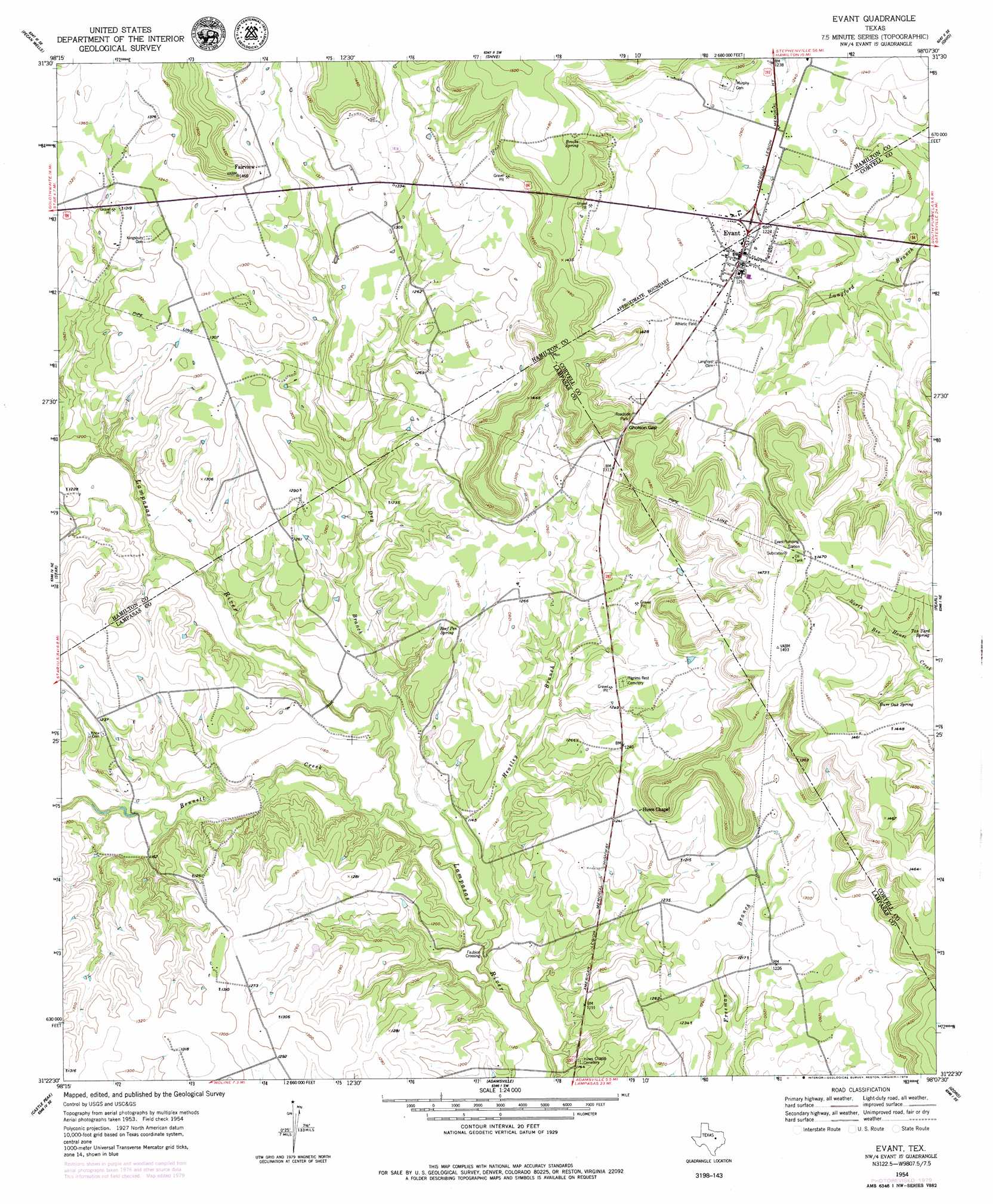
Evant Topo Map Texas
To zoom in, hover over the map of Evant
USGS Topo Quad 31098d2 - 1:24,000 scale
| Topo Map Name: | Evant |
| USGS Topo Quad ID: | 31098d2 |
| Print Size: | ca. 21 1/4" wide x 27" high |
| Southeast Coordinates: | 31.375° N latitude / 98.125° W longitude |
| Map Center Coordinates: | 31.4375° N latitude / 98.1875° W longitude |
| U.S. State: | TX |
| Filename: | o31098d2.jpg |
| Download Map JPG Image: | Evant topo map 1:24,000 scale |
| Map Type: | Topographic |
| Topo Series: | 7.5´ |
| Map Scale: | 1:24,000 |
| Source of Map Images: | United States Geological Survey (USGS) |
| Alternate Map Versions: |
Evant TX 1954, updated 1957 Download PDF Buy paper map Evant TX 1954, updated 1979 Download PDF Buy paper map Evant TX 2010 Download PDF Buy paper map Evant TX 2012 Download PDF Buy paper map Evant TX 2016 Download PDF Buy paper map |
1:24,000 Topo Quads surrounding Evant
Indian Gap |
Pottsville |
Hamilton West |
Hamilton East |
Cutoff Mountain |
Caradan |
Pecan Wells |
Shive |
Ohio |
Jonesboro |
Center City |
Star |
Evant |
Pearl |
Purmela |
Antelope Gap |
Castle Peak |
Adamsville |
Izoro |
Pidcoke |
Lometa |
Ogles |
Flat Top Peak |
Rumley |
Twin Mountains |
> Back to 31098a1 at 1:100,000 scale
> Back to 31098a1 at 1:250,000 scale
> Back to U.S. Topo Maps home
Evant topo map: Gazetteer
Evant: Gaps
Gholson Gap elevation 418m 1371′Evant: Populated Places
Evant elevation 382m 1253′Fairview elevation 407m 1335′
Faubion Crossing elevation 328m 1076′
Evant: Springs
Beef Pen Spring elevation 373m 1223′Brooks Spring elevation 433m 1420′
Burr Oak Spring elevation 419m 1374′
Tan Yard Spring elevation 413m 1354′
Evant: Streams
Bennett Creek elevation 342m 1122′Dry Branch elevation 341m 1118′
Heatley Branch elevation 335m 1099′
Evant digital topo map on disk
Buy this Evant topo map showing relief, roads, GPS coordinates and other geographical features, as a high-resolution digital map file on DVD: