Pecos West Topo Map Texas
To zoom in, hover over the map of Pecos West
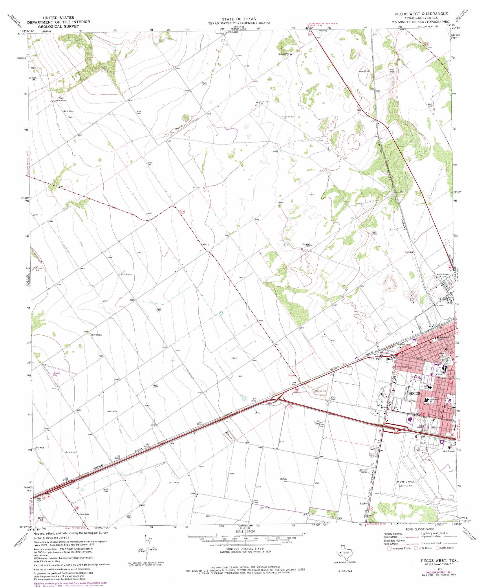
USGS Topo Quad 31103d5 - 1:24,000 scale
| Topo Map Name: | Pecos West |
| USGS Topo Quad ID: | 31103d5 |
| Print Size: | ca. 21 1/4" wide x 27" high |
| Southeast Coordinates: | 31.375° N latitude / 103.5° W longitude |
| Map Center Coordinates: | 31.4375° N latitude / 103.5625° W longitude |
| U.S. State: | TX |
| Filename: | o31103d5.jpg |
| Download Map JPG Image: | Pecos West topo map 1:24,000 scale |
| Map Type: | Topographic |
| Topo Series: | 7.5´ |
| Map Scale: | 1:24,000 |
| Source of Map Images: | United States Geological Survey (USGS) |
| Alternate Map Versions: |
Pecos West TX 1971, updated 1973 Download PDF Buy paper map Pecos West TX 1971, updated 1981 Download PDF Buy paper map Pecos West TX 2010 Download PDF Buy paper map Pecos West TX 2012 Download PDF Buy paper map Pecos West TX 2016 Download PDF Buy paper map |
1:24,000 Topo Quads surrounding Pecos West
Narrow Bow Draw |
Anderson Ranch |
Mentone |
Soda Lake Nw |
Soda Lake Ne |
Halamicek Ranch |
Mentone Sw |
Sand Lake |
Soda Lake |
Soda Lake Se |
Big Hill |
Hermosa |
Pecos West |
Pecos East |
Quito Draw |
Toyah |
Hermosa Sw |
Worsham |
Toyah Lake |
Old X Ranch |
Florenzo Hill |
Saragosa Nw |
Verhalen North |
Barstow 3 Nw |
Barstow 3 Ne |
> Back to 31103a1 at 1:100,000 scale
> Back to 31102a1 at 1:250,000 scale
> Back to U.S. Topo Maps home
Pecos West topo map: Gazetteer
Pecos West: Airports
Pecos Municipal Airport elevation 794m 2604′Pecos West: Populated Places
Locker elevation 799m 2621′Mann elevation 795m 2608′
Pecos West digital topo map on disk
Buy this Pecos West topo map showing relief, roads, GPS coordinates and other geographical features, as a high-resolution digital map file on DVD: