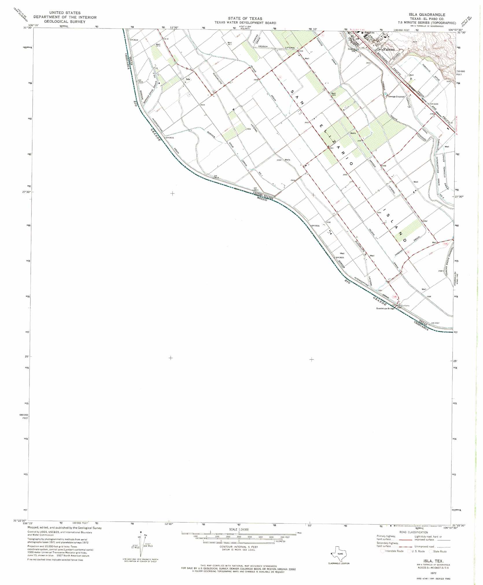
Isla Topo Map Texas
To zoom in, hover over the map of Isla
USGS Topo Quad 31106d2 - 1:24,000 scale
| Topo Map Name: | Isla |
| USGS Topo Quad ID: | 31106d2 |
| Print Size: | ca. 21 1/4" wide x 27" high |
| Southeast Coordinates: | 31.375° N latitude / 106.125° W longitude |
| Map Center Coordinates: | 31.4375° N latitude / 106.1875° W longitude |
| U.S. State: | TX |
| Filename: | o31106d2.jpg |
| Download Map JPG Image: | Isla topo map 1:24,000 scale |
| Map Type: | Topographic |
| Topo Series: | 7.5´ |
| Map Scale: | 1:24,000 |
| Source of Map Images: | United States Geological Survey (USGS) |
| Alternate Map Versions: |
Isla TX 1972, updated 1974 Download PDF Buy paper map Isla TX 2010 Download PDF Buy paper map Isla TX 2012 Download PDF Buy paper map Isla TX 2016 Download PDF Buy paper map |
1:24,000 Topo Quads surrounding Isla
Ysleta Nw |
Ysleta |
Clint Nw |
Clint Ne |
Padre Canyon |
San Elizario |
Clint |
Clint Se |
T P Well |
|
Isla |
Tornillo |
Fort Hancock Nw |
||
Acala |
||||
> Back to 31106a1 at 1:100,000 scale
> Back to 31106a1 at 1:250,000 scale
> Back to U.S. Topo Maps home
Isla topo map: Gazetteer
Isla: Bridges
Guadalupe Bridge elevation 1094m 3589′Isla: Canals
Border Spur Drain Number One elevation 1099m 3605′Border Spur Drain Number Two elevation 1102m 3615′
Fabens Drain elevation 1098m 3602′
Fabens Drain elevation 1095m 3592′
Guadalupe Lateral elevation 1098m 3602′
Hansen Lateral elevation 1099m 3605′
Island Drain elevation 1097m 3599′
Tornillo Intercepting Drain Number Two elevation 1095m 3592′
Upper Tornillo Drain elevation 1095m 3592′
Isla: Islands
San Elizario Island elevation 1098m 3602′Isla: Populated Places
Isla elevation 1101m 3612′Isla: Ridges
Tornillo Spur elevation 1097m 3599′Isla digital topo map on disk
Buy this Isla topo map showing relief, roads, GPS coordinates and other geographical features, as a high-resolution digital map file on DVD: