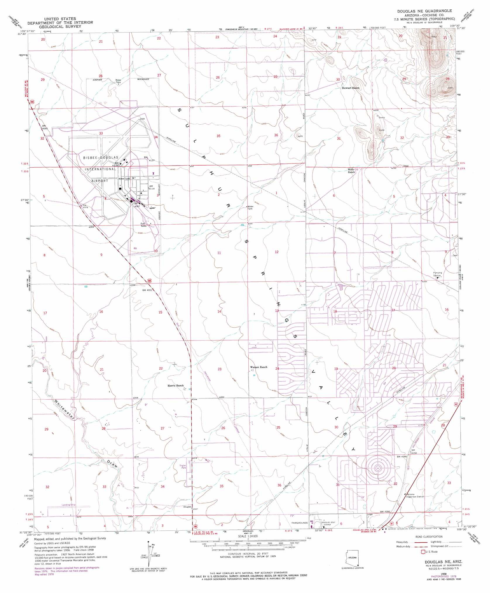
Douglas Ne Topo Map Arizona
To zoom in, hover over the map of Douglas Ne
USGS Topo Quad 31109d5 - 1:24,000 scale
| Topo Map Name: | Douglas Ne |
| USGS Topo Quad ID: | 31109d5 |
| Print Size: | ca. 21 1/4" wide x 27" high |
| Southeast Coordinates: | 31.375° N latitude / 109.5° W longitude |
| Map Center Coordinates: | 31.4375° N latitude / 109.5625° W longitude |
| U.S. State: | AZ |
| Filename: | o31109d5.jpg |
| Download Map JPG Image: | Douglas Ne topo map 1:24,000 scale |
| Map Type: | Topographic |
| Topo Series: | 7.5´ |
| Map Scale: | 1:24,000 |
| Source of Map Images: | United States Geological Survey (USGS) |
| Alternate Map Versions: |
Douglas NE AZ 1958, updated 1959 Download PDF Buy paper map Douglas NE AZ 1958, updated 1978 Download PDF Buy paper map Douglas NE AZ 1996, updated 2003 Download PDF Buy paper map Douglas NE AZ 2011 Download PDF Buy paper map Douglas NE AZ 2014 Download PDF Buy paper map |
1:24,000 Topo Quads surrounding Douglas Ne
Outlaw Mountain |
Elfrida |
Swisshelm Mountain |
Bruno Peak |
Swede Peak |
Gleeson Se |
Mcneal |
Leslie Canyon |
Pedregosa Mountains West |
Pedregosa Mountains East |
Bisbee Ne |
Double Adobe |
Douglas Ne |
College Peaks |
Cinder Hill |
Bisbee Se |
Paul Spur |
Douglas |
East Of Douglas |
San Bernardino Ranch |
> Back to 31109a1 at 1:100,000 scale
> Back to 31108a1 at 1:250,000 scale
> Back to U.S. Topo Maps home
Douglas Ne topo map: Gazetteer
Douglas Ne: Airports
Bisbee-Douglas International Airport elevation 1256m 4120′Puerto Cielo elevation 1211m 3973′
Douglas Ne: Valleys
Mud Springs Draw elevation 1281m 4202′Douglas Ne digital topo map on disk
Buy this Douglas Ne topo map showing relief, roads, GPS coordinates and other geographical features, as a high-resolution digital map file on DVD: