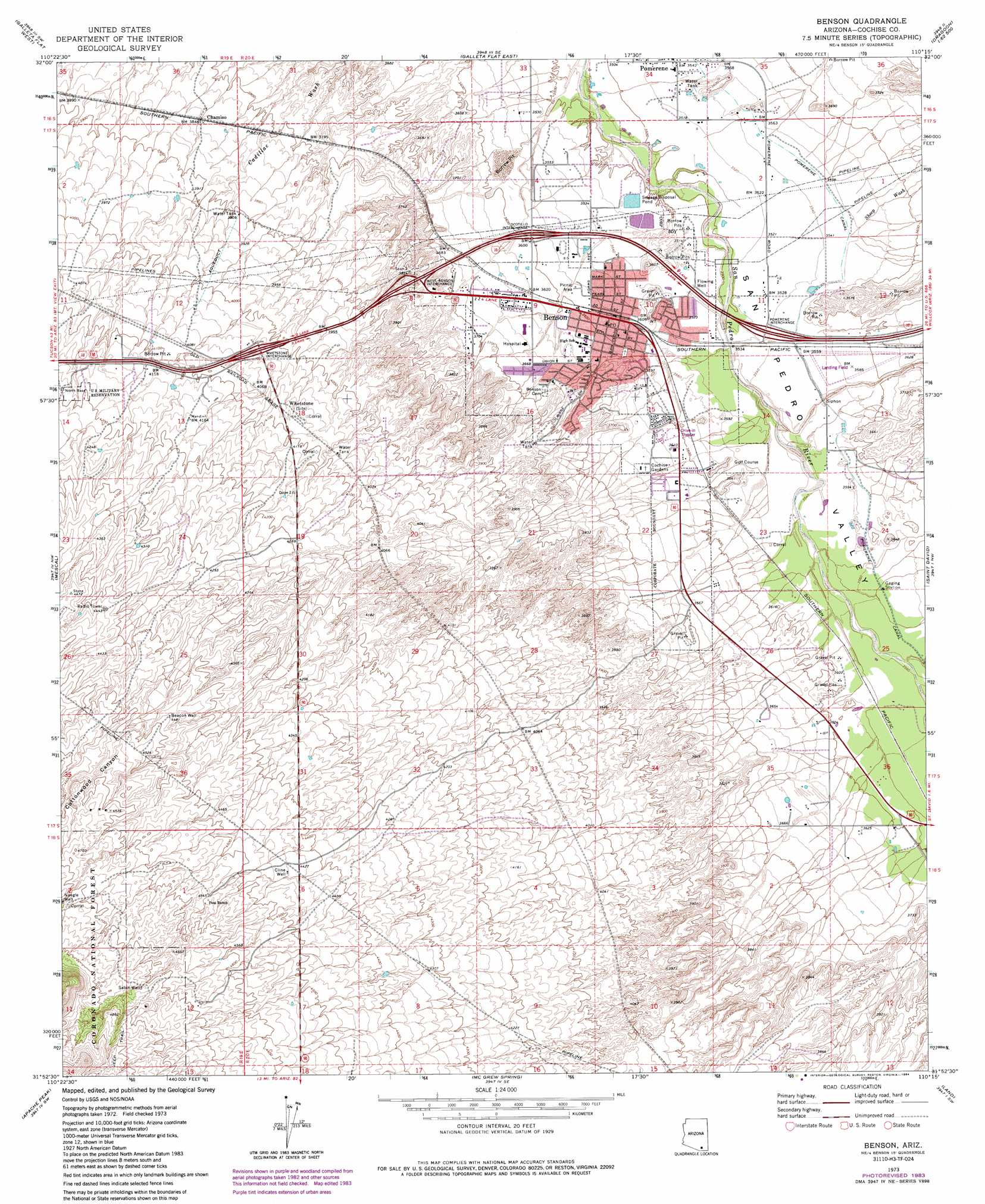
Benson Topo Map Arizona
To zoom in, hover over the map of Benson
USGS Topo Quad 31110h3 - 1:24,000 scale
| Topo Map Name: | Benson |
| USGS Topo Quad ID: | 31110h3 |
| Print Size: | ca. 21 1/4" wide x 27" high |
| Southeast Coordinates: | 31.875° N latitude / 110.25° W longitude |
| Map Center Coordinates: | 31.9375° N latitude / 110.3125° W longitude |
| U.S. State: | AZ |
| Filename: | o31110h3.jpg |
| Download Map JPG Image: | Benson topo map 1:24,000 scale |
| Map Type: | Topographic |
| Topo Series: | 7.5´ |
| Map Scale: | 1:24,000 |
| Source of Map Images: | United States Geological Survey (USGS) |
| Alternate Map Versions: |
Benson AZ 1973, updated 1976 Download PDF Buy paper map Benson AZ 1973, updated 1984 Download PDF Buy paper map Benson AZ 1996, updated 2002 Download PDF Buy paper map Benson AZ 2012 Download PDF Buy paper map Benson AZ 2014 Download PDF Buy paper map |
| FStopo: | US Forest Service topo Benson is available: Download FStopo PDF Download FStopo TIF |
1:24,000 Topo Quads surrounding Benson
Mica Mountain |
Happy Valley |
Wildhorse Mountain |
Deepwell Ranch |
Steele Hills |
Rincon Peak |
Galleta Flat West |
Galleta Flat East |
San Pedro Ranch |
Dragoon |
The Narrows |
Mescal |
Benson |
Saint David |
Knob Hill |
Spring Water Canyon |
Apache Peak |
Mcgrew Spring |
Land |
Haberstock Hill |
Elgin |
Mustang Mountains |
Huachuca City |
Fairbank |
Tombstone |
> Back to 31110e1 at 1:100,000 scale
> Back to 31110a1 at 1:250,000 scale
> Back to U.S. Topo Maps home
Benson topo map: Gazetteer
Benson: Airports
Benson Airport elevation 1095m 3592′Benson: Canals
Pomerene Canal elevation 1086m 3562′Benson: Crossings
Benson Interchange elevation 1086m 3562′Ocotillo Interchange elevation 1099m 3605′
West Benson Interchange elevation 1147m 3763′
Whetstone Interchange elevation 1234m 4048′
Benson: Populated Places
Benson elevation 1093m 3585′Chamiso elevation 1172m 3845′
Pomerene elevation 1080m 3543′
Whetstone elevation 1240m 4068′
Benson: Post Offices
Benson Post Office elevation 1096m 3595′Benson: Streams
Sheep Wash elevation 0m 0′Benson: Valleys
Cottonwood Canyon elevation 1287m 4222′Benson: Wells
Beacon Well elevation 1367m 4484′Cline Well elevation 1354m 4442′
Sabin Well elevation 0m 0′
Benson digital topo map on disk
Buy this Benson topo map showing relief, roads, GPS coordinates and other geographical features, as a high-resolution digital map file on DVD: