Malpais Hill Topo Map Arizona
To zoom in, hover over the map of Malpais Hill
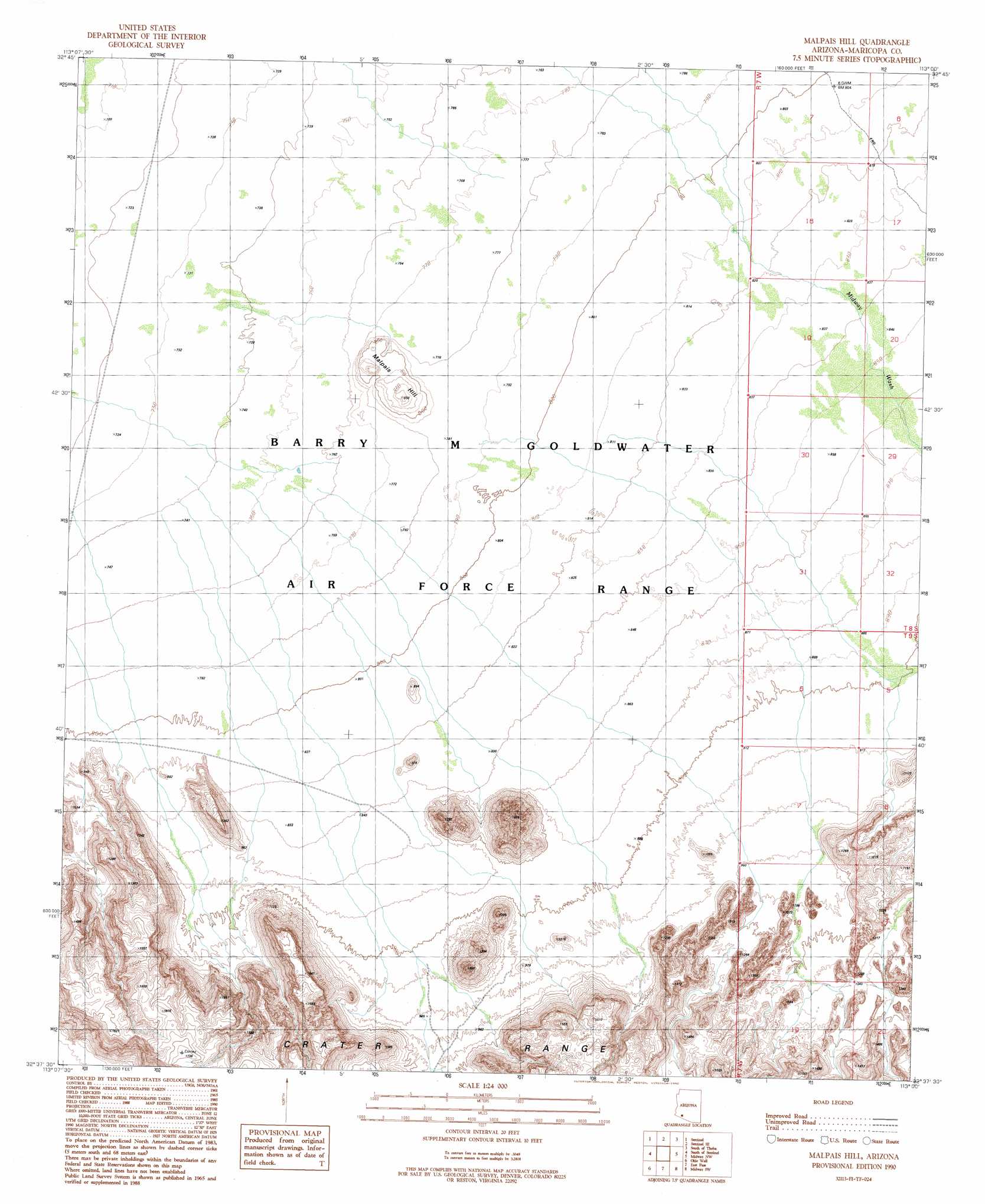
USGS Topo Quad 32113f1 - 1:24,000 scale
| Topo Map Name: | Malpais Hill |
| USGS Topo Quad ID: | 32113f1 |
| Print Size: | ca. 21 1/4" wide x 27" high |
| Southeast Coordinates: | 32.625° N latitude / 113° W longitude |
| Map Center Coordinates: | 32.6875° N latitude / 113.0625° W longitude |
| U.S. State: | AZ |
| Filename: | o32113f1.jpg |
| Download Map JPG Image: | Malpais Hill topo map 1:24,000 scale |
| Map Type: | Topographic |
| Topo Series: | 7.5´ |
| Map Scale: | 1:24,000 |
| Source of Map Images: | United States Geological Survey (USGS) |
| Alternate Map Versions: |
Malpais Hill AZ 1990, updated 1990 Download PDF Buy paper map Malpais Hill AZ 2011 Download PDF Buy paper map Malpais Hill AZ 2014 Download PDF Buy paper map |
1:24,000 Topo Quads surrounding Malpais Hill
Agua Caliente |
Sentinel Peak |
Sentinel Ne |
Theba |
Smurr |
Aztec Se |
Sentinel |
Sentinel Se |
South Of Theba |
Black Gap |
Aguila Mountains Ne |
South Of Sentinel |
Malpais Hill |
Midway Nw |
Midway |
Aguila Mountains Se |
Okie Well |
East Pass |
Midway Sw |
Deadman Gap |
Granite Mountains North |
West Of Growler Peak |
Growler Peak |
Childs Mountain |
Ajo North |
> Back to 32113e1 at 1:100,000 scale
> Back to 32112a1 at 1:250,000 scale
> Back to U.S. Topo Maps home
Malpais Hill topo map: Gazetteer
Malpais Hill: Streams
Midway Wash elevation 250m 820′Malpais Hill: Summits
Malpais Hill elevation 258m 846′Malpais Hill digital topo map on disk
Buy this Malpais Hill topo map showing relief, roads, GPS coordinates and other geographical features, as a high-resolution digital map file on DVD: