Shallowater Topo Map Texas
To zoom in, hover over the map of Shallowater
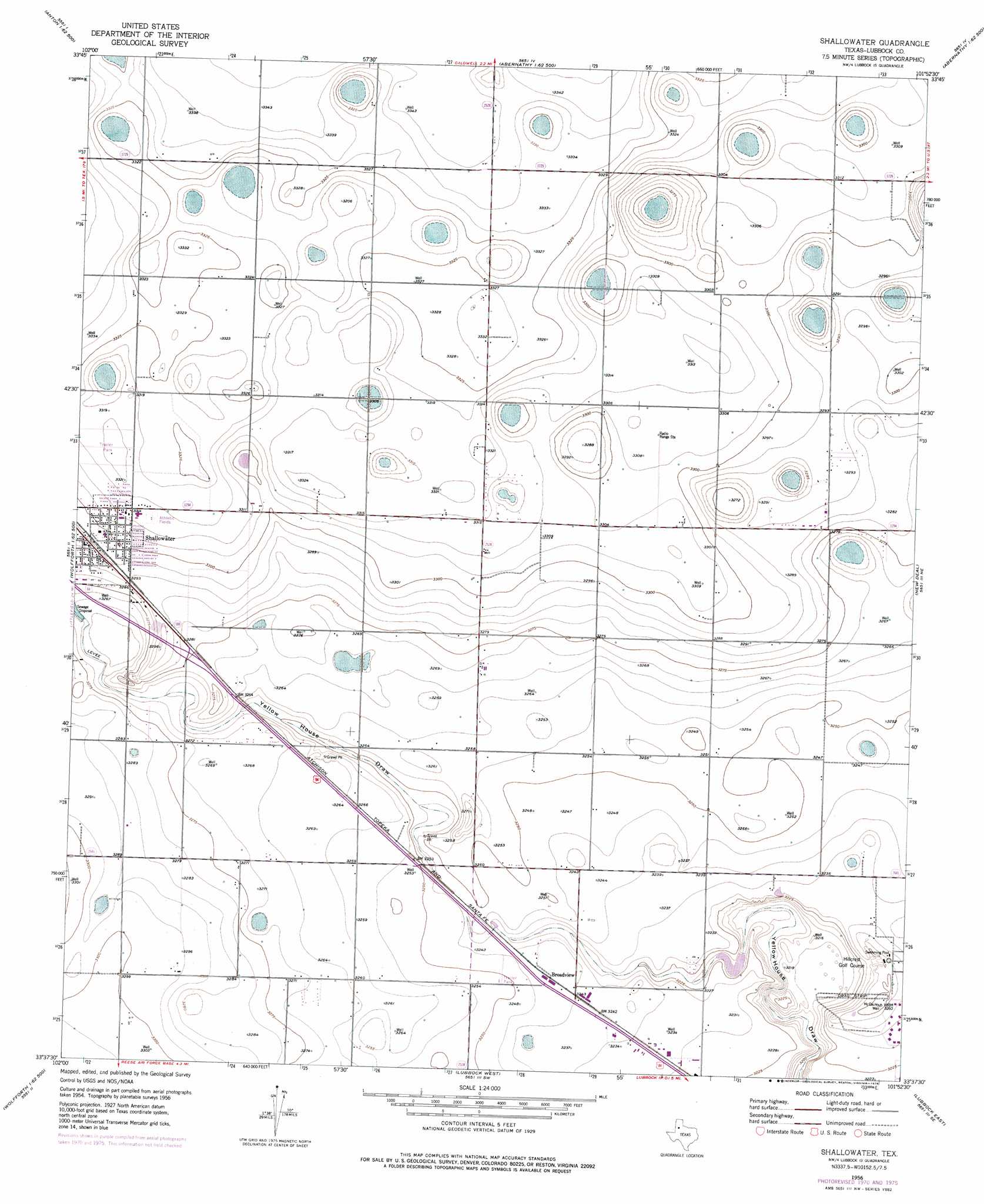
USGS Topo Quad 33101f8 - 1:24,000 scale
| Topo Map Name: | Shallowater |
| USGS Topo Quad ID: | 33101f8 |
| Print Size: | ca. 21 1/4" wide x 27" high |
| Southeast Coordinates: | 33.625° N latitude / 101.875° W longitude |
| Map Center Coordinates: | 33.6875° N latitude / 101.9375° W longitude |
| U.S. State: | TX |
| Filename: | o33101f8.jpg |
| Download Map JPG Image: | Shallowater topo map 1:24,000 scale |
| Map Type: | Topographic |
| Topo Series: | 7.5´ |
| Map Scale: | 1:24,000 |
| Source of Map Images: | United States Geological Survey (USGS) |
| Alternate Map Versions: |
Shallowater TX 1956, updated 1957 Download PDF Buy paper map Shallowater TX 1956, updated 1971 Download PDF Buy paper map Shallowater TX 1956, updated 1976 Download PDF Buy paper map Shallowater TX 2010 Download PDF Buy paper map Shallowater TX 2012 Download PDF Buy paper map Shallowater TX 2016 Download PDF Buy paper map |
1:24,000 Topo Quads surrounding Shallowater
Spade |
Anton Ne |
Cotton Center |
Underwood |
Julia Lake |
Anton |
Roundup |
Abernathy Sw |
Abernathy |
Heckville |
Wolfforth Nw |
Wolfforth Ne |
Shallowater |
New Deal |
Idalou |
Smyer |
Wolfforth |
Lubbock West |
Lubbock East |
Buffalo Springs Lake |
Ropesville |
Busterville |
Slide |
Woodrow |
Slaton |
> Back to 33101e1 at 1:100,000 scale
> Back to 33100a1 at 1:250,000 scale
> Back to U.S. Topo Maps home
Shallowater topo map: Gazetteer
Shallowater: Airports
University Medical Center Heliport elevation 978m 3208′Shallowater: Parks
Lubbock Lake Landmark State Historical Park elevation 983m 3225′Yellow House Canyon Park elevation 982m 3221′
Shallowater: Populated Places
Broadview elevation 989m 3244′Shallowater elevation 1004m 3293′
Shallowater: Wells
McCauley Well elevation 991m 3251′Shallowater digital topo map on disk
Buy this Shallowater topo map showing relief, roads, GPS coordinates and other geographical features, as a high-resolution digital map file on DVD: