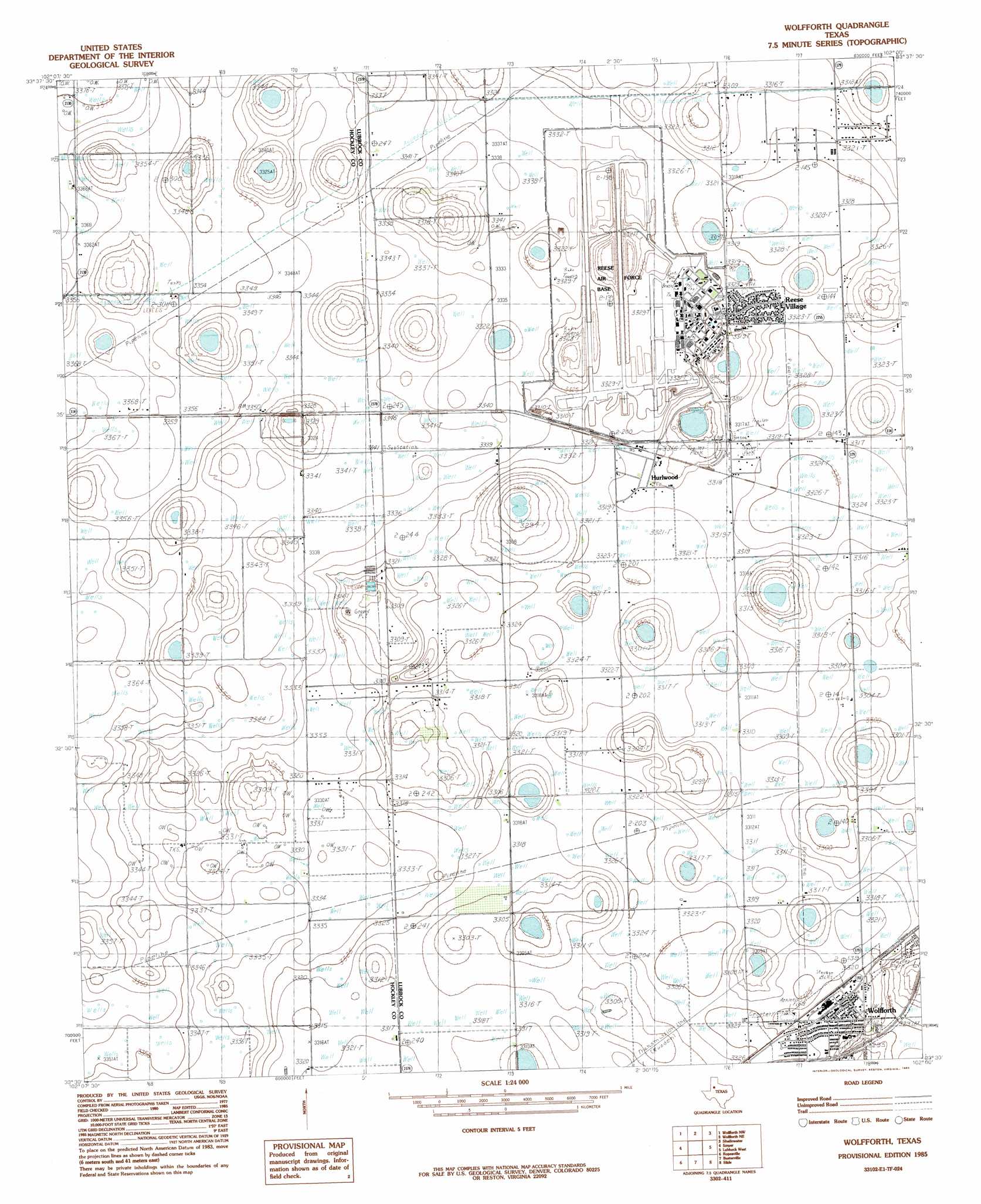
Wolfforth Topo Map Texas
To zoom in, hover over the map of Wolfforth
USGS Topo Quad 33102e1 - 1:24,000 scale
| Topo Map Name: | Wolfforth |
| USGS Topo Quad ID: | 33102e1 |
| Print Size: | ca. 21 1/4" wide x 27" high |
| Southeast Coordinates: | 33.5° N latitude / 102° W longitude |
| Map Center Coordinates: | 33.5625° N latitude / 102.0625° W longitude |
| U.S. State: | TX |
| Filename: | o33102e1.jpg |
| Download Map JPG Image: | Wolfforth topo map 1:24,000 scale |
| Map Type: | Topographic |
| Topo Series: | 7.5´ |
| Map Scale: | 1:24,000 |
| Source of Map Images: | United States Geological Survey (USGS) |
| Alternate Map Versions: |
Wolfforth SE TX 1976, updated 1978 Download PDF Buy paper map Wolfforth TX 1985, updated 1985 Download PDF Buy paper map Wolfforth TX 2010 Download PDF Buy paper map Wolfforth TX 2012 Download PDF Buy paper map Wolfforth TX 2016 Download PDF Buy paper map |
1:24,000 Topo Quads surrounding Wolfforth
Lums Chapel |
Anton |
Roundup |
Abernathy Sw |
Abernathy |
Whitharral |
Wolfforth Nw |
Wolfforth Ne |
Shallowater |
New Deal |
Levelland East |
Smyer |
Wolfforth |
Lubbock West |
Lubbock East |
Lockettville |
Ropesville |
Busterville |
Slide |
Woodrow |
Sundown Se |
Meadow |
Meadow Se |
New Home |
New Home Se |
> Back to 33102e1 at 1:100,000 scale
> Back to 33102a1 at 1:250,000 scale
> Back to U.S. Topo Maps home
Wolfforth topo map: Gazetteer
Wolfforth: Populated Places
Hurlwood elevation 1011m 3316′Reese Village elevation 1012m 3320′
Wolfforth elevation 1011m 3316′
Wolfforth digital topo map on disk
Buy this Wolfforth topo map showing relief, roads, GPS coordinates and other geographical features, as a high-resolution digital map file on DVD: