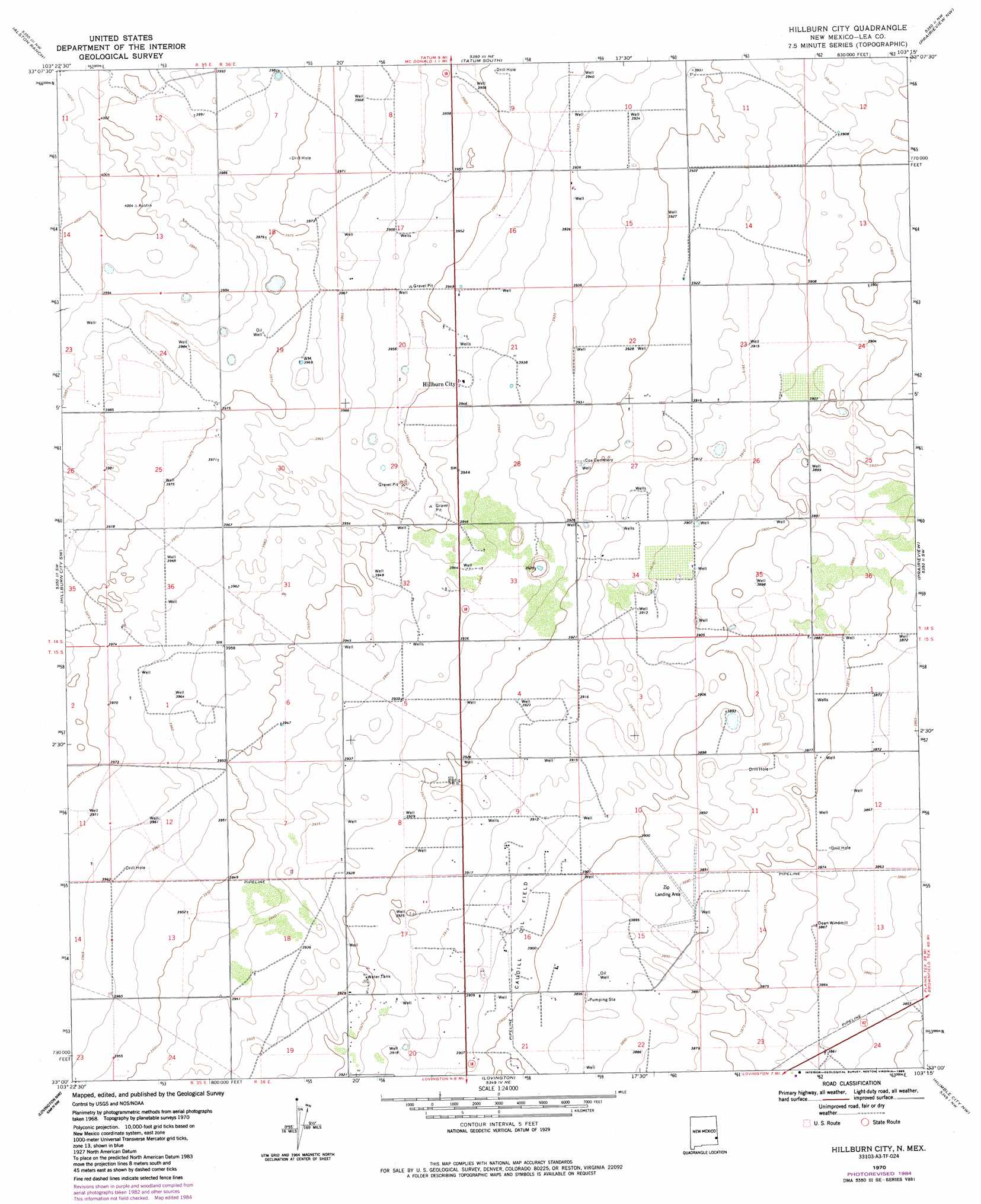
Hillburn City Topo Map New Mexico
To zoom in, hover over the map of Hillburn City
USGS Topo Quad 33103a3 - 1:24,000 scale
| Topo Map Name: | Hillburn City |
| USGS Topo Quad ID: | 33103a3 |
| Print Size: | ca. 21 1/4" wide x 27" high |
| Southeast Coordinates: | 33° N latitude / 103.25° W longitude |
| Map Center Coordinates: | 33.0625° N latitude / 103.3125° W longitude |
| U.S. State: | NM |
| Filename: | o33103a3.jpg |
| Download Map JPG Image: | Hillburn City topo map 1:24,000 scale |
| Map Type: | Topographic |
| Topo Series: | 7.5´ |
| Map Scale: | 1:24,000 |
| Source of Map Images: | United States Geological Survey (USGS) |
| Alternate Map Versions: |
Hillburn City NM 1970, updated 1972 Download PDF Buy paper map Hillburn City NM 1970, updated 1972 Download PDF Buy paper map Hillburn City NM 1970, updated 1985 Download PDF Buy paper map Hillburn City NM 2010 Download PDF Buy paper map Hillburn City NM 2013 Download PDF Buy paper map Hillburn City NM 2017 Download PDF Buy paper map |
1:24,000 Topo Quads surrounding Hillburn City
Dallas Store |
Simanola Valley |
Tatum North |
Gladiola |
Bronco |
Frier Ranch |
Alston Ranch |
Tatum South |
Prairieview Nw |
Prairieview Ne |
Fort Ranch |
Hillburn City Sw |
Hillburn City |
Prairieview |
Prairieview Se |
Buckeye Ne |
Lovington Nw |
Lovington |
Humble City Nw |
Humble City Ne |
Buckeye |
Lovington Sw |
Lovington Se |
Humble City |
Humble City Se |
> Back to 33103a1 at 1:100,000 scale
> Back to 33102a1 at 1:250,000 scale
> Back to U.S. Topo Maps home
Hillburn City topo map: Gazetteer
Hillburn City: Oilfields
Caudill Oil Field elevation 1190m 3904′Hillburn City: Populated Places
Hillburn City elevation 1203m 3946′Hillburn City: Wells
10060 Water Well elevation 1213m 3979′10068 Water Well elevation 1211m 3973′
10071 Water Well elevation 1196m 3923′
10072 Water Well elevation 1196m 3923′
10073 Water Well elevation 1203m 3946′
10074 Water Well elevation 1206m 3956′
10075 Water Well elevation 1205m 3953′
10076 Water Well elevation 1201m 3940′
10077 Water Well elevation 1194m 3917′
10078 Water Well elevation 1192m 3910′
10115 Water Well elevation 1206m 3956′
10116 Water Well elevation 1201m 3940′
10118 Water Well elevation 1198m 3930′
10119 Water Well elevation 1198m 3930′
10120 Water Well elevation 1195m 3920′
10121 Water Well elevation 1199m 3933′
10122 Water Well elevation 1195m 3920′
10123 Water Well elevation 1183m 3881′
10124 Water Well elevation 1197m 3927′
10125 Water Well elevation 1197m 3927′
10126 Water Well elevation 1192m 3910′
Hillburn City digital topo map on disk
Buy this Hillburn City topo map showing relief, roads, GPS coordinates and other geographical features, as a high-resolution digital map file on DVD: