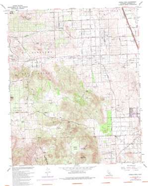
Steele Peak Topo Map California
To zoom in, hover over the map of Steele Peak
USGS Topo Quad 33117g3 - 1:24,000 scale
| Topo Map Name: | Steele Peak |
| USGS Topo Quad ID: | 33117g3 |
| Print Size: | ca. 21 1/4" wide x 27" high |
| Southeast Coordinates: | 33.75° N latitude / 117.25° W longitude |
| Map Center Coordinates: | 33.8125° N latitude / 117.3125° W longitude |
| U.S. State: | CA |
| Filename: | o33117g3.jpg |
| Download Map JPG Image: | Steele Peak topo map 1:24,000 scale |
| Map Type: | Topographic |
| Topo Series: | 7.5´ |
| Map Scale: | 1:24,000 |
| Source of Map Images: | United States Geological Survey (USGS) |
| Alternate Map Versions: |
Steele Peak CA 1953, updated 1955 Download PDF Buy paper map Steele Peak CA 1953, updated 1963 Download PDF Buy paper map Steele Peak CA 1967, updated 1969 Download PDF Buy paper map Steele Peak CA 1967, updated 1975 Download PDF Buy paper map Steele Peak CA 1967, updated 1987 Download PDF Buy paper map Steele Peak CA 2012 Download PDF Buy paper map Steele Peak CA 2015 Download PDF Buy paper map |
1:24,000 Topo Quads surrounding Steele Peak
> Back to 33117e1 at 1:100,000 scale
> Back to 33116a1 at 1:250,000 scale
> Back to U.S. Topo Maps home
Steele Peak topo map: Gazetteer
Steele Peak: Basins
Steele Valley elevation 633m 2076′Steele Peak: Crossings
Interchange 22 elevation 458m 1502′Interchange 23 elevation 462m 1515′
Steele Peak: Mines
Gavilan Mine elevation 639m 2096′Ida-Leona Mine elevation 638m 2093′
Santa Rosa Mine elevation 705m 2312′
Steele Peak: Parks
Hartford Spring County Park elevation 637m 2089′Motte Rimrock State Reserve elevation 554m 1817′
University of California Ecological Study Area elevation 535m 1755′
Steele Peak: Populated Places
Camelot Hills elevation 712m 2335′Gavilan Hills elevation 647m 2122′
Glen Valley elevation 495m 1624′
Good Hope elevation 473m 1551′
Good Meadow elevation 506m 1660′
Mead Valley elevation 505m 1656′
Santa Rosa Ranch Estates elevation 684m 2244′
Val Verde elevation 459m 1505′
Steele Peak: Post Offices
Mead Valley Post Office elevation 506m 1660′Steele Peak: Ranges
Three Sisters elevation 575m 1886′Steele Peak: Springs
Harford Spring elevation 562m 1843′Steele Peak: Summits
Steele Peak elevation 768m 2519′Steele Peak: Tunnels
Val Verde Tunnel elevation 505m 1656′Steele Peak: Valleys
Mead Valley elevation 488m 1601′Steele Peak digital topo map on disk
Buy this Steele Peak topo map showing relief, roads, GPS coordinates and other geographical features, as a high-resolution digital map file on DVD:


