Buckle L Ranch Topo Map Texas
To zoom in, hover over the map of Buckle L Ranch
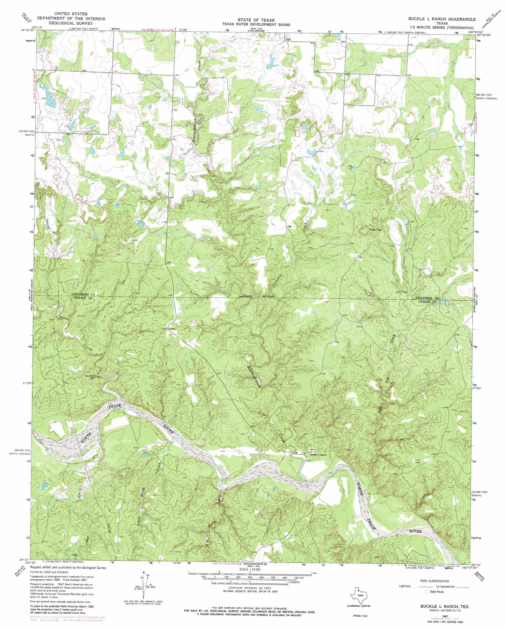
USGS Topo Quad 34100c2 - 1:24,000 scale
| Topo Map Name: | Buckle L Ranch |
| USGS Topo Quad ID: | 34100c2 |
| Print Size: | ca. 21 1/4" wide x 27" high |
| Southeast Coordinates: | 34.25° N latitude / 100.125° W longitude |
| Map Center Coordinates: | 34.3125° N latitude / 100.1875° W longitude |
| U.S. State: | TX |
| Filename: | o34100c2.jpg |
| Download Map JPG Image: | Buckle L Ranch topo map 1:24,000 scale |
| Map Type: | Topographic |
| Topo Series: | 7.5´ |
| Map Scale: | 1:24,000 |
| Source of Map Images: | United States Geological Survey (USGS) |
| Alternate Map Versions: |
Buckle L Ranch TX 1967, updated 1969 Download PDF Buy paper map Buckle L Ranch TX 1967, updated 1981 Download PDF Buy paper map Buckle L Ranch TX 2010 Download PDF Buy paper map Buckle L Ranch TX 2012 Download PDF Buy paper map Buckle L Ranch TX 2016 Download PDF Buy paper map |
1:24,000 Topo Quads surrounding Buckle L Ranch
Estelline |
Estelline Se |
Smithdale |
Garden Valley |
Hollis Sw |
Tell North |
Carey |
Childress |
Kirkland North |
Williams |
Tell South |
Hell Roaring Creek |
Buckle L Ranch |
Kirkland South |
Goodlett |
Cee Vee |
Dunlap |
Swearingen |
Baker |
Cactus Creek |
Devils Canyon |
Paducah |
Moons Camp |
Triangle Ranch |
Vivian |
> Back to 34100a1 at 1:100,000 scale
> Back to 34100a1 at 1:250,000 scale
> Back to U.S. Topo Maps home
Buckle L Ranch topo map: Gazetteer
Buckle L Ranch: Streams
Big Nasty Creek elevation 478m 1568′Chimney Creek elevation 485m 1591′
Flat Top Creek elevation 474m 1555′
Little Nasty Creek elevation 482m 1581′
Salt Creek elevation 485m 1591′
Scatterbranch Creek elevation 476m 1561′
Shores Creek elevation 484m 1587′
Buckle L Ranch: Summits
Flat Top elevation 565m 1853′Buckle L Ranch digital topo map on disk
Buy this Buckle L Ranch topo map showing relief, roads, GPS coordinates and other geographical features, as a high-resolution digital map file on DVD: