Baker Topo Map Texas
To zoom in, hover over the map of Baker
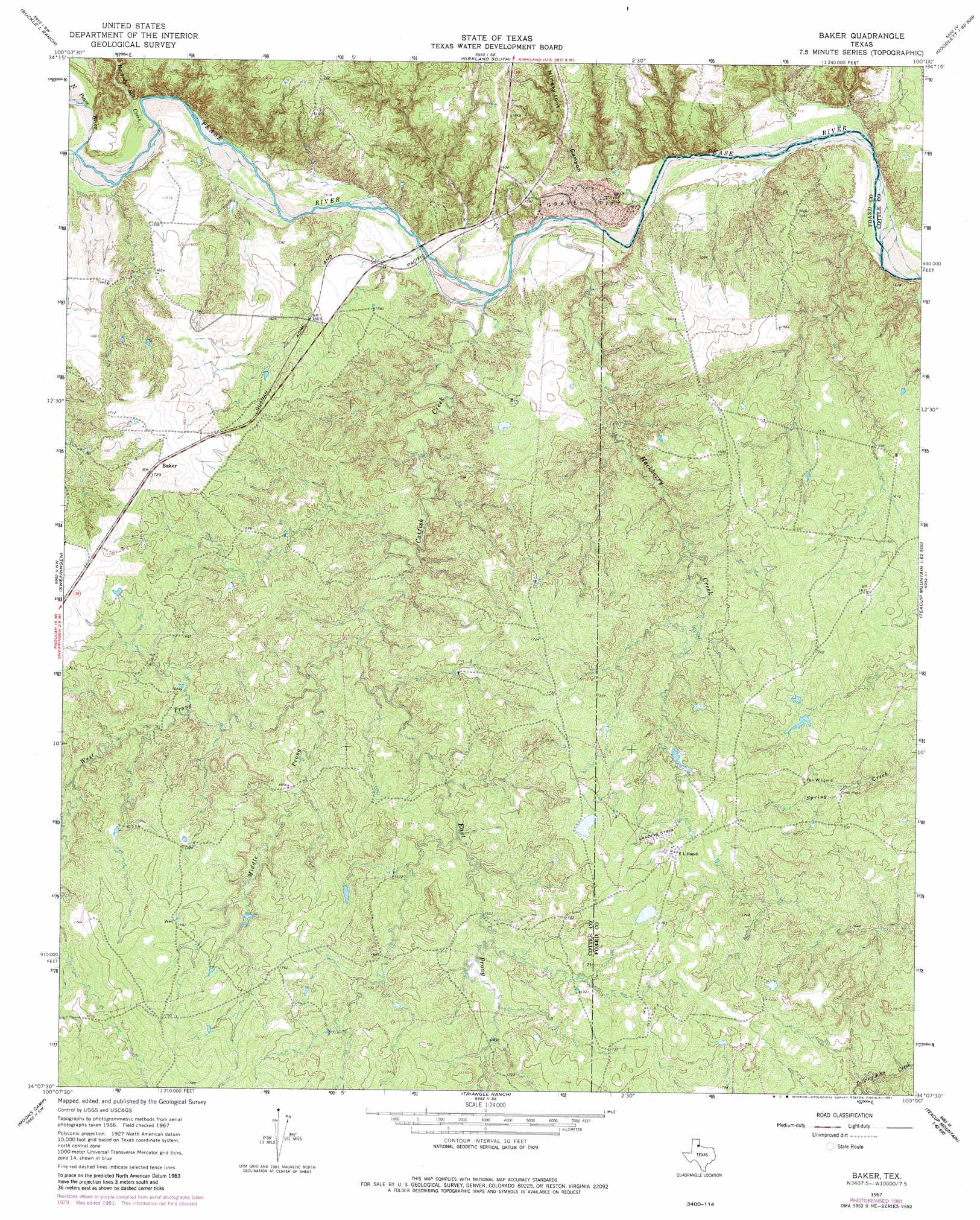
USGS Topo Quad 34100b1 - 1:24,000 scale
| Topo Map Name: | Baker |
| USGS Topo Quad ID: | 34100b1 |
| Print Size: | ca. 21 1/4" wide x 27" high |
| Southeast Coordinates: | 34.125° N latitude / 100° W longitude |
| Map Center Coordinates: | 34.1875° N latitude / 100.0625° W longitude |
| U.S. State: | TX |
| Filename: | o34100b1.jpg |
| Download Map JPG Image: | Baker topo map 1:24,000 scale |
| Map Type: | Topographic |
| Topo Series: | 7.5´ |
| Map Scale: | 1:24,000 |
| Source of Map Images: | United States Geological Survey (USGS) |
| Alternate Map Versions: |
Baker TX 1967, updated 1969 Download PDF Buy paper map Baker TX 1967, updated 1981 Download PDF Buy paper map Baker TX 2010 Download PDF Buy paper map Baker TX 2013 Download PDF Buy paper map Baker TX 2016 Download PDF Buy paper map |
1:24,000 Topo Quads surrounding Baker
Carey |
Childress |
Kirkland North |
Williams |
North Groesbeck |
Hell Roaring Creek |
Buckle L Ranch |
Kirkland South |
Goodlett |
Quanah West |
Dunlap |
Swearingen |
Baker |
Cactus Creek |
Maybell Canyon |
Paducah |
Moons Camp |
Triangle Ranch |
Vivian |
Teacup Mountain |
Ginsite |
Chalk |
Y Ranch |
Boiling Spring |
Foard City |
> Back to 34100a1 at 1:100,000 scale
> Back to 34100a1 at 1:250,000 scale
> Back to U.S. Topo Maps home
Baker topo map: Gazetteer
Baker: Populated Places
Baker elevation 529m 1735′Baker: Streams
Catfish Creek elevation 456m 1496′East Prong Catfish Creek elevation 478m 1568′
Hackberry Creek elevation 454m 1489′
Middle Pease River elevation 467m 1532′
Middle Prong Catfish Creek elevation 489m 1604′
North Pease River elevation 467m 1532′
Raggedy Bill Creek elevation 464m 1522′
West Prong Catfish Creek elevation 478m 1568′
Baker: Valleys
Ninety-Foot Canyon elevation 458m 1502′Baker digital topo map on disk
Buy this Baker topo map showing relief, roads, GPS coordinates and other geographical features, as a high-resolution digital map file on DVD: