Williams Topo Map Texas
To zoom in, hover over the map of Williams
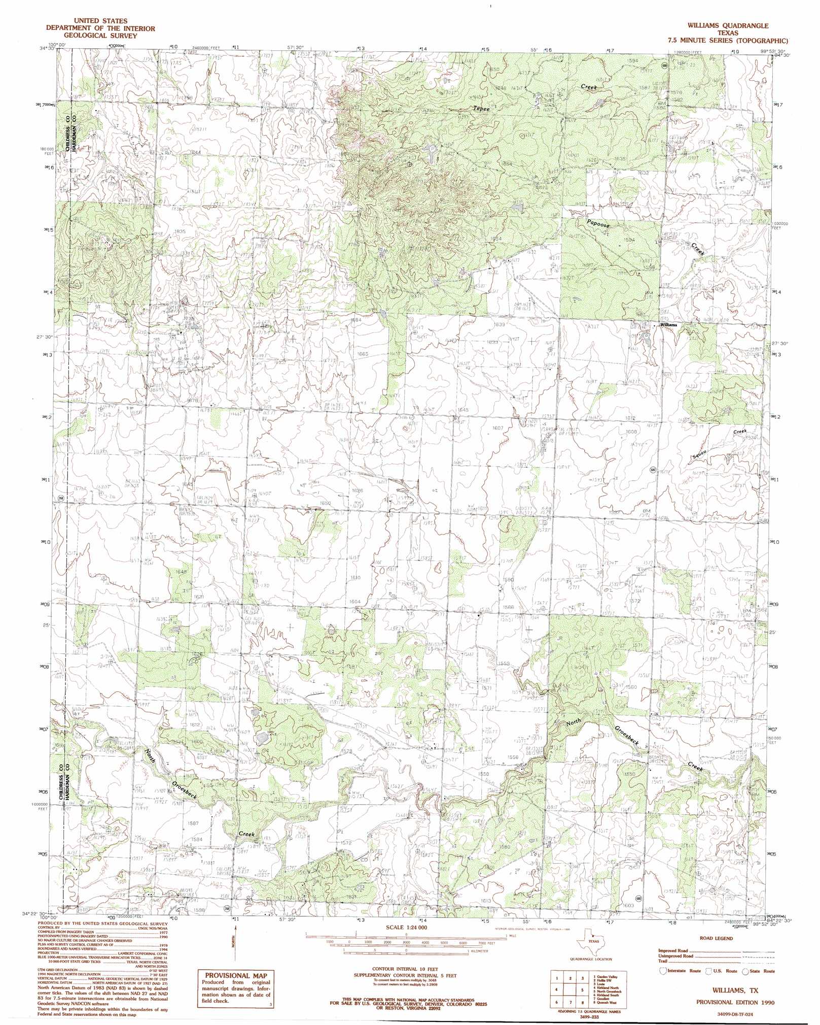
USGS Topo Quad 34099d8 - 1:24,000 scale
| Topo Map Name: | Williams |
| USGS Topo Quad ID: | 34099d8 |
| Print Size: | ca. 21 1/4" wide x 27" high |
| Southeast Coordinates: | 34.375° N latitude / 99.875° W longitude |
| Map Center Coordinates: | 34.4375° N latitude / 99.9375° W longitude |
| U.S. State: | TX |
| Filename: | o34099d8.jpg |
| Download Map JPG Image: | Williams topo map 1:24,000 scale |
| Map Type: | Topographic |
| Topo Series: | 7.5´ |
| Map Scale: | 1:24,000 |
| Source of Map Images: | United States Geological Survey (USGS) |
| Alternate Map Versions: |
Willams TX 1984, updated 1985 Download PDF Buy paper map Willams TX 1990, updated 1995 Download PDF Buy paper map Williams TX 2010 Download PDF Buy paper map Williams TX 2012 Download PDF Buy paper map Williams TX 2016 Download PDF Buy paper map |
1:24,000 Topo Quads surrounding Williams
Loco |
Arlie |
Hollis |
Gould |
Mcqueen |
Smithdale |
Garden Valley |
Hollis Sw |
Hollis Se |
Duke Sw |
Childress |
Kirkland North |
Williams |
North Groesbeck |
Eldorado |
Buckle L Ranch |
Kirkland South |
Goodlett |
Quanah West |
Quanah East |
Swearingen |
Baker |
Cactus Creek |
Maybell Canyon |
Big Mound |
> Back to 34099a1 at 1:100,000 scale
> Back to 34098a1 at 1:250,000 scale
> Back to U.S. Topo Maps home
Williams digital topo map on disk
Buy this Williams topo map showing relief, roads, GPS coordinates and other geographical features, as a high-resolution digital map file on DVD: