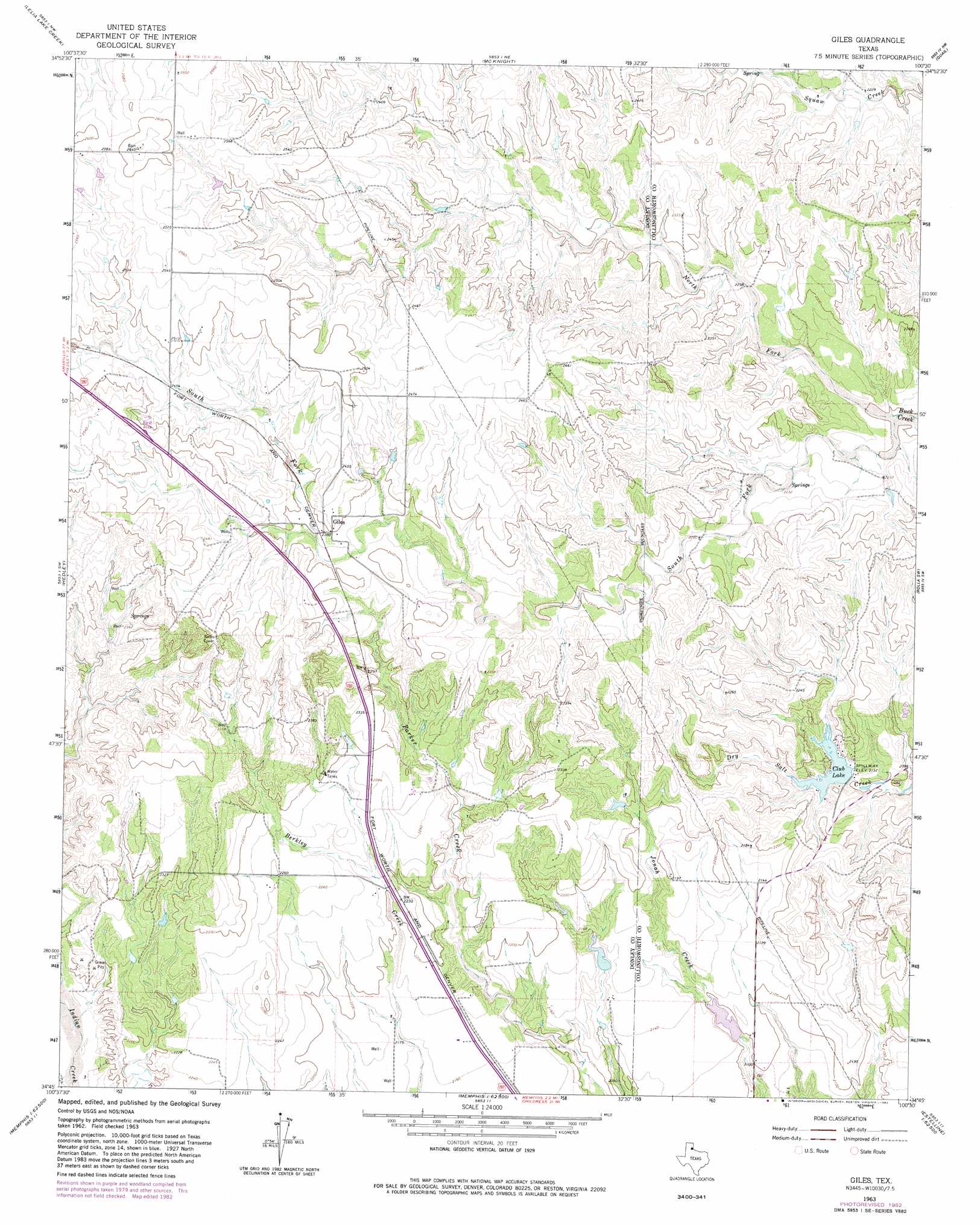
Giles Topo Map Texas
To zoom in, hover over the map of Giles
USGS Topo Quad 34100g5 - 1:24,000 scale
| Topo Map Name: | Giles |
| USGS Topo Quad ID: | 34100g5 |
| Print Size: | ca. 21 1/4" wide x 27" high |
| Southeast Coordinates: | 34.75° N latitude / 100.5° W longitude |
| Map Center Coordinates: | 34.8125° N latitude / 100.5625° W longitude |
| U.S. State: | TX |
| Filename: | o34100g5.jpg |
| Download Map JPG Image: | Giles topo map 1:24,000 scale |
| Map Type: | Topographic |
| Topo Series: | 7.5´ |
| Map Scale: | 1:24,000 |
| Source of Map Images: | United States Geological Survey (USGS) |
| Alternate Map Versions: |
Giles TX 1963, updated 1966 Download PDF Buy paper map Giles TX 1963, updated 1982 Download PDF Buy paper map Giles TX 2010 Download PDF Buy paper map Giles TX 2012 Download PDF Buy paper map Giles TX 2016 Download PDF Buy paper map |
1:24,000 Topo Quads surrounding Giles
Griffin Ranch |
Troublesome Creek |
Spencer Lake |
Abra |
Dozier |
Lelia Lake |
Lelia Lake Creek |
Mcknight |
Quail |
Rolla Ne |
Clarendon Se |
Hedley |
Giles |
Rolla Sw |
Rolla |
Lesley |
Memphis Nw |
Memphis |
Estelline Nw |
Estelline Ne |
Heel Fly Draw |
Plaska |
Parnell |
Estelline |
Estelline Se |
> Back to 34100e1 at 1:100,000 scale
> Back to 34100a1 at 1:250,000 scale
> Back to U.S. Topo Maps home
Giles topo map: Gazetteer
Giles: Dams
Brookhollow Country Club Lake Dam elevation 641m 2103′Evans Dam elevation 645m 2116′
Giles: Populated Places
Giles elevation 737m 2417′Giles: Reservoirs
Club Lake elevation 648m 2125′Evans Lake elevation 645m 2116′
Giles: Springs
Club Spring elevation 647m 2122′Parker Springs (historical) elevation 723m 2372′
Giles: Streams
North Fork Buck Creek elevation 670m 2198′South Fork Buck Creek elevation 670m 2198′
Giles digital topo map on disk
Buy this Giles topo map showing relief, roads, GPS coordinates and other geographical features, as a high-resolution digital map file on DVD: