Vaughn Topo Map New Mexico
To zoom in, hover over the map of Vaughn
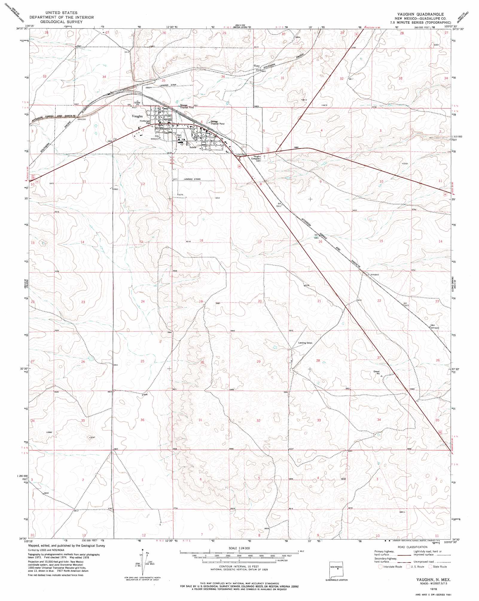
USGS Topo Quad 34105e2 - 1:24,000 scale
| Topo Map Name: | Vaughn |
| USGS Topo Quad ID: | 34105e2 |
| Print Size: | ca. 21 1/4" wide x 27" high |
| Southeast Coordinates: | 34.5° N latitude / 105.125° W longitude |
| Map Center Coordinates: | 34.5625° N latitude / 105.1875° W longitude |
| U.S. State: | NM |
| Filename: | o34105e2.jpg |
| Download Map JPG Image: | Vaughn topo map 1:24,000 scale |
| Map Type: | Topographic |
| Topo Series: | 7.5´ |
| Map Scale: | 1:24,000 |
| Source of Map Images: | United States Geological Survey (USGS) |
| Alternate Map Versions: |
Vaughn NM 1978, updated 1978 Download PDF Buy paper map Vaughn NM 2010 Download PDF Buy paper map Vaughn NM 2013 Download PDF Buy paper map Vaughn NM 2017 Download PDF Buy paper map |
1:24,000 Topo Quads surrounding Vaughn
Santo Nino Canyon |
Pinavete Canyon |
George Ranch |
Tapia Ranch |
Pastura |
Encino |
Santa Barbara Lake |
Mesa Leon |
Burro Lake |
El Morro Ranch Nw |
Dunlap Ranch |
Tejon |
Vaughn |
Long Draw |
El Morro Ranch |
Duran |
Duran Ne |
Gacho Hill Nw |
Gacho Hill |
Duoro |
Camaleon Draw West |
Camaleon Draw East |
Gacho Hill Sw |
Gacho Hill Se |
Loco Draw |
> Back to 34105e1 at 1:100,000 scale
> Back to 34104a1 at 1:250,000 scale
> Back to U.S. Topo Maps home
Vaughn topo map: Gazetteer
Vaughn: Airports
Vaughn Municipal Airport elevation 1805m 5921′Vaughn: Parks
Huntsinger Park elevation 1828m 5997′Vaughn Historical Marker elevation 1822m 5977′
Vaughn: Populated Places
Tony elevation 1787m 5862′Vaughn elevation 1822m 5977′
Vaughn: Post Offices
Vaughn Post Office elevation 1822m 5977′Vaughn digital topo map on disk
Buy this Vaughn topo map showing relief, roads, GPS coordinates and other geographical features, as a high-resolution digital map file on DVD: