Wind Mesa Topo Map New Mexico
To zoom in, hover over the map of Wind Mesa
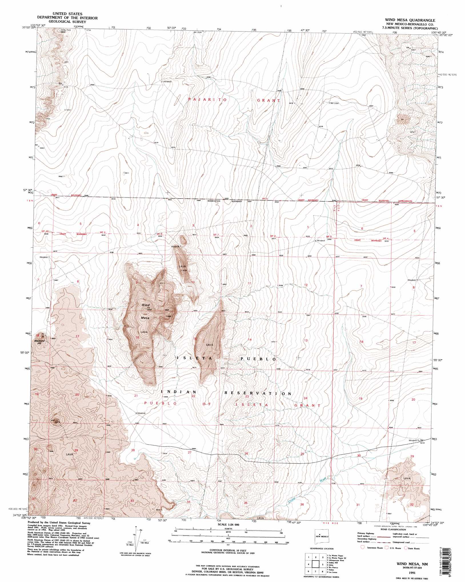
USGS Topo Quad 34106h7 - 1:24,000 scale
| Topo Map Name: | Wind Mesa |
| USGS Topo Quad ID: | 34106h7 |
| Print Size: | ca. 21 1/4" wide x 27" high |
| Southeast Coordinates: | 34.875° N latitude / 106.75° W longitude |
| Map Center Coordinates: | 34.9375° N latitude / 106.8125° W longitude |
| U.S. State: | NM |
| Filename: | o34106h7.jpg |
| Download Map JPG Image: | Wind Mesa topo map 1:24,000 scale |
| Map Type: | Topographic |
| Topo Series: | 7.5´ |
| Map Scale: | 1:24,000 |
| Source of Map Images: | United States Geological Survey (USGS) |
| Alternate Map Versions: |
Wind Mesa NM 1952, updated 1953 Download PDF Buy paper map Wind Mesa NM 1952, updated 1969 Download PDF Buy paper map Wind Mesa NM 1952, updated 1984 Download PDF Buy paper map Wind Mesa NM 1991, updated 1996 Download PDF Buy paper map Wind Mesa NM 2011 Download PDF Buy paper map Wind Mesa NM 2013 Download PDF Buy paper map Wind Mesa NM 2017 Download PDF Buy paper map |
1:24,000 Topo Quads surrounding Wind Mesa
Herrera |
Benavidez Ranch |
Volcano Ranch |
Los Griegos |
Alameda |
Canoncito School |
La Mesita Negra |
La Mesita Negra Se |
Albuquerque West |
Albuquerque East |
South Garcia |
Dalies Nw |
Wind Mesa |
Isleta |
Hubbell Spring |
South Garcia Se |
Rio Puerco |
Dalies |
Los Lunas |
Los Lunas Se |
Mesas Mojinas |
Belen Nw |
Belen |
Tome |
Tome Ne |
> Back to 34106e1 at 1:100,000 scale
> Back to 34106a1 at 1:250,000 scale
> Back to U.S. Topo Maps home
Wind Mesa topo map: Gazetteer
Wind Mesa: Mines
Edgar D Otto Mine elevation 1723m 5652′Wind Mesa: Streams
Cedar Wash elevation 1612m 5288′Wind Mesa: Summits
Blackbird Hill elevation 1710m 5610′Wind Mesa elevation 1808m 5931′
Wind Mesa: Wells
10000 Water Well elevation 1608m 5275′Wind Mesa digital topo map on disk
Buy this Wind Mesa topo map showing relief, roads, GPS coordinates and other geographical features, as a high-resolution digital map file on DVD: