Swansea Topo Map Arizona
To zoom in, hover over the map of Swansea
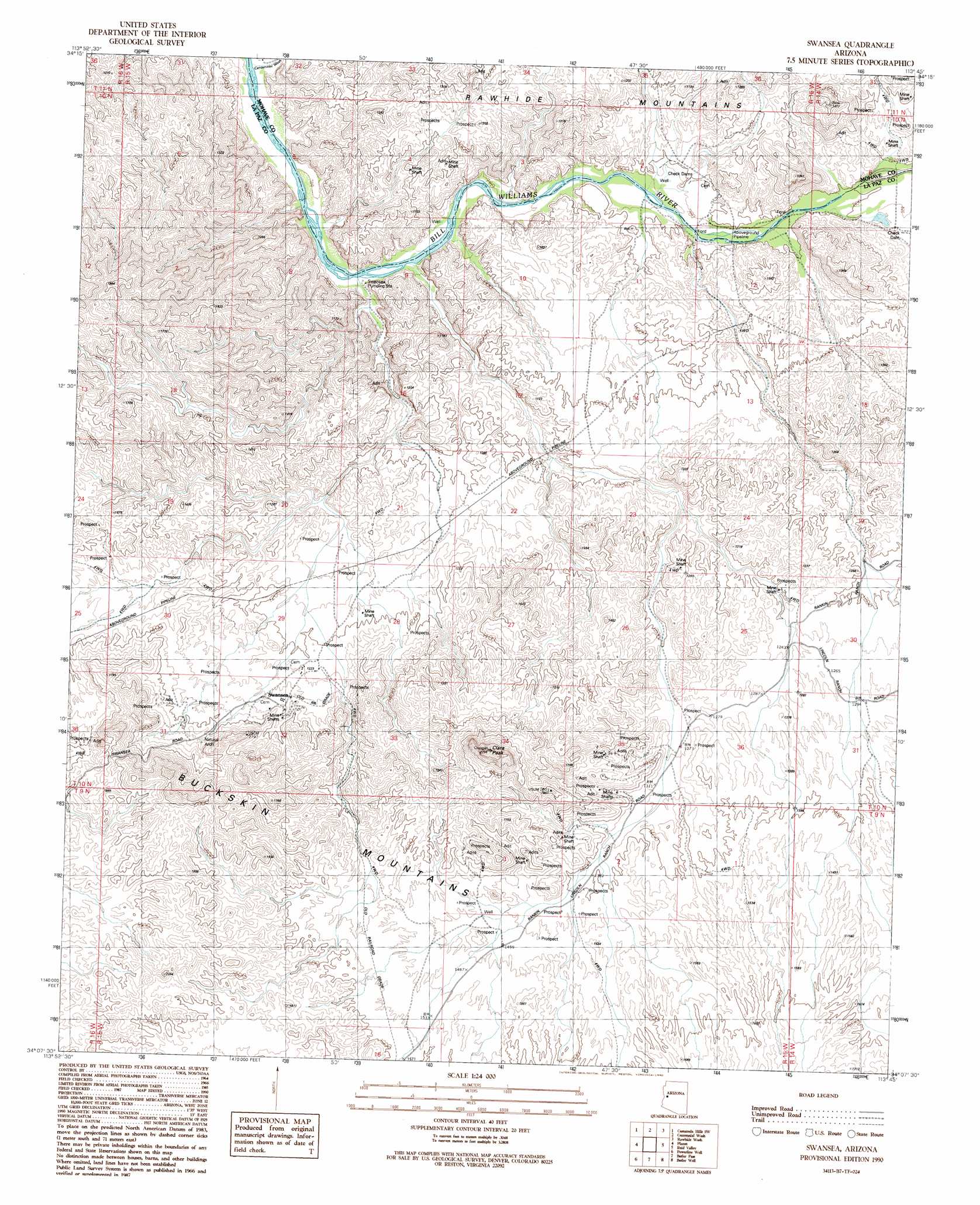
USGS Topo Quad 34113b7 - 1:24,000 scale
| Topo Map Name: | Swansea |
| USGS Topo Quad ID: | 34113b7 |
| Print Size: | ca. 21 1/4" wide x 27" high |
| Southeast Coordinates: | 34.125° N latitude / 113.75° W longitude |
| Map Center Coordinates: | 34.1875° N latitude / 113.8125° W longitude |
| U.S. State: | AZ |
| Filename: | o34113b7.jpg |
| Download Map JPG Image: | Swansea topo map 1:24,000 scale |
| Map Type: | Topographic |
| Topo Series: | 7.5´ |
| Map Scale: | 1:24,000 |
| Source of Map Images: | United States Geological Survey (USGS) |
| Alternate Map Versions: |
Swansea AZ 1990, updated 1990 Download PDF Buy paper map Swansea AZ 2011 Download PDF Buy paper map Swansea AZ 2014 Download PDF Buy paper map |
1:24,000 Topo Quads surrounding Swansea
Mohave Springs |
Castaneda Hills |
Mccracken Peak |
Signal |
Signal Mountain |
Monkeys Head |
Castaneda Hills Sw |
Centennial Wash |
Rawhide Wash |
Artillery Peak |
Osborne Well |
Planet |
Swansea |
Reid Valley |
Alamo Dam |
Bobs Well |
Powerline Well |
Butler Pass |
Butler Well |
Alamo Dam Se |
Bouse |
Bouse Hills West |
Bouse Hills East |
Harcuvar Peak |
Cunningham Pass |
> Back to 34113a1 at 1:100,000 scale
> Back to 34112a1 at 1:250,000 scale
> Back to U.S. Topo Maps home
Swansea topo map: Gazetteer
Swansea: Arches
Miners Arch elevation 453m 1486′Swansea: Populated Places
Swansea elevation 391m 1282′Swansea: Ranges
Buckskin Mountains elevation 456m 1496′Swansea: Streams
Centennial Wash elevation 217m 711′Swansea: Summits
Clara Peak elevation 707m 2319′Swansea digital topo map on disk
Buy this Swansea topo map showing relief, roads, GPS coordinates and other geographical features, as a high-resolution digital map file on DVD: