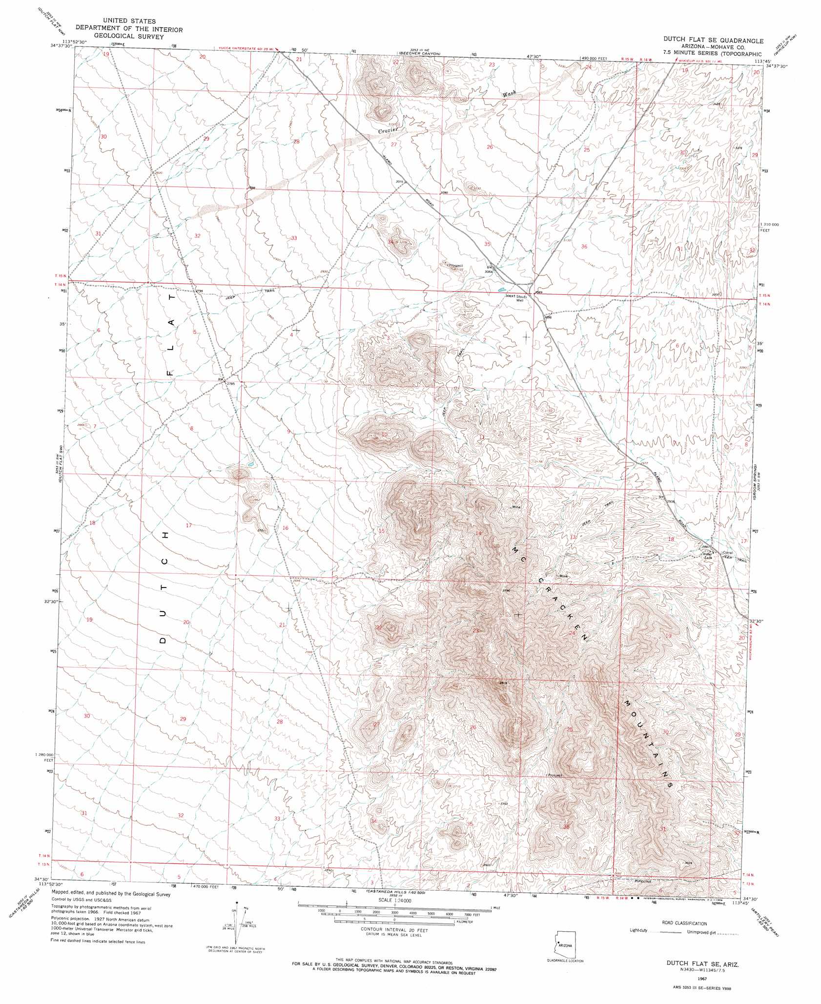
Dutch Flat Se Topo Map Arizona
To zoom in, hover over the map of Dutch Flat Se
USGS Topo Quad 34113e7 - 1:24,000 scale
| Topo Map Name: | Dutch Flat Se |
| USGS Topo Quad ID: | 34113e7 |
| Print Size: | ca. 21 1/4" wide x 27" high |
| Southeast Coordinates: | 34.5° N latitude / 113.75° W longitude |
| Map Center Coordinates: | 34.5625° N latitude / 113.8125° W longitude |
| U.S. State: | AZ |
| Filename: | o34113e7.jpg |
| Download Map JPG Image: | Dutch Flat Se topo map 1:24,000 scale |
| Map Type: | Topographic |
| Topo Series: | 7.5´ |
| Map Scale: | 1:24,000 |
| Source of Map Images: | United States Geological Survey (USGS) |
| Alternate Map Versions: |
Dutch Flat SE AZ 1967, updated 1969 Download PDF Buy paper map Dutch Flat SE AZ 2011 Download PDF Buy paper map Dutch Flat SE AZ 2014 Download PDF Buy paper map |
1:24,000 Topo Quads surrounding Dutch Flat Se
Yucca Se |
Creamery Canyon |
Diamond Joe Peak |
Gunsight Canyon |
Tule Wash |
Buck Mountains Ne |
Dutch Flat Nw |
Beecher Canyon |
Aubrey Peak |
Wikieup |
Buck Mountains Se |
Dutch Flat Sw |
Dutch Flat Se |
Groom Spring |
Greenwood Peak |
Mohave Springs |
Castaneda Hills |
Mccracken Peak |
Signal |
Signal Mountain |
Monkeys Head |
Castaneda Hills Sw |
Centennial Wash |
Rawhide Wash |
Artillery Peak |
> Back to 34113e1 at 1:100,000 scale
> Back to 34112a1 at 1:250,000 scale
> Back to U.S. Topo Maps home
Dutch Flat Se topo map: Gazetteer
Dutch Flat Se: Ranges
McCracken Mountains elevation 905m 2969′Dutch Flat Se: Reservoirs
Cedric Tank elevation 854m 2801′Hill Tank elevation 835m 2739′
Dutch Flat Se: Streams
Crozier Wash elevation 884m 2900′Dutch Flat Se: Wells
Cedric Well elevation 949m 3113′Stouts Well elevation 938m 3077′
Dutch Flat Se digital topo map on disk
Buy this Dutch Flat Se topo map showing relief, roads, GPS coordinates and other geographical features, as a high-resolution digital map file on DVD: