Stepladder Mountains Nw Topo Map California
To zoom in, hover over the map of Stepladder Mountains Nw
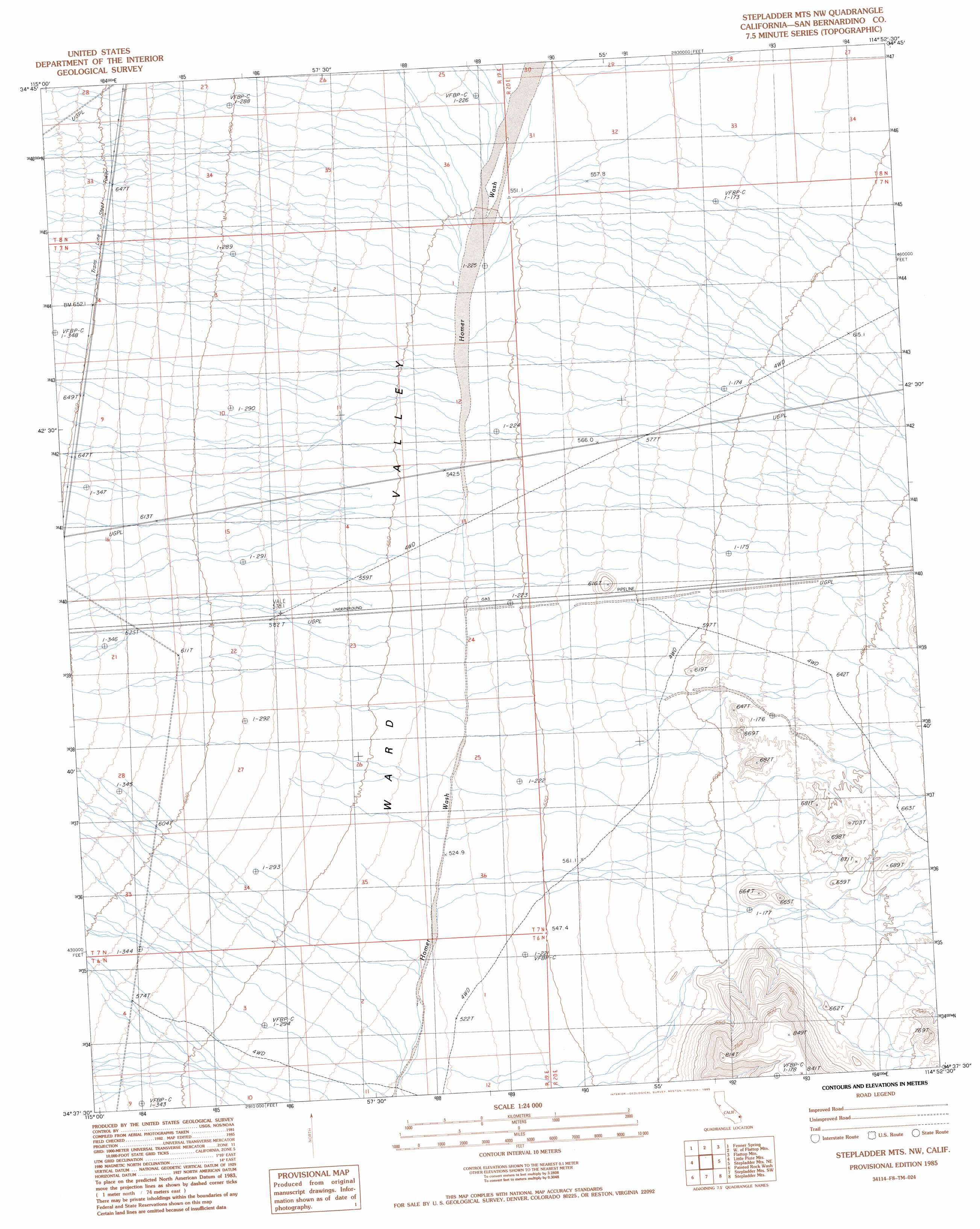
USGS Topo Quad 34114f8 - 1:24,000 scale
| Topo Map Name: | Stepladder Mountains Nw |
| USGS Topo Quad ID: | 34114f8 |
| Print Size: | ca. 21 1/4" wide x 27" high |
| Southeast Coordinates: | 34.625° N latitude / 114.875° W longitude |
| Map Center Coordinates: | 34.6875° N latitude / 114.9375° W longitude |
| U.S. State: | CA |
| Filename: | o34114f8.jpg |
| Download Map JPG Image: | Stepladder Mountains Nw topo map 1:24,000 scale |
| Map Type: | Topographic |
| Topo Series: | 7.5´ |
| Map Scale: | 1:24,000 |
| Source of Map Images: | United States Geological Survey (USGS) |
| Alternate Map Versions: |
Stepladder Mts. NW CA 1985, updated 1985 Download PDF Buy paper map Stepladder Mountains NW CA 2012 Download PDF Buy paper map Stepladder Mountains NW CA 2015 Download PDF Buy paper map |
1:24,000 Topo Quads surrounding Stepladder Mountains Nw
Fenner Hills |
Goffs |
Homer |
Bannock |
Needles Nw |
Fenner |
Fenner Spring |
West Of Flattop Mountain |
Flattop Mountain |
Needles Sw |
Essex |
Little Piute Mountains |
Stepladder Mountains Nw |
Stepladder Mountains Ne |
Monumental Pass |
Old Woman Statue |
Painted Rock Wash |
Stepladder Mountains Sw |
Stepladder Mountains |
Snaggletooth |
Sheep Camp Spring |
Wilhelm Spring |
West Of Mohawk Spring |
Mohawk Spring |
Savahia Peak Nw |
> Back to 34114e1 at 1:100,000 scale
> Back to 34114a1 at 1:250,000 scale
> Back to U.S. Topo Maps home
No gazetteer data is available for the Stepladder Mountains Nw topo map sheet.
Stepladder Mountains Nw digital topo map on disk
Buy this Stepladder Mountains Nw topo map showing relief, roads, GPS coordinates and other geographical features, as a high-resolution digital map file on DVD: