Sheep Camp Spring Topo Map California
To zoom in, hover over the map of Sheep Camp Spring
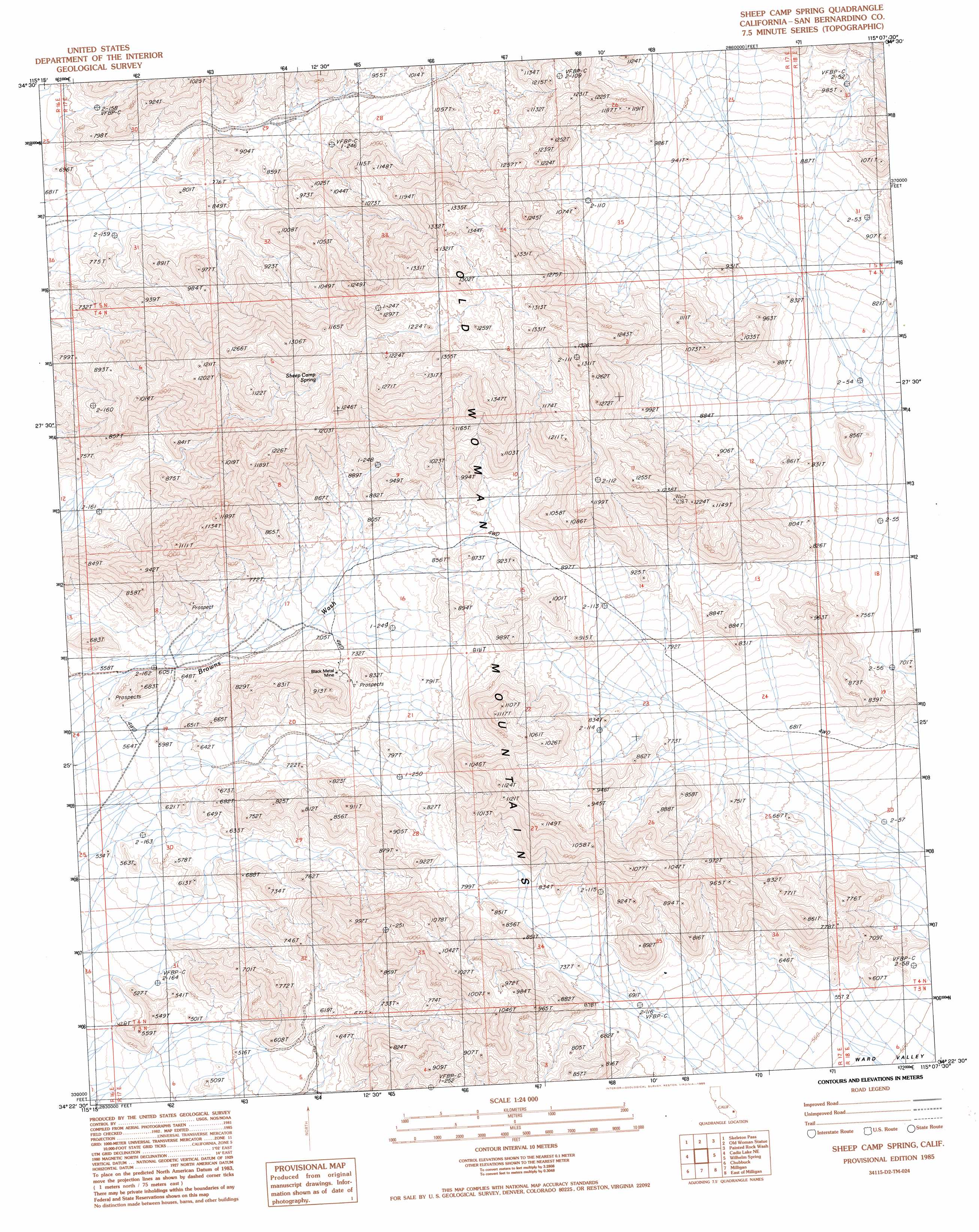
USGS Topo Quad 34115d2 - 1:24,000 scale
| Topo Map Name: | Sheep Camp Spring |
| USGS Topo Quad ID: | 34115d2 |
| Print Size: | ca. 21 1/4" wide x 27" high |
| Southeast Coordinates: | 34.375° N latitude / 115.125° W longitude |
| Map Center Coordinates: | 34.4375° N latitude / 115.1875° W longitude |
| U.S. State: | CA |
| Filename: | o34115d2.jpg |
| Download Map JPG Image: | Sheep Camp Spring topo map 1:24,000 scale |
| Map Type: | Topographic |
| Topo Series: | 7.5´ |
| Map Scale: | 1:24,000 |
| Source of Map Images: | United States Geological Survey (USGS) |
| Alternate Map Versions: |
Sheep Camp Spring CA 1985, updated 1985 Download PDF Buy paper map Sheep Camp Spring CA 2012 Download PDF Buy paper map Sheep Camp Spring CA 2015 Download PDF Buy paper map |
1:24,000 Topo Quads surrounding Sheep Camp Spring
Castle Dome |
Danby |
Essex |
Little Piute Mountains |
Stepladder Mountains Nw |
Cadiz Summit |
Skeleton Pass |
Old Woman Statue |
Painted Rock Wash |
Stepladder Mountains Sw |
Cadiz Lake Nw |
Cadiz Lake Ne |
Sheep Camp Spring |
Wilhelm Spring |
West Of Mohawk Spring |
Cadiz Lake |
Chubbuck |
Milligan |
East Of Milligan |
Martins Well |
Cadiz Valley Nw |
Cadiz Valley Ne |
Iron Mountains |
Danby Lake |
Sablon |
> Back to 34115a1 at 1:100,000 scale
> Back to 34114a1 at 1:250,000 scale
> Back to U.S. Topo Maps home
Sheep Camp Spring topo map: Gazetteer
Sheep Camp Spring: Mines
Black Metal Mine elevation 769m 2522′Sheep Camp Spring: Ranges
Old Woman Mountains elevation 899m 2949′Sheep Camp Spring: Springs
Sheep Camp Spring elevation 1063m 3487′Sheep Camp Spring digital topo map on disk
Buy this Sheep Camp Spring topo map showing relief, roads, GPS coordinates and other geographical features, as a high-resolution digital map file on DVD: