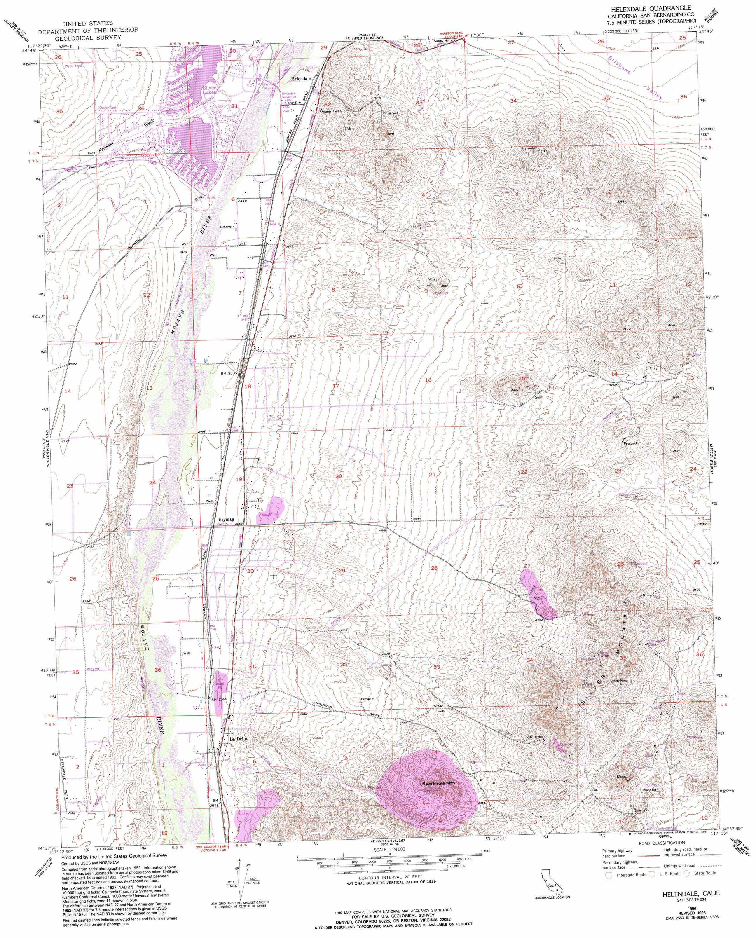
Helendale Topo Map California
To zoom in, hover over the map of Helendale
USGS Topo Quad 34117f3 - 1:24,000 scale
| Topo Map Name: | Helendale |
| USGS Topo Quad ID: | 34117f3 |
| Print Size: | ca. 21 1/4" wide x 27" high |
| Southeast Coordinates: | 34.625° N latitude / 117.25° W longitude |
| Map Center Coordinates: | 34.6875° N latitude / 117.3125° W longitude |
| U.S. State: | CA |
| Filename: | o34117f3.jpg |
| Download Map JPG Image: | Helendale topo map 1:24,000 scale |
| Map Type: | Topographic |
| Topo Series: | 7.5´ |
| Map Scale: | 1:24,000 |
| Source of Map Images: | United States Geological Survey (USGS) |
| Alternate Map Versions: |
Helendale CA 1956, updated 1957 Download PDF Buy paper map Helendale CA 1956, updated 1966 Download PDF Buy paper map Helendale CA 1956, updated 1969 Download PDF Buy paper map Helendale CA 1956, updated 1975 Download PDF Buy paper map Helendale CA 1956, updated 1993 Download PDF Buy paper map Helendale CA 2012 Download PDF Buy paper map Helendale CA 2015 Download PDF Buy paper map |
1:24,000 Topo Quads surrounding Helendale
Kramer Junction |
Kramer Hills |
Twelve Gauge Lake |
Hinkley |
Barstow |
Red Buttes |
Astley Rancho |
Wild Crossing |
Hodge |
Barstow Se |
Shadow Mountains |
Victorville Nw |
Helendale |
Turtle Valley |
Stoddard Well |
Shadow Mountains Se |
Adelanto |
Victorville |
Apple Valley North |
Fairview Valley |
Phelan |
Baldy Mesa |
Hesperia |
Apple Valley South |
Fifteenmile Valley |
> Back to 34117e1 at 1:100,000 scale
> Back to 34116a1 at 1:250,000 scale
> Back to U.S. Topo Maps home
Helendale topo map: Gazetteer
Helendale: Airports
Palisades Ranch Airport elevation 763m 2503′Helendale: Mines
Apex Mine elevation 1203m 3946′Branch Mine elevation 1169m 3835′
Oro Grande Mine elevation 1181m 3874′
Western States Mine elevation 1140m 3740′
Helendale: Populated Places
Bryman elevation 770m 2526′Helendale elevation 742m 2434′
La Delta elevation 789m 2588′
Helendale: Post Offices
Helendale Post Office elevation 741m 2431′Helendale: Reservoirs
North Lake elevation 748m 2454′South Lake elevation 751m 2463′
Helendale: Streams
Fremont Wash elevation 743m 2437′Helendale: Summits
Silver Mountain elevation 1271m 4169′Sparkhule Mountain elevation 1090m 3576′
Helendale digital topo map on disk
Buy this Helendale topo map showing relief, roads, GPS coordinates and other geographical features, as a high-resolution digital map file on DVD: