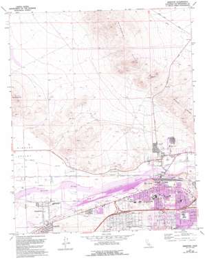
Barstow Topo Map California
To zoom in, hover over the map of Barstow
USGS Topo Quad 34117h1 - 1:24,000 scale
| Topo Map Name: | Barstow |
| USGS Topo Quad ID: | 34117h1 |
| Print Size: | ca. 21 1/4" wide x 27" high |
| Southeast Coordinates: | 34.875° N latitude / 117° W longitude |
| Map Center Coordinates: | 34.9375° N latitude / 117.0625° W longitude |
| U.S. State: | CA |
| Filename: | o34117h1.jpg |
| Download Map JPG Image: | Barstow topo map 1:24,000 scale |
| Map Type: | Topographic |
| Topo Series: | 7.5´ |
| Map Scale: | 1:24,000 |
| Source of Map Images: | United States Geological Survey (USGS) |
| Alternate Map Versions: |
Barstow CA 1971, updated 1974 Download PDF Buy paper map Barstow CA 1971, updated 1974 Download PDF Buy paper map Barstow CA 1971, updated 1980 Download PDF Buy paper map Barstow CA 1971, updated 1988 Download PDF Buy paper map Barstow CA 1971, updated 1993 Download PDF Buy paper map Barstow CA 2012 Download PDF Buy paper map Barstow CA 2015 Download PDF Buy paper map |
1:24,000 Topo Quads surrounding Barstow
> Back to 34117e1 at 1:100,000 scale
> Back to 34116a1 at 1:250,000 scale
> Back to U.S. Topo Maps home
Barstow topo map: Gazetteer
Barstow: Airports
Barstow Community Hospital Heliport elevation 690m 2263′Barstow: Mines
Waterman Mine elevation 879m 2883′Barstow: Parks
Barstow Heights Park elevation 748m 2454′Daha Park elevation 718m 2355′
Dana Park elevation 722m 2368′
Foglesong Park elevation 667m 2188′
H Street Soccer Fields elevation 677m 2221′
Jasper Park elevation 679m 2227′
Lillian Park elevation 688m 2257′
Stringham Park elevation 684m 2244′
Waterman Park elevation 646m 2119′
Barstow: Populated Places
Barstow elevation 663m 2175′Grandview elevation 670m 2198′
Hutt elevation 656m 2152′
Irwin Estates elevation 666m 2185′
Lenwood elevation 695m 2280′
Mace (historical) elevation 663m 2175′
North Barstow elevation 643m 2109′
Skyline North elevation 667m 2188′
Barstow: Post Offices
Barstow Post Office elevation 686m 2250′Barstow: Ranges
Mitchel Range elevation 863m 2831′Waterman Hills elevation 1025m 3362′
Barstow: Summits
B Hill elevation 736m 2414′Barstow digital topo map on disk
Buy this Barstow topo map showing relief, roads, GPS coordinates and other geographical features, as a high-resolution digital map file on DVD:


