Chimney Butte Topo Map Arizona
To zoom in, hover over the map of Chimney Butte
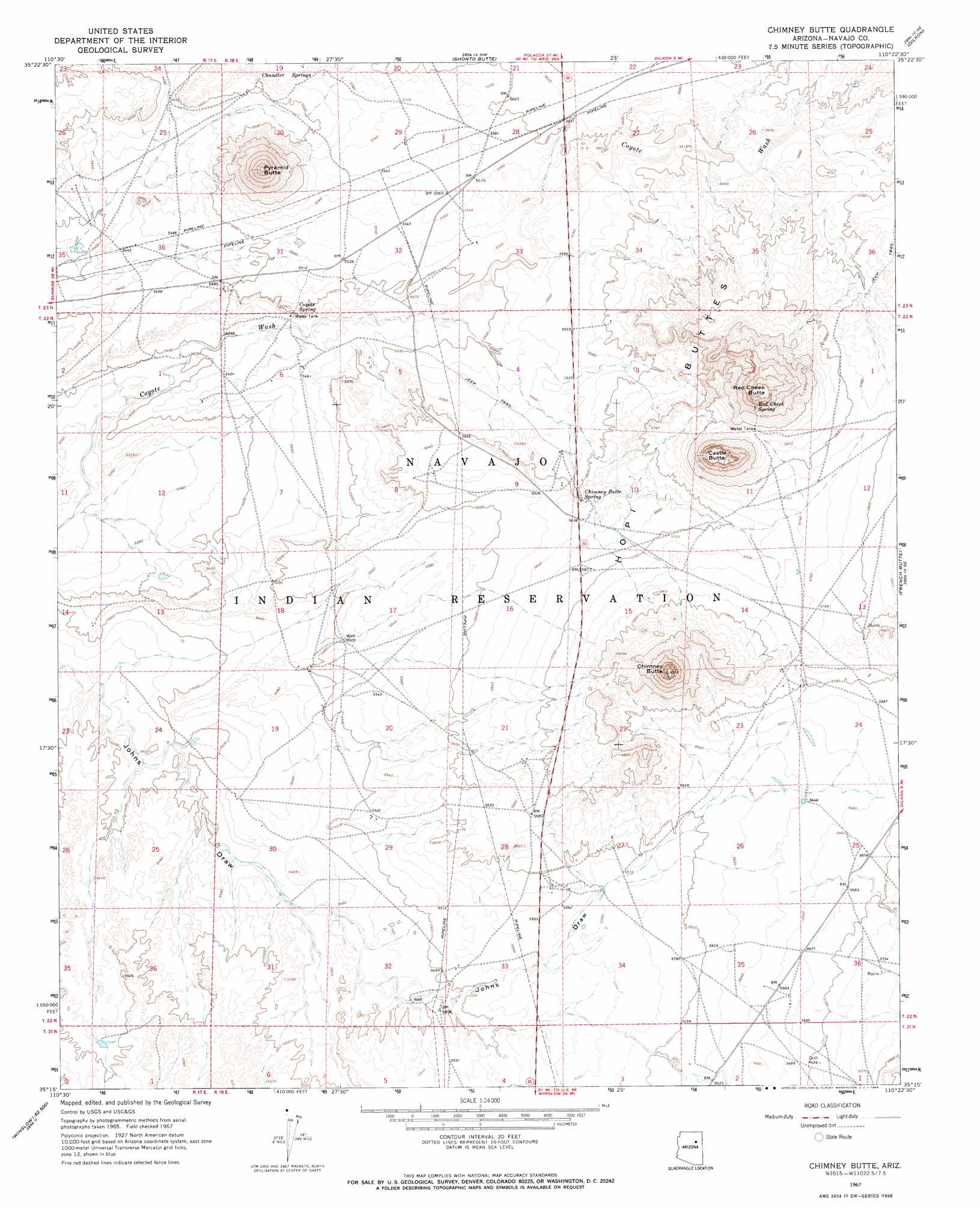
USGS Topo Quad 35110c4 - 1:24,000 scale
| Topo Map Name: | Chimney Butte |
| USGS Topo Quad ID: | 35110c4 |
| Print Size: | ca. 21 1/4" wide x 27" high |
| Southeast Coordinates: | 35.25° N latitude / 110.375° W longitude |
| Map Center Coordinates: | 35.3125° N latitude / 110.4375° W longitude |
| U.S. State: | AZ |
| Filename: | o35110c4.jpg |
| Download Map JPG Image: | Chimney Butte topo map 1:24,000 scale |
| Map Type: | Topographic |
| Topo Series: | 7.5´ |
| Map Scale: | 1:24,000 |
| Source of Map Images: | United States Geological Survey (USGS) |
| Alternate Map Versions: |
Chimney Butte AZ 1967, updated 1969 Download PDF Buy paper map Chimney Butte AZ 2011 Download PDF Buy paper map Chimney Butte AZ 2014 Download PDF Buy paper map |
1:24,000 Topo Quads surrounding Chimney Butte
Tovar Mesa West |
Tovar Mesa East |
Egloffstein Butte |
Hauke Mesa |
First Flat Mesa |
Montezumas Chair Nw |
Montezumas Chair |
Shonto Butte |
Dilkon |
Na Ah Tee Canyon |
Bird Springs Wash |
Elephant Butte |
Chimney Butte |
French Butte |
Sunflower Butte |
Winslow Nw |
Winslow Ne |
Standing Horse Mesa |
Rotten Bananas Butte |
Turkey Track Butte |
Winslow |
Rincon Ranch |
Humpy Camp Well |
Blairs Spring |
Lee Mountain |
> Back to 35110a1 at 1:100,000 scale
> Back to 35110a1 at 1:250,000 scale
> Back to U.S. Topo Maps home
Chimney Butte topo map: Gazetteer
Chimney Butte: Springs
Chimney Butte Spring elevation 1708m 5603′Coyote Spring elevation 1675m 5495′
Red Cheek Spring elevation 1864m 6115′
Chimney Butte: Summits
Castle Butte elevation 1976m 6482′Chimney Butte elevation 1996m 6548′
Pyramid Butte elevation 1910m 6266′
Red Cheek Butte elevation 1968m 6456′
Chimney Butte digital topo map on disk
Buy this Chimney Butte topo map showing relief, roads, GPS coordinates and other geographical features, as a high-resolution digital map file on DVD: