Na Ah Tee Canyon Topo Map Arizona
To zoom in, hover over the map of Na Ah Tee Canyon
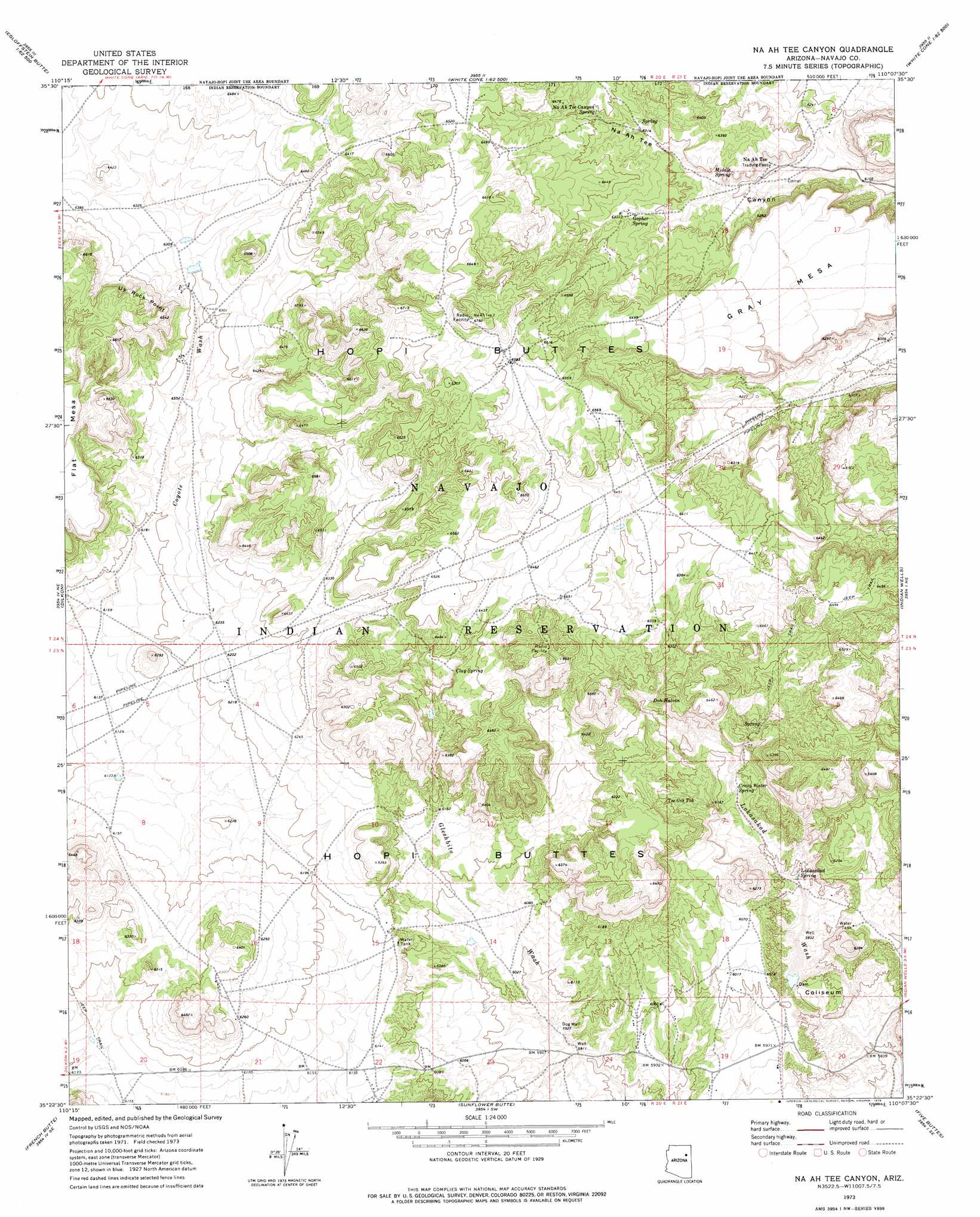
USGS Topo Quad 35110d2 - 1:24,000 scale
| Topo Map Name: | Na Ah Tee Canyon |
| USGS Topo Quad ID: | 35110d2 |
| Print Size: | ca. 21 1/4" wide x 27" high |
| Southeast Coordinates: | 35.375° N latitude / 110.125° W longitude |
| Map Center Coordinates: | 35.4375° N latitude / 110.1875° W longitude |
| U.S. State: | AZ |
| Filename: | o35110d2.jpg |
| Download Map JPG Image: | Na Ah Tee Canyon topo map 1:24,000 scale |
| Map Type: | Topographic |
| Topo Series: | 7.5´ |
| Map Scale: | 1:24,000 |
| Source of Map Images: | United States Geological Survey (USGS) |
| Alternate Map Versions: |
Na Ah Tee Canyon AZ 1973, updated 1976 Download PDF Buy paper map Na Ah Tee Canyon AZ 2011 Download PDF Buy paper map Na Ah Tee Canyon AZ 2014 Download PDF Buy paper map |
1:24,000 Topo Quads surrounding Na Ah Tee Canyon
Snake Butte |
Star Mountain |
Jadito Spring |
Tsin Naan Tee |
Toyei School |
Egloffstein Butte |
Hauke Mesa |
First Flat Mesa |
White Cone |
Satan Butte |
Shonto Butte |
Dilkon |
Na Ah Tee Canyon |
Indian Wells |
Greasewood Spring |
Chimney Butte |
French Butte |
Sunflower Butte |
Five Buttes |
Arrowhead Butte |
Standing Horse Mesa |
Rotten Bananas Butte |
Turkey Track Butte |
Mitten Peak |
Pilot Rock |
> Back to 35110a1 at 1:100,000 scale
> Back to 35110a1 at 1:250,000 scale
> Back to U.S. Topo Maps home
Na Ah Tee Canyon topo map: Gazetteer
Na Ah Tee Canyon: Cliffs
Up Rock Point elevation 1994m 6541′Na Ah Tee Canyon: Populated Places
Na Ah Tee elevation 1909m 6263′Na Ah Tee Canyon: Springs
Clay Spring elevation 1935m 6348′Crazy Water Spring elevation 1847m 6059′
Doh Halian elevation 1896m 6220′
Gopher Spring elevation 1933m 6341′
Lokasakad Spring elevation 1826m 5990′
Middle Spring elevation 1921m 6302′
Na Ah Tee Canyon Spring elevation 1951m 6400′
Tse Gis Toh elevation 1867m 6125′
Na Ah Tee Canyon: Summits
Gray Mesa elevation 1947m 6387′Na Ah Tee Canyon: Wells
Dog Well elevation 1811m 5941′Na Ah Tee Canyon digital topo map on disk
Buy this Na Ah Tee Canyon topo map showing relief, roads, GPS coordinates and other geographical features, as a high-resolution digital map file on DVD: