Wasco Sw Topo Map California
To zoom in, hover over the map of Wasco Sw
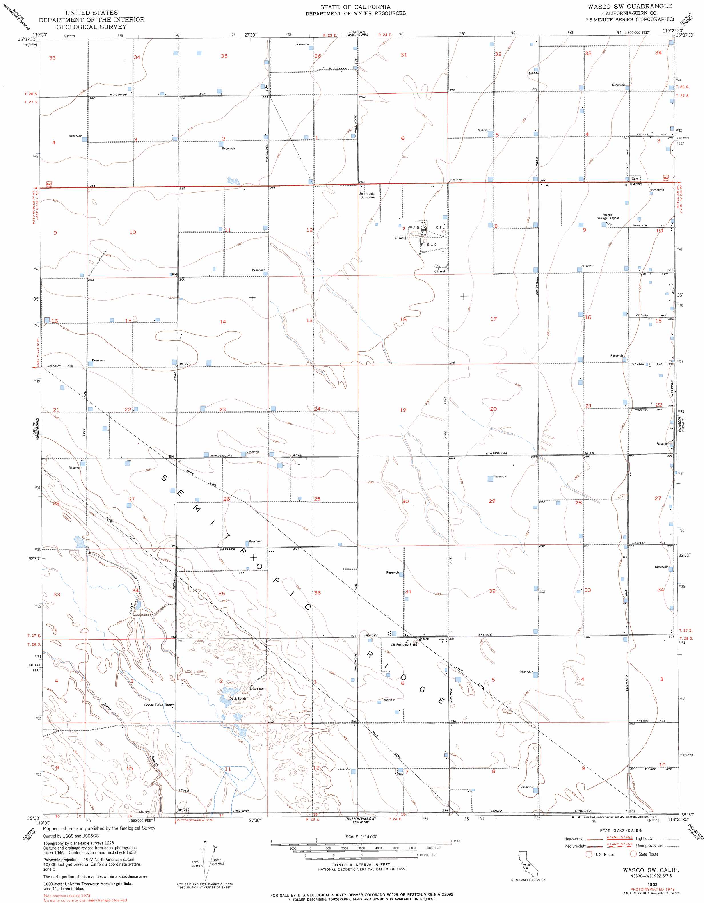
USGS Topo Quad 35119e4 - 1:24,000 scale
| Topo Map Name: | Wasco Sw |
| USGS Topo Quad ID: | 35119e4 |
| Print Size: | ca. 21 1/4" wide x 27" high |
| Southeast Coordinates: | 35.5° N latitude / 119.375° W longitude |
| Map Center Coordinates: | 35.5625° N latitude / 119.4375° W longitude |
| U.S. State: | CA |
| Filename: | o35119e4.jpg |
| Download Map JPG Image: | Wasco Sw topo map 1:24,000 scale |
| Map Type: | Topographic |
| Topo Series: | 7.5´ |
| Map Scale: | 1:24,000 |
| Source of Map Images: | United States Geological Survey (USGS) |
| Alternate Map Versions: |
Wasco SW CA 1953, updated 1954 Download PDF Buy paper map Wasco SW CA 1953, updated 1977 Download PDF Buy paper map Wasco SW CA 2012 Download PDF Buy paper map Wasco SW CA 2015 Download PDF Buy paper map |
1:24,000 Topo Quads surrounding Wasco Sw
Lone Tree Well |
Hacienda Ranch |
Allensworth |
Delano West |
Delano East |
Lost Hills Nw |
Lost Hills Ne |
Wasco Nw |
Pond |
Mcfarland |
Lost Hills |
Semitropic |
Wasco Sw |
Wasco |
Famoso |
Belridge |
Lokern |
Buttonwillow |
Rio Bravo |
Rosedale |
Reward |
West Elk Hills |
East Elk Hills |
Tupman |
Stevens |
> Back to 35119e1 at 1:100,000 scale
> Back to 35118a1 at 1:250,000 scale
> Back to U.S. Topo Maps home
Wasco Sw topo map: Gazetteer
Wasco Sw: Oilfields
Wasco Oil Field elevation 85m 278′Wasco Sw: Populated Places
Leonards (historical) elevation 90m 295′Wasco Sw digital topo map on disk
Buy this Wasco Sw topo map showing relief, roads, GPS coordinates and other geographical features, as a high-resolution digital map file on DVD:
Southern Sierra Nevada, California & Southern Nevada
Buy digital topo maps: Southern Sierra Nevada, California & Southern Nevada