Gate Nw Topo Map Oklahoma
To zoom in, hover over the map of Gate Nw
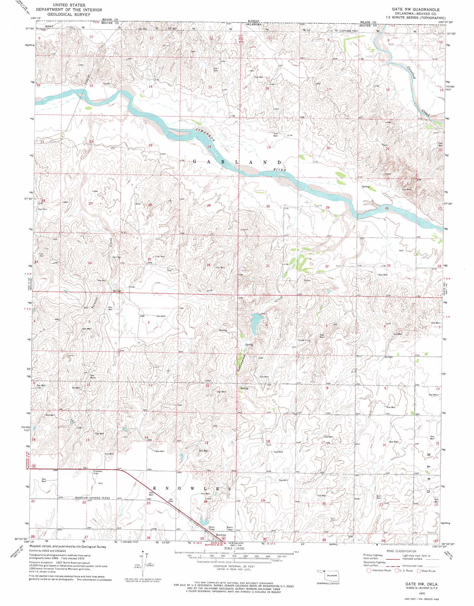
USGS Topo Quad 36100h2 - 1:24,000 scale
| Topo Map Name: | Gate Nw |
| USGS Topo Quad ID: | 36100h2 |
| Print Size: | ca. 21 1/4" wide x 27" high |
| Southeast Coordinates: | 36.875° N latitude / 100.125° W longitude |
| Map Center Coordinates: | 36.9375° N latitude / 100.1875° W longitude |
| U.S. State: | OK |
| Filename: | o36100h2.jpg |
| Download Map JPG Image: | Gate Nw topo map 1:24,000 scale |
| Map Type: | Topographic |
| Topo Series: | 7.5´ |
| Map Scale: | 1:24,000 |
| Source of Map Images: | United States Geological Survey (USGS) |
| Alternate Map Versions: |
Gate NW OK 1970, updated 1973 Download PDF Buy paper map Gate NW OK 2010 Download PDF Buy paper map Gate NW OK 2012 Download PDF Buy paper map Gate NW OK 2016 Download PDF Buy paper map |
1:24,000 Topo Quads surrounding Gate Nw
Lake Meade |
Irish Flats Ne |
Proffitt Lake Nw |
Proffitt Lake |
Ashland Nw |
Irish Flats |
Irish Flats Se |
Proffitt Lake Sw |
Mount Helen |
Englewood |
Mocane Nw |
Mocane |
Gate Nw |
Gate Ne |
Rosston Nw |
Mocane Sw |
Mocane Se |
Knowles |
Gate |
Rosston |
Clear Lake Nw |
Clear Lake |
Logan Nw |
Logan Ne |
Laverne |
> Back to 36100e1 at 1:100,000 scale
> Back to 36100a1 at 1:250,000 scale
> Back to U.S. Topo Maps home
Gate Nw topo map: Gazetteer
Gate Nw: Dams
Barby Sargent Number 1 Dam elevation 719m 2358′Barby Sargent Number 3 Dam elevation 688m 2257′
Gate Nw: Reservoirs
Barby Sargent Number 1 Reservoir elevation 719m 2358′Barby Sargent Number 3 Reservoir elevation 688m 2257′
Gate Nw: Streams
Cottonwood Creek elevation 640m 2099′Taintor Creek elevation 657m 2155′
Gate Nw digital topo map on disk
Buy this Gate Nw topo map showing relief, roads, GPS coordinates and other geographical features, as a high-resolution digital map file on DVD: