Mocane Sw Topo Map Oklahoma
To zoom in, hover over the map of Mocane Sw
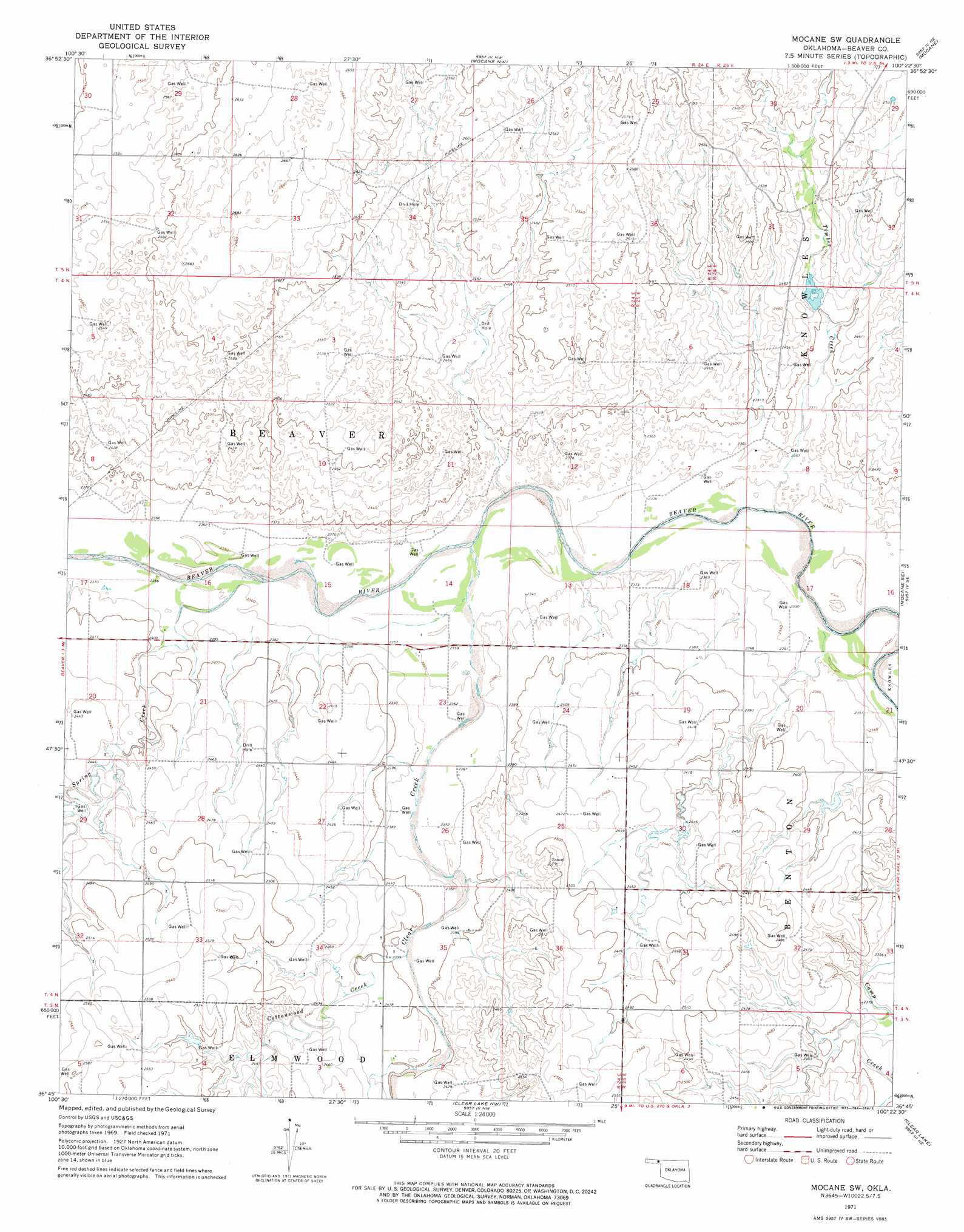
USGS Topo Quad 36100g4 - 1:24,000 scale
| Topo Map Name: | Mocane Sw |
| USGS Topo Quad ID: | 36100g4 |
| Print Size: | ca. 21 1/4" wide x 27" high |
| Southeast Coordinates: | 36.75° N latitude / 100.375° W longitude |
| Map Center Coordinates: | 36.8125° N latitude / 100.4375° W longitude |
| U.S. State: | OK |
| Filename: | o36100g4.jpg |
| Download Map JPG Image: | Mocane Sw topo map 1:24,000 scale |
| Map Type: | Topographic |
| Topo Series: | 7.5´ |
| Map Scale: | 1:24,000 |
| Source of Map Images: | United States Geological Survey (USGS) |
| Alternate Map Versions: |
Mocane SW OK 1971, updated 1973 Download PDF Buy paper map Mocane SW OK 2010 Download PDF Buy paper map Mocane SW OK 2012 Download PDF Buy paper map Mocane SW OK 2016 Download PDF Buy paper map |
1:24,000 Topo Quads surrounding Mocane Sw
Kismet Sw |
Kismet Se |
Irish Flats |
Irish Flats Se |
Proffitt Lake Sw |
Beaver Nw |
Forgan |
Mocane Nw |
Mocane |
Gate Nw |
Floris |
Beaver |
Mocane Sw |
Mocane Se |
Knowles |
Balko |
Balko Ne |
Clear Lake Nw |
Clear Lake |
Logan Nw |
Balko Sw |
Elmwood |
Clear Lake Sw |
Clear Lake Se |
Logan |
> Back to 36100e1 at 1:100,000 scale
> Back to 36100a1 at 1:250,000 scale
> Back to U.S. Topo Maps home
Mocane Sw topo map: Gazetteer
Mocane Sw: Dams
Oknoname 007003 Dam elevation 733m 2404′Mocane Sw: Reservoirs
Oknoname 007003 Reservoir elevation 733m 2404′Mocane Sw: Streams
Clear Creek elevation 714m 2342′Cottonwood Creek elevation 728m 2388′
Spring Creek elevation 718m 2355′
Timber Creek elevation 711m 2332′
Mocane Sw digital topo map on disk
Buy this Mocane Sw topo map showing relief, roads, GPS coordinates and other geographical features, as a high-resolution digital map file on DVD: