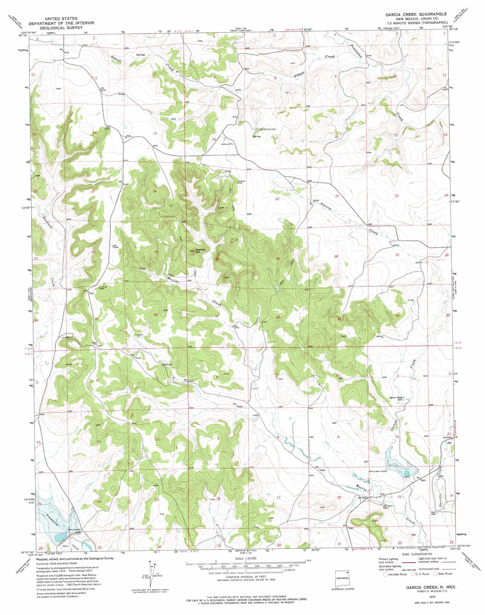
Garcia Creek Topo Map New Mexico
To zoom in, hover over the map of Garcia Creek
USGS Topo Quad 36103b5 - 1:24,000 scale
| Topo Map Name: | Garcia Creek |
| USGS Topo Quad ID: | 36103b5 |
| Print Size: | ca. 21 1/4" wide x 27" high |
| Southeast Coordinates: | 36.125° N latitude / 103.5° W longitude |
| Map Center Coordinates: | 36.1875° N latitude / 103.5625° W longitude |
| U.S. State: | NM |
| Filename: | o36103b5.jpg |
| Download Map JPG Image: | Garcia Creek topo map 1:24,000 scale |
| Map Type: | Topographic |
| Topo Series: | 7.5´ |
| Map Scale: | 1:24,000 |
| Source of Map Images: | United States Geological Survey (USGS) |
| Alternate Map Versions: |
Garcia Creek NM 1973, updated 1978 Download PDF Buy paper map Garcia Creek NM 2010 Download PDF Buy paper map Garcia Creek NM 2013 Download PDF Buy paper map Garcia Creek NM 2017 Download PDF Buy paper map |
1:24,000 Topo Quads surrounding Garcia Creek
Sofia |
Tripod Mountain |
Snyder Lake |
Black Canyon |
Royce |
Romero Spring |
Pennington |
Goat Canyon |
Tate School |
Sand Hill |
Aragon Hill |
Beenham |
Garcia Creek |
Car Top Butte |
Clapham |
Yates Se |
Beenham Sw |
Minnie Butte |
Pedernal Creek |
Skull Mesa |
Albert |
Bueyeros |
Bueyeros Ne |
Cottonwood Springs |
Hayden |
> Back to 36103a1 at 1:100,000 scale
> Back to 36102a1 at 1:250,000 scale
> Back to U.S. Topo Maps home
Garcia Creek topo map: Gazetteer
Garcia Creek: Dams
Poling Erosion Control Dam elevation 1523m 4996′Poling Irrigation System Dam elevation 1514m 4967′
Tramperos Creek Site One Dam elevation 1524m 5000′
Tramperos Creek Site Two Dam elevation 1502m 4927′
Garcia Creek: Populated Places
Garcia (historical) elevation 1517m 4977′Garcia Creek: Streams
Abbott Creek elevation 1590m 5216′Garcia Creek elevation 1485m 4872′
Garcia Creek: Summits
Orphan Hill elevation 1655m 5429′Garcia Creek digital topo map on disk
Buy this Garcia Creek topo map showing relief, roads, GPS coordinates and other geographical features, as a high-resolution digital map file on DVD: