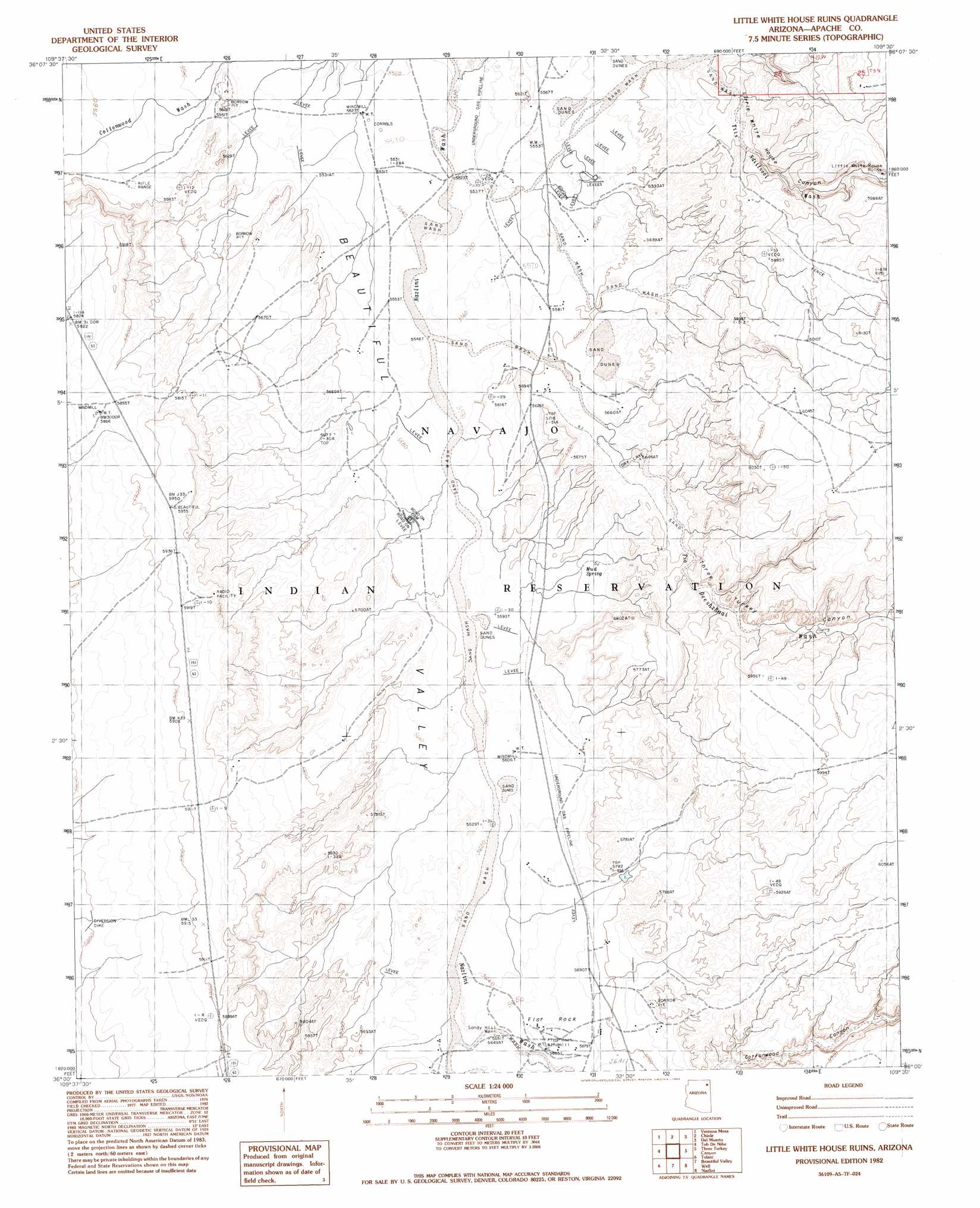
Little White House Ruins Topo Map Arizona
To zoom in, hover over the map of Little White House Ruins
USGS Topo Quad 36109a5 - 1:24,000 scale
| Topo Map Name: | Little White House Ruins |
| USGS Topo Quad ID: | 36109a5 |
| Print Size: | ca. 21 1/4" wide x 27" high |
| Southeast Coordinates: | 36° N latitude / 109.5° W longitude |
| Map Center Coordinates: | 36.0625° N latitude / 109.5625° W longitude |
| U.S. State: | AZ |
| Filename: | o36109a5.jpg |
| Download Map JPG Image: | Little White House Ruins topo map 1:24,000 scale |
| Map Type: | Topographic |
| Topo Series: | 7.5´ |
| Map Scale: | 1:24,000 |
| Source of Map Images: | United States Geological Survey (USGS) |
| Alternate Map Versions: |
Chinle 4 SE AZ 1955, updated 1957 Download PDF Buy paper map Little White House Ruins AZ 1982, updated 1983 Download PDF Buy paper map Mud Spring AZ 2011 Download PDF Buy paper map Mud Spring AZ 2014 Download PDF Buy paper map |
1:24,000 Topo Quads surrounding Little White House Ruins
Sweathouse Peak |
Many Farms Sw |
Many Farms |
Tall Tree Mesa |
Red Cornfield Mesa |
Lohali Point |
Ventana Mesa |
Chinle |
Del Merto |
Mummy Cave Ruins |
Salina |
Toh De Niihe |
Little White House Ruins |
Three Turkey Canyon |
Spider Rock |
Steamboat Rock Ne |
Tolani |
Beautiful Valley Well |
Nazlini |
White Rock Wash |
Steamboat Rock |
Ganado Mesa Sw |
Ganado Mesa |
Red Clay Wash |
Oak Creek Mountain |
> Back to 36109a1 at 1:100,000 scale
> Back to 36108a1 at 1:250,000 scale
> Back to U.S. Topo Maps home
Little White House Ruins topo map: Gazetteer
Little White House Ruins: Dams
Taylor Reservoir Dam elevation 1732m 5682′Little White House Ruins: Populated Places
Flat Rock elevation 1726m 5662′Little White House Ruins: Springs
Mud Springs elevation 1707m 5600′Little White House Ruins: Streams
Tiis Ndiitsooi Wash elevation 1686m 5531′Tse Deeshzhaai Wash elevation 1693m 5554′
Little White House Ruins: Valleys
Bis Ii Ah Wash elevation 1720m 5643′Little White House Canyon elevation 1718m 5636′
Three Turkey Canyon elevation 1692m 5551′
Little White House Ruins: Wells
Flat Rock Windmill elevation 1727m 5666′Sandy Hill Well elevation 1723m 5652′
Little White House Ruins digital topo map on disk
Buy this Little White House Ruins topo map showing relief, roads, GPS coordinates and other geographical features, as a high-resolution digital map file on DVD: