Ganado Mesa Sw Topo Map Arizona
To zoom in, hover over the map of Ganado Mesa Sw
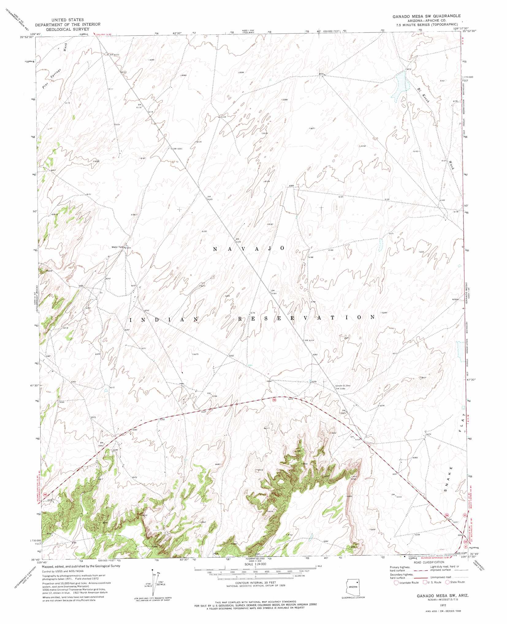
USGS Topo Quad 35109g6 - 1:24,000 scale
| Topo Map Name: | Ganado Mesa Sw |
| USGS Topo Quad ID: | 35109g6 |
| Print Size: | ca. 21 1/4" wide x 27" high |
| Southeast Coordinates: | 35.75° N latitude / 109.625° W longitude |
| Map Center Coordinates: | 35.8125° N latitude / 109.6875° W longitude |
| U.S. State: | AZ |
| Filename: | o35109g6.jpg |
| Download Map JPG Image: | Ganado Mesa Sw topo map 1:24,000 scale |
| Map Type: | Topographic |
| Topo Series: | 7.5´ |
| Map Scale: | 1:24,000 |
| Source of Map Images: | United States Geological Survey (USGS) |
| Alternate Map Versions: |
Ganado Mesa SW AZ 1972, updated 1976 Download PDF Buy paper map Ganado Mesa SW AZ 2011 Download PDF Buy paper map Ganado Mesa SW AZ 2014 Download PDF Buy paper map |
1:24,000 Topo Quads surrounding Ganado Mesa Sw
Toadimdaaska Mesa |
Salina |
Toh De Niihe |
Little White House Ruins |
Three Turkey Canyon |
Beeshsikad Spring |
Steamboat Rock Ne |
Tolani |
Beautiful Valley Well |
Nazlini |
Big Willow Spring Canyon |
Steamboat Rock |
Ganado Mesa Sw |
Ganado Mesa |
Red Clay Wash |
Toyei School |
Steamboat Canyon |
Cornfields |
Ganado |
Kinlichee |
Satan Butte |
Greasewood |
Sunrise Springs |
Klagetoh North |
Tudecoz Spring |
> Back to 35109e1 at 1:100,000 scale
> Back to 35108a1 at 1:250,000 scale
> Back to U.S. Topo Maps home
No gazetteer data is available for the Ganado Mesa Sw topo map sheet.
Ganado Mesa Sw digital topo map on disk
Buy this Ganado Mesa Sw topo map showing relief, roads, GPS coordinates and other geographical features, as a high-resolution digital map file on DVD: