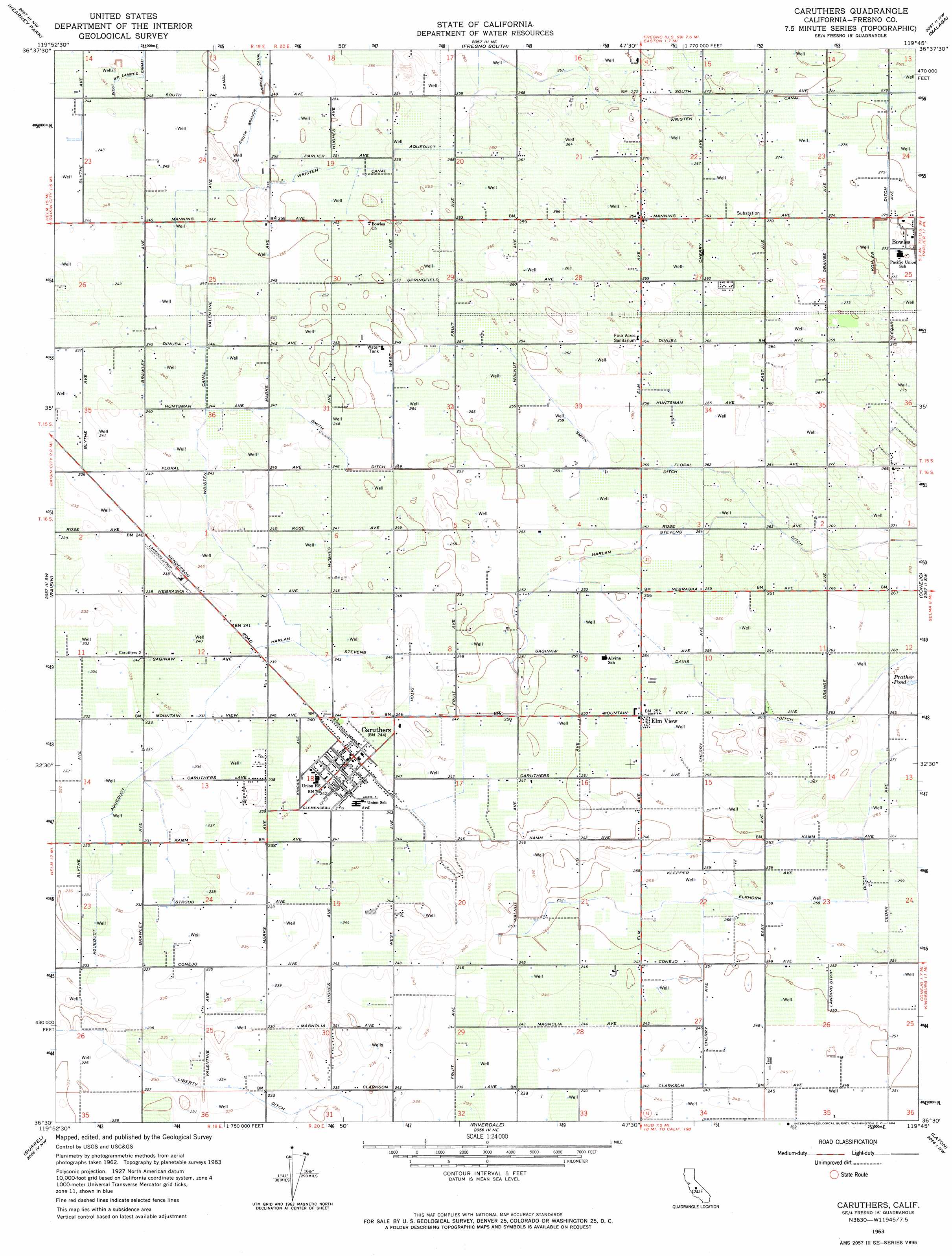
Caruthers Topo Map California
To zoom in, hover over the map of Caruthers
USGS Topo Quad 36119e7 - 1:24,000 scale
| Topo Map Name: | Caruthers |
| USGS Topo Quad ID: | 36119e7 |
| Print Size: | ca. 21 1/4" wide x 27" high |
| Southeast Coordinates: | 36.5° N latitude / 119.75° W longitude |
| Map Center Coordinates: | 36.5625° N latitude / 119.8125° W longitude |
| U.S. State: | CA |
| Filename: | o36119e7.jpg |
| Download Map JPG Image: | Caruthers topo map 1:24,000 scale |
| Map Type: | Topographic |
| Topo Series: | 7.5´ |
| Map Scale: | 1:24,000 |
| Source of Map Images: | United States Geological Survey (USGS) |
| Alternate Map Versions: |
Caruthers CA 1946, updated 1959 Download PDF Buy paper map Caruthers CA 1947 Download PDF Buy paper map Caruthers CA 1947 Download PDF Buy paper map Caruthers CA 1963, updated 1964 Download PDF Buy paper map Caruthers CA 1963, updated 1964 Download PDF Buy paper map Caruthers CA 2012 Download PDF Buy paper map Caruthers CA 2015 Download PDF Buy paper map |
1:24,000 Topo Quads surrounding Caruthers
Biola |
Herndon |
Fresno North |
Clovis |
Round Mountain |
Kerman |
Kearney Park |
Fresno South |
Malaga |
Sanger |
Helm |
Raisin |
Caruthers |
Conejo |
Selma |
Five Points |
Burrel |
Riverdale |
Laton |
Burris Park |
Calflax |
Vanguard |
Lemoore |
Hanford |
Remnoy |
> Back to 36119e1 at 1:100,000 scale
> Back to 36118a1 at 1:250,000 scale
> Back to U.S. Topo Maps home
Caruthers topo map: Gazetteer
Caruthers: Airports
Al Divine Airport elevation 77m 252′Caruthers: Canals
Davis Ditch elevation 83m 272′Harlan Stevens Ditch elevation 79m 259′
Kohler Ditch elevation 84m 275′
Smith Ditch elevation 77m 252′
South Branch Lampee Canal elevation 77m 252′
Wristen Canal elevation 84m 275′
Caruthers: Populated Places
Bowles elevation 85m 278′Caruthers elevation 75m 246′
Elm View elevation 78m 255′
Caruthers: Post Offices
Caruthers Post Office elevation 75m 246′Caruthers digital topo map on disk
Buy this Caruthers topo map showing relief, roads, GPS coordinates and other geographical features, as a high-resolution digital map file on DVD:
Southern Sierra Nevada, California & Southern Nevada
Buy digital topo maps: Southern Sierra Nevada, California & Southern Nevada