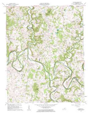
Hudgins Topo Map Kentucky
To zoom in, hover over the map of Hudgins
USGS Topo Quad 37085c6 - 1:24,000 scale
| Topo Map Name: | Hudgins |
| USGS Topo Quad ID: | 37085c6 |
| Print Size: | ca. 21 1/4" wide x 27" high |
| Southeast Coordinates: | 37.25° N latitude / 85.625° W longitude |
| Map Center Coordinates: | 37.3125° N latitude / 85.6875° W longitude |
| U.S. State: | KY |
| Filename: | o37085c6.jpg |
| Download Map JPG Image: | Hudgins topo map 1:24,000 scale |
| Map Type: | Topographic |
| Topo Series: | 7.5´ |
| Map Scale: | 1:24,000 |
| Source of Map Images: | United States Geological Survey (USGS) |
| Alternate Map Versions: |
Hudgins KY 1953, updated 1954 Download PDF Buy paper map Hudgins KY 1961, updated 1963 Download PDF Buy paper map Hudgins KY 2010 Download PDF Buy paper map Hudgins KY 2013 Download PDF Buy paper map Hudgins KY 2016 Download PDF Buy paper map |
1:24,000 Topo Quads surrounding Hudgins
> Back to 37085a1 at 1:100,000 scale
> Back to 37084a1 at 1:250,000 scale
> Back to U.S. Topo Maps home
Hudgins topo map: Gazetteer
Hudgins: Bends
Caven Bend elevation 206m 675′Charlie Rhea Bend elevation 188m 616′
Davis Bend elevation 166m 544′
Figett Bend elevation 173m 567′
Lobb Bend elevation 190m 623′
Round Bottom elevation 171m 561′
Scott Bend elevation 183m 600′
Hudgins: Cliffs
Bell Cliff elevation 217m 711′Hudgins: Gaps
The Narrows elevation 179m 587′Hudgins: Islands
Armour Island elevation 153m 501′Charlie Rhea Island elevation 156m 511′
Sidebottom Island elevation 152m 498′
Vance Island elevation 154m 505′
Hudgins: Lakes
Bayles Pond elevation 216m 708′Deer Pond elevation 229m 751′
Dobson Pond elevation 218m 715′
Hudgins: Populated Places
Defries elevation 198m 649′Eve elevation 205m 672′
Hudgins elevation 218m 715′
Lobb elevation 222m 728′
Powder Mill elevation 168m 551′
Hudgins: Springs
Three Hundred Springs elevation 178m 583′Hudgins: Streams
Big Brush Creek elevation 152m 498′Holly Branch elevation 219m 718′
Little Barren River elevation 153m 501′
Little Brush Creek elevation 164m 538′
Lynn Camp Creek elevation 152m 498′
Rock Lick Branch elevation 171m 561′
Hudgins: Summits
Akin Knob elevation 296m 971′Maxey Knob elevation 327m 1072′
Puckett Knob elevation 290m 951′
Hudgins digital topo map on disk
Buy this Hudgins topo map showing relief, roads, GPS coordinates and other geographical features, as a high-resolution digital map file on DVD:


