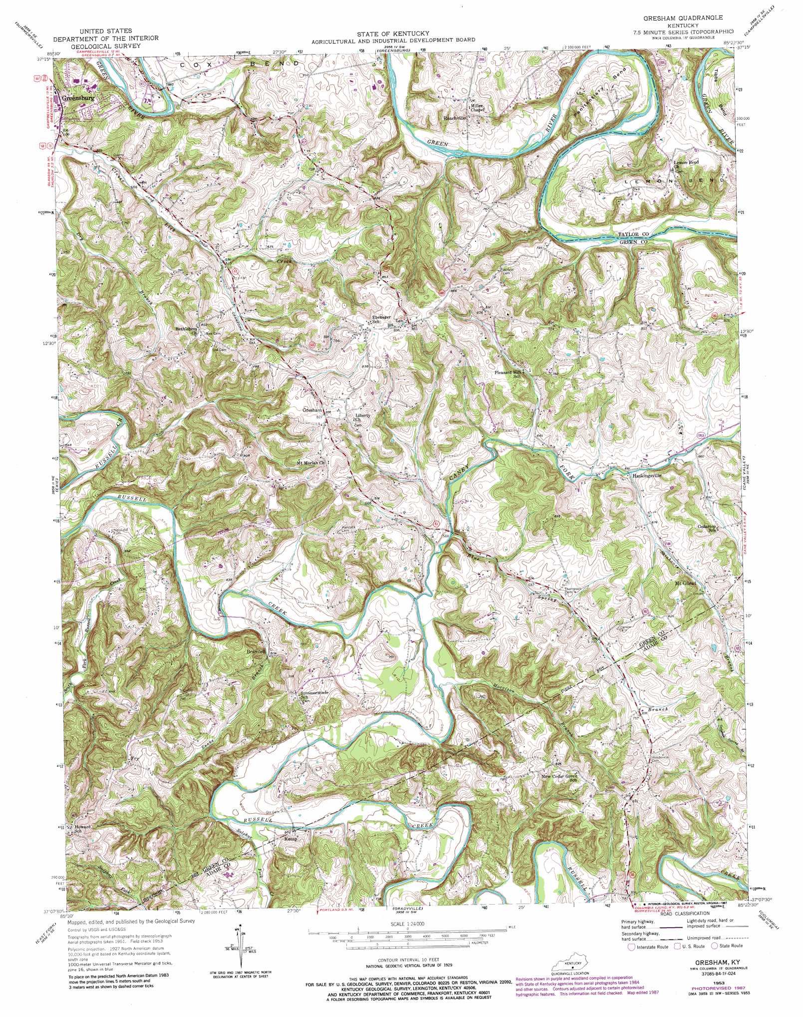
Gresham Topo Map Kentucky
To zoom in, hover over the map of Gresham
USGS Topo Quad 37085b4 - 1:24,000 scale
| Topo Map Name: | Gresham |
| USGS Topo Quad ID: | 37085b4 |
| Print Size: | ca. 21 1/4" wide x 27" high |
| Southeast Coordinates: | 37.125° N latitude / 85.375° W longitude |
| Map Center Coordinates: | 37.1875° N latitude / 85.4375° W longitude |
| U.S. State: | KY |
| Filename: | o37085b4.jpg |
| Download Map JPG Image: | Gresham topo map 1:24,000 scale |
| Map Type: | Topographic |
| Topo Series: | 7.5´ |
| Map Scale: | 1:24,000 |
| Source of Map Images: | United States Geological Survey (USGS) |
| Alternate Map Versions: |
Gresham KY 1953, updated 1955 Download PDF Buy paper map Gresham KY 1953, updated 1965 Download PDF Buy paper map Gresham KY 1953, updated 1968 Download PDF Buy paper map Gresham KY 1953, updated 1987 Download PDF Buy paper map Gresham KY 2010 Download PDF Buy paper map Gresham KY 2013 Download PDF Buy paper map Gresham KY 2016 Download PDF Buy paper map |
1:24,000 Topo Quads surrounding Gresham
Magnolia |
Hibernia |
Saloma |
Spurlington |
Bradfordsville |
Hudgins |
Summersville |
Greensburg |
Campbellsville |
Mannsville |
Center |
Exie |
Gresham |
Cane Valley |
Knifley |
Sulphur Well |
East Fork |
Gradyville |
Columbia |
Montpelier |
Summer Shade |
Edmonton |
Breeding |
Amandaville |
Creelsboro |
> Back to 37085a1 at 1:100,000 scale
> Back to 37084a1 at 1:250,000 scale
> Back to U.S. Topo Maps home
Gresham topo map: Gazetteer
Gresham: Bends
Lemon Bend elevation 238m 780′Penitentiary Bend elevation 197m 646′
Gresham: Populated Places
Bramlett elevation 186m 610′Fry elevation 262m 859′
Gresham elevation 254m 833′
Haskingsville elevation 195m 639′
Kemp elevation 183m 600′
Mount Gilead elevation 217m 711′
Roachville elevation 209m 685′
Gresham: Streams
Blue Spring Branch elevation 176m 577′Caney Fork elevation 174m 570′
Morrison Branch elevation 175m 574′
Skinhouse Branch elevation 194m 636′
Smith Branch elevation 201m 659′
Snake Branch elevation 179m 587′
South Fork Russell Creek elevation 169m 554′
Sulphur Fork Creek elevation 179m 587′
Gresham digital topo map on disk
Buy this Gresham topo map showing relief, roads, GPS coordinates and other geographical features, as a high-resolution digital map file on DVD: