Lebanon West Topo Map Kentucky
To zoom in, hover over the map of Lebanon West
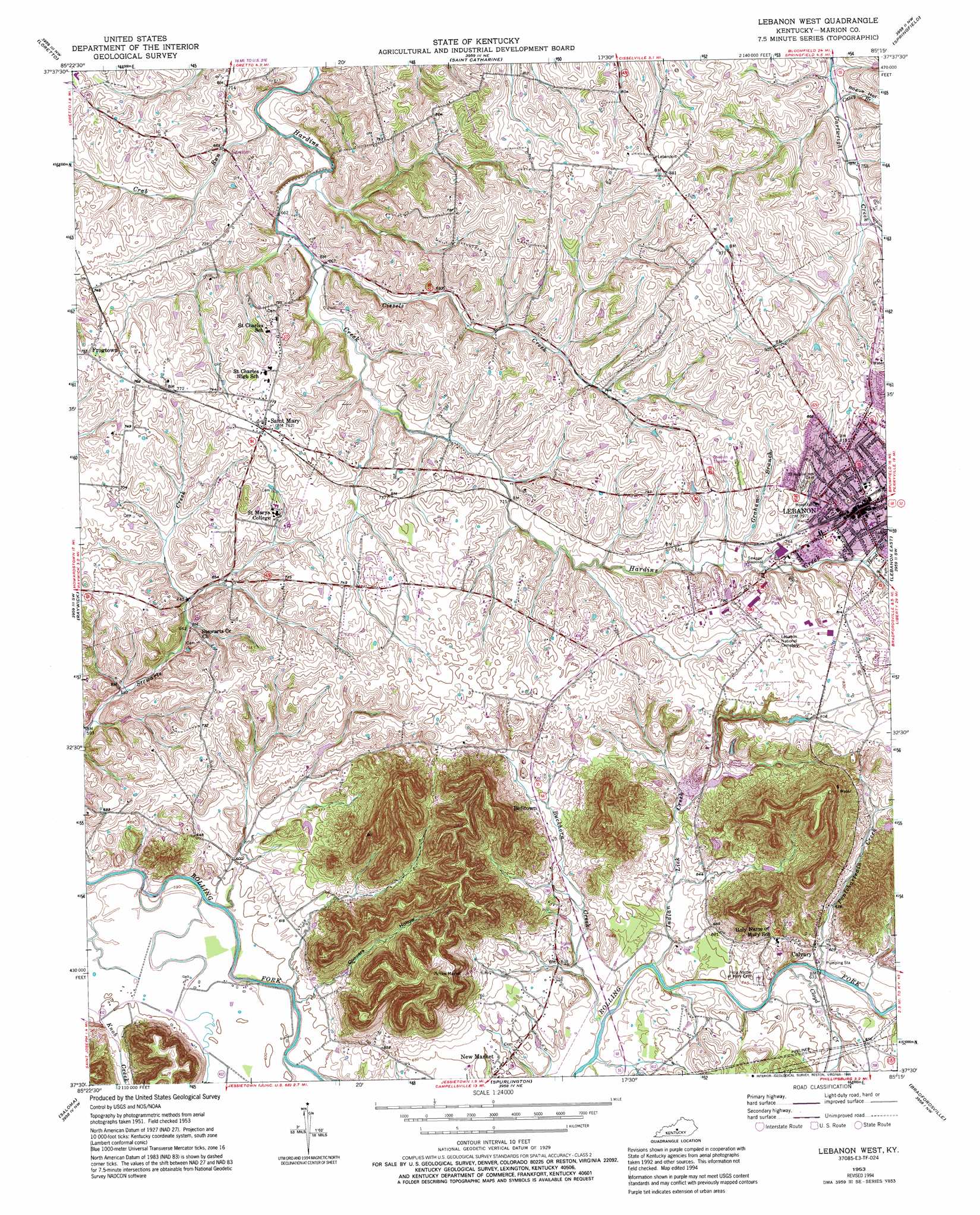
USGS Topo Quad 37085e3 - 1:24,000 scale
| Topo Map Name: | Lebanon West |
| USGS Topo Quad ID: | 37085e3 |
| Print Size: | ca. 21 1/4" wide x 27" high |
| Southeast Coordinates: | 37.5° N latitude / 85.25° W longitude |
| Map Center Coordinates: | 37.5625° N latitude / 85.3125° W longitude |
| U.S. State: | KY |
| Filename: | o37085e3.jpg |
| Download Map JPG Image: | Lebanon West topo map 1:24,000 scale |
| Map Type: | Topographic |
| Topo Series: | 7.5´ |
| Map Scale: | 1:24,000 |
| Source of Map Images: | United States Geological Survey (USGS) |
| Alternate Map Versions: |
Lebanon West KY 1953, updated 1968 Download PDF Buy paper map Lebanon West KY 2010 Download PDF Buy paper map Lebanon West KY 2013 Download PDF Buy paper map Lebanon West KY 2016 Download PDF Buy paper map |
1:24,000 Topo Quads surrounding Lebanon West
Cravens |
Bardstown |
Maud |
Brush Grove |
Cardwell |
New Haven |
Loretto |
Saint Catherine |
Springfield |
Mackville |
Howardstown |
Raywick |
Lebanon West |
Lebanon East |
Gravel Switch |
Hibernia |
Saloma |
Spurlington |
Bradfordsville |
Bradfordsville Ne |
Summersville |
Greensburg |
Campbellsville |
Mannsville |
Clementsville |
> Back to 37085e1 at 1:100,000 scale
> Back to 37084a1 at 1:250,000 scale
> Back to U.S. Topo Maps home
Lebanon West topo map: Gazetteer
Lebanon West: Populated Places
Belltown elevation 205m 672′Calvary elevation 195m 639′
Frogtown elevation 232m 761′
Lebanon elevation 241m 790′
New Market elevation 197m 646′
Saint Mary elevation 234m 767′
Lebanon West: Post Offices
Calvary Post Office (historical) elevation 194m 636′New Market Post Office (historical) elevation 199m 652′
Lebanon West: Streams
Buckhorn Creek elevation 186m 610′Casey Branch elevation 226m 741′
Cissels Creek elevation 201m 659′
Cloyd Creek elevation 188m 616′
Crab Run elevation 198m 649′
Graham Branch elevation 225m 738′
Hood Branch elevation 231m 757′
Indian Lick Creek elevation 186m 610′
Pontchartrain Creek elevation 186m 610′
Lebanon West: Valleys
Coopers Hollow elevation 181m 593′Rogue Hollow elevation 229m 751′
Lebanon West digital topo map on disk
Buy this Lebanon West topo map showing relief, roads, GPS coordinates and other geographical features, as a high-resolution digital map file on DVD: