Farmington Topo Map Missouri
To zoom in, hover over the map of Farmington
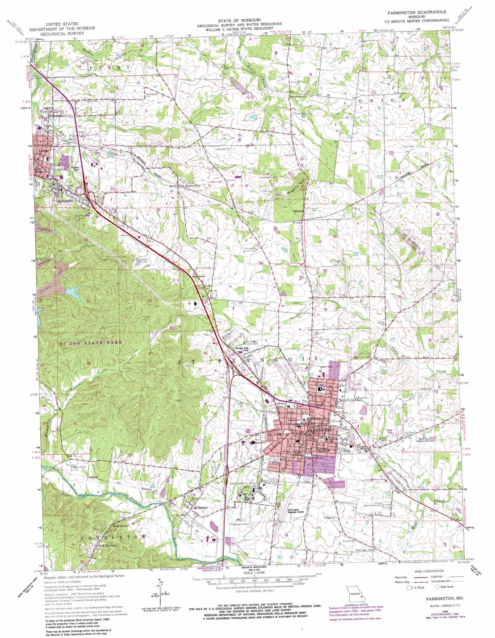
USGS Topo Quad 37090g4 - 1:24,000 scale
| Topo Map Name: | Farmington |
| USGS Topo Quad ID: | 37090g4 |
| Print Size: | ca. 21 1/4" wide x 27" high |
| Southeast Coordinates: | 37.75° N latitude / 90.375° W longitude |
| Map Center Coordinates: | 37.8125° N latitude / 90.4375° W longitude |
| U.S. State: | MO |
| Filename: | o37090g4.jpg |
| Download Map JPG Image: | Farmington topo map 1:24,000 scale |
| Map Type: | Topographic |
| Topo Series: | 7.5´ |
| Map Scale: | 1:24,000 |
| Source of Map Images: | United States Geological Survey (USGS) |
| Alternate Map Versions: |
Farmington MO 1964, updated 1965 Download PDF Buy paper map Farmington MO 1964, updated 1977 Download PDF Buy paper map Farmington MO 1964, updated 1982 Download PDF Buy paper map Farmington MO 2011 Download PDF Buy paper map Farmington MO 2015 Download PDF Buy paper map |
1:24,000 Topo Quads surrounding Farmington
Tiff |
Vineland |
Halifax |
Danby |
Bloomsdale |
Mineral Point |
Bonne Terre |
French Village |
Lawrenceton |
Weingarten |
Irondale |
Flat River |
Farmington |
Sprott |
Coffman |
Graniteville |
Iron Mountain Lake |
Wachita Mountain |
Knob Lick |
Womack |
Ironton |
Lake Killarney |
Rhodes Mountain |
Fredericktown |
Higdon |
> Back to 37090e1 at 1:100,000 scale
> Back to 37090a1 at 1:250,000 scale
> Back to U.S. Topo Maps home
Farmington topo map: Gazetteer
Farmington: Airports
Farmington Community Hospital Heliport elevation 274m 898′Farmington Regional Airport elevation 279m 915′
Farmington: Mines
Mine Number 10 elevation 288m 944′Mine Number 25 elevation 274m 898′
State Hospital Quarry (historical) elevation 280m 918′
Farmington: Parks
Columbia Park elevation 257m 843′Wilson Rozier Park elevation 287m 941′
Farmington: Populated Places
De Lassus elevation 273m 895′Esther elevation 246m 807′
Farmington elevation 278m 912′
Hurryville elevation 258m 846′
Leadington elevation 256m 839′
Ogborn elevation 289m 948′
Rock Springs elevation 287m 941′
Farmington: Springs
Rock Spring elevation 274m 898′Farmington: Streams
Blankshire Branch elevation 265m 869′Flanery Branch elevation 261m 856′
Kennedy Branch elevation 256m 839′
Farmington: Summits
Chalk Hill elevation 328m 1076′Wiggins Hill elevation 341m 1118′
Farmington digital topo map on disk
Buy this Farmington topo map showing relief, roads, GPS coordinates and other geographical features, as a high-resolution digital map file on DVD: