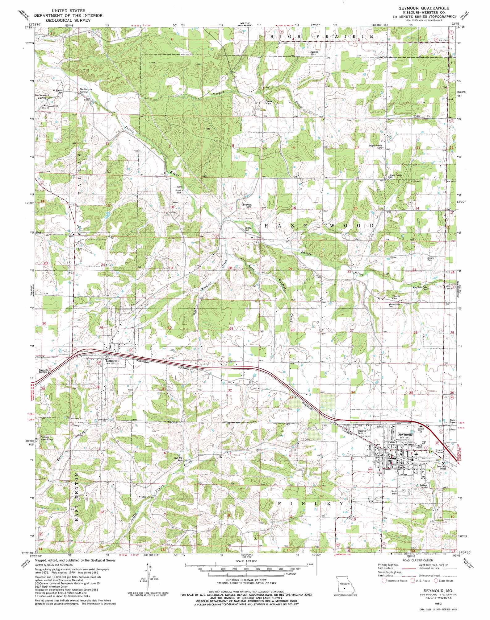
Seymour Topo Map Missouri
To zoom in, hover over the map of Seymour
USGS Topo Quad 37092b7 - 1:24,000 scale
| Topo Map Name: | Seymour |
| USGS Topo Quad ID: | 37092b7 |
| Print Size: | ca. 21 1/4" wide x 27" high |
| Southeast Coordinates: | 37.125° N latitude / 92.75° W longitude |
| Map Center Coordinates: | 37.1875° N latitude / 92.8125° W longitude |
| U.S. State: | MO |
| Filename: | o37092b7.jpg |
| Download Map JPG Image: | Seymour topo map 1:24,000 scale |
| Map Type: | Topographic |
| Topo Series: | 7.5´ |
| Map Scale: | 1:24,000 |
| Source of Map Images: | United States Geological Survey (USGS) |
| Alternate Map Versions: |
Seymour MO 1982, updated 1983 Download PDF Buy paper map Seymour MO 2011 Download PDF Buy paper map Seymour MO 2015 Download PDF Buy paper map |
1:24,000 Topo Quads surrounding Seymour
Elkland |
Beach |
Niangua |
Rader |
Grovespring |
Strafford |
Marshfield |
High Prarie |
Duncan |
Hartville |
Oak Grove Heights |
Fordland |
Seymour |
Mansfield Nw |
Mansfield Ne |
Rogersville |
Bruner |
Dogwood |
Cedar Gap |
Mansfield |
Chadwick |
Keltner |
Goodhope |
Ava |
Sweden |
> Back to 37092a1 at 1:100,000 scale
> Back to 37092a1 at 1:250,000 scale
> Back to U.S. Topo Maps home
Seymour topo map: Gazetteer
Seymour: Mines
Porter Mine elevation 431m 1414′Seymour: Parks
South Park elevation 501m 1643′Seymour: Populated Places
Diggins elevation 504m 1653′Finley Falls elevation 434m 1423′
Mountain Dale elevation 470m 1541′
Seymour elevation 501m 1643′
Seymour: Springs
McCormack Spring elevation 432m 1417′McElwain Spring elevation 421m 1381′
Seymour: Streams
East Wildcat Creek elevation 437m 1433′Teague Creek elevation 420m 1377′
West Wildcat Creek elevation 437m 1433′
Seymour digital topo map on disk
Buy this Seymour topo map showing relief, roads, GPS coordinates and other geographical features, as a high-resolution digital map file on DVD: