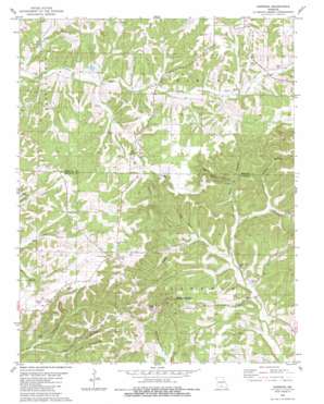
Dogwood Topo Map Missouri
To zoom in, hover over the map of Dogwood
USGS Topo Quad 37092a7 - 1:24,000 scale
| Topo Map Name: | Dogwood |
| USGS Topo Quad ID: | 37092a7 |
| Print Size: | ca. 21 1/4" wide x 27" high |
| Southeast Coordinates: | 37° N latitude / 92.75° W longitude |
| Map Center Coordinates: | 37.0625° N latitude / 92.8125° W longitude |
| U.S. State: | MO |
| Filename: | o37092a7.jpg |
| Download Map JPG Image: | Dogwood topo map 1:24,000 scale |
| Map Type: | Topographic |
| Topo Series: | 7.5´ |
| Map Scale: | 1:24,000 |
| Source of Map Images: | United States Geological Survey (USGS) |
| Alternate Map Versions: |
Dogwood MO 1982, updated 1983 Download PDF Buy paper map Dogwood MO 2011 Download PDF Buy paper map Dogwood MO 2015 Download PDF Buy paper map |
1:24,000 Topo Quads surrounding Dogwood
> Back to 37092a1 at 1:100,000 scale
> Back to 37092a1 at 1:250,000 scale
> Back to U.S. Topo Maps home
Dogwood topo map: Gazetteer
Dogwood: Populated Places
Depew elevation 483m 1584′Dogwood elevation 512m 1679′
Sarvis Point elevation 424m 1391′
Tigris elevation 358m 1174′
Dogwood: Post Offices
Depew Post Office (historical) elevation 483m 1584′Dogwood: Streams
Bad Branch elevation 389m 1276′Silvey Branch elevation 415m 1361′
Dogwood: Valleys
Big Spring Hollow elevation 388m 1272′Brixey Hollow elevation 379m 1243′
Buck Hollow elevation 383m 1256′
Cedar Hollow elevation 374m 1227′
Red Bank Hollow elevation 363m 1190′
Sand Hill Hollow elevation 371m 1217′
Dogwood digital topo map on disk
Buy this Dogwood topo map showing relief, roads, GPS coordinates and other geographical features, as a high-resolution digital map file on DVD:


