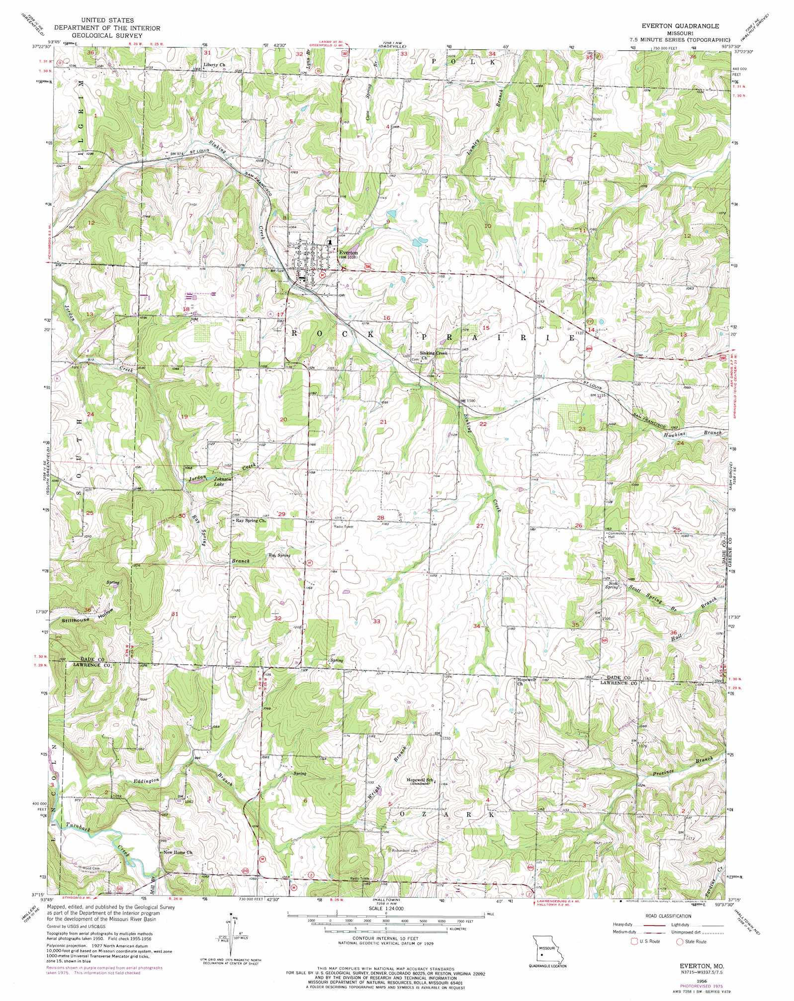
Everton Topo Map Missouri
To zoom in, hover over the map of Everton
USGS Topo Quad 37093c6 - 1:24,000 scale
| Topo Map Name: | Everton |
| USGS Topo Quad ID: | 37093c6 |
| Print Size: | ca. 21 1/4" wide x 27" high |
| Southeast Coordinates: | 37.25° N latitude / 93.625° W longitude |
| Map Center Coordinates: | 37.3125° N latitude / 93.6875° W longitude |
| U.S. State: | MO |
| Filename: | o37093c6.jpg |
| Download Map JPG Image: | Everton topo map 1:24,000 scale |
| Map Type: | Topographic |
| Topo Series: | 7.5´ |
| Map Scale: | 1:24,000 |
| Source of Map Images: | United States Geological Survey (USGS) |
| Alternate Map Versions: |
Everton MO 1956, updated 1957 Download PDF Buy paper map Everton MO 1956, updated 1976 Download PDF Buy paper map Everton MO 2011 Download PDF Buy paper map Everton MO 2015 Download PDF Buy paper map |
1:24,000 Topo Quads surrounding Everton
Cedarville |
Crisp |
Bona |
Aldrich |
Bolivar |
Lockwood |
Greenfield |
Dadeville |
Walnut Grove |
Morrisville |
Kings Point |
South Greenfield |
Everton |
Ash Grove |
Willard |
Rescue |
Miller |
Halltown |
Halltown Ne |
Brookline |
Stotts City |
Mount Vernon |
Chesapeake |
Billings |
Republic |
> Back to 37093a1 at 1:100,000 scale
> Back to 37092a1 at 1:250,000 scale
> Back to U.S. Topo Maps home
Everton topo map: Gazetteer
Everton: Populated Places
Emmett (historical) elevation 351m 1151′Everton elevation 332m 1089′
Everton: Reservoirs
Johnson Lake elevation 326m 1069′Everton: Springs
Ray Spring elevation 344m 1128′Scott Spring elevation 335m 1099′
Everton: Streams
Mill Branch elevation 296m 971′Ray Spring Branch elevation 320m 1049′
Scott Spring Branch elevation 314m 1030′
Wright Branch elevation 328m 1076′
Everton digital topo map on disk
Buy this Everton topo map showing relief, roads, GPS coordinates and other geographical features, as a high-resolution digital map file on DVD: