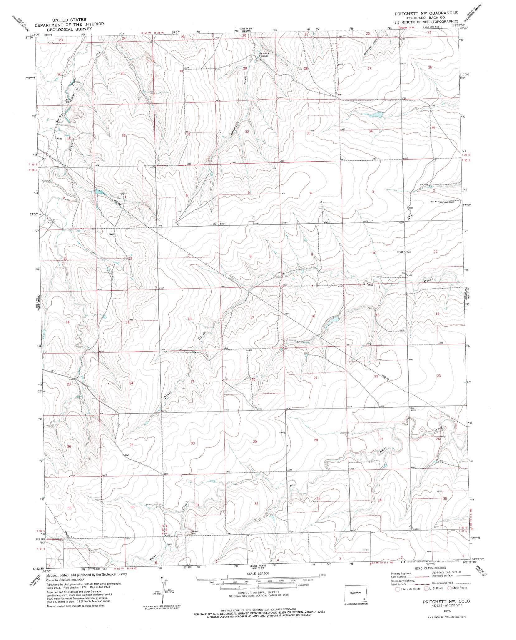
Pritchett Nw Topo Map Colorado
To zoom in, hover over the map of Pritchett Nw
USGS Topo Quad 37102d8 - 1:24,000 scale
| Topo Map Name: | Pritchett Nw |
| USGS Topo Quad ID: | 37102d8 |
| Print Size: | ca. 21 1/4" wide x 27" high |
| Southeast Coordinates: | 37.375° N latitude / 102.875° W longitude |
| Map Center Coordinates: | 37.4375° N latitude / 102.9375° W longitude |
| U.S. State: | CO |
| Filename: | o37102d8.jpg |
| Download Map JPG Image: | Pritchett Nw topo map 1:24,000 scale |
| Map Type: | Topographic |
| Topo Series: | 7.5´ |
| Map Scale: | 1:24,000 |
| Source of Map Images: | United States Geological Survey (USGS) |
| Alternate Map Versions: |
Pritchett NW CO 1978, updated 1978 Download PDF Buy paper map Pritchett NW CO 2011 Download PDF Buy paper map Pritchett NW CO 2013 Download PDF Buy paper map Pritchett NW CO 2016 Download PDF Buy paper map |
| FStopo: | US Forest Service topo Pritchett NW is available: Download FStopo PDF Download FStopo TIF |
1:24,000 Topo Quads surrounding Pritchett Nw
Ninaview |
Clay Ranch |
Pipe Spring |
Floating W Ranch |
Hasser Ranch |
Plug Hat Ranch |
Walker Canyon |
Deora |
Mcendree Ranch |
Big Rock Grange |
Buck Canyon |
Table Mesa |
Pritchett Nw |
Harbord |
Springfield West |
Andrix |
Utleyville |
Lone Rock |
Pritchett |
Springfield Sw |
Pintada Creek |
Carrizo Mountain |
Reader Lake |
Edler |
Campo Nw |
> Back to 37102a1 at 1:100,000 scale
> Back to 37102a1 at 1:250,000 scale
> Back to U.S. Topo Maps home
Pritchett Nw topo map: Gazetteer
Pritchett Nw: Dams
Plum Creek Stock Dam elevation 1461m 4793′Pritchett Nw: Populated Places
Graft elevation 1458m 4783′Pritchett Nw: Reservoirs
Plum Creek Stock Reservoir elevation 1461m 4793′Pritchett Nw: Trails
Granada - Fort Union Route of Santa Fe National Historic Trail elevation 1440m 4724′Pritchett Nw digital topo map on disk
Buy this Pritchett Nw topo map showing relief, roads, GPS coordinates and other geographical features, as a high-resolution digital map file on DVD: