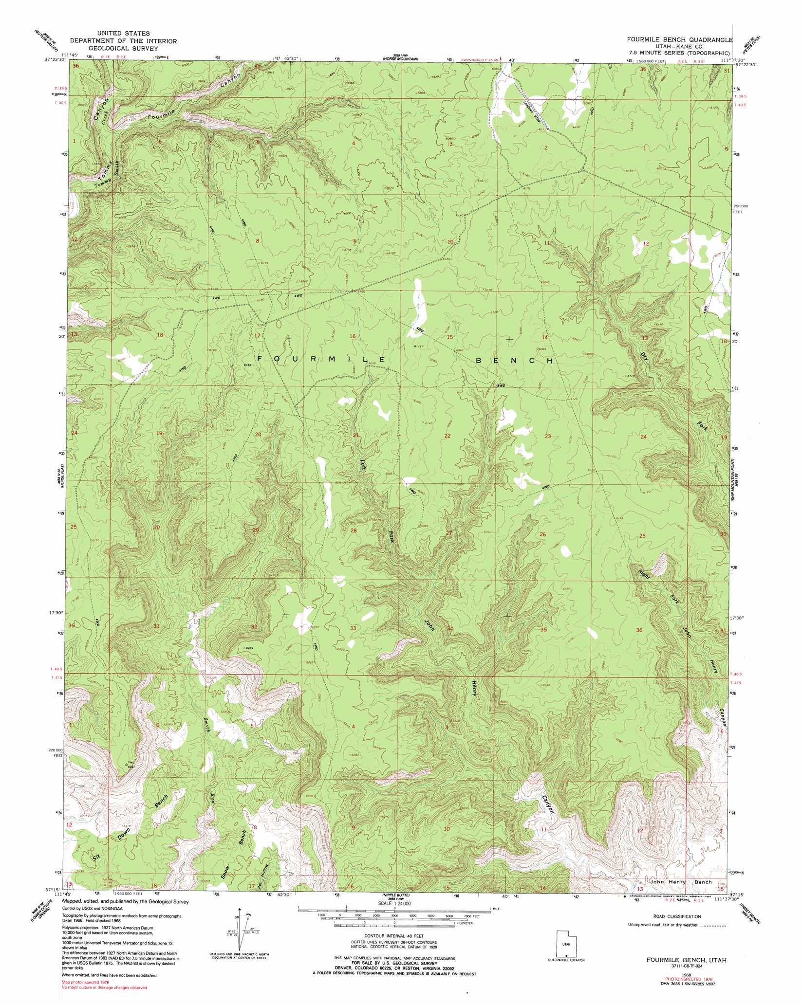
Fourmile Bench Topo Map Utah
To zoom in, hover over the map of Fourmile Bench
USGS Topo Quad 37111c6 - 1:24,000 scale
| Topo Map Name: | Fourmile Bench |
| USGS Topo Quad ID: | 37111c6 |
| Print Size: | ca. 21 1/4" wide x 27" high |
| Southeast Coordinates: | 37.25° N latitude / 111.625° W longitude |
| Map Center Coordinates: | 37.3125° N latitude / 111.6875° W longitude |
| U.S. State: | UT |
| Filename: | o37111c6.jpg |
| Download Map JPG Image: | Fourmile Bench topo map 1:24,000 scale |
| Map Type: | Topographic |
| Topo Series: | 7.5´ |
| Map Scale: | 1:24,000 |
| Source of Map Images: | United States Geological Survey (USGS) |
| Alternate Map Versions: |
Fourmile Bench UT 1968, updated 1970 Download PDF Buy paper map Fourmile Bench UT 1968, updated 1971 Download PDF Buy paper map Fourmile Bench UT 1968, updated 1991 Download PDF Buy paper map Fourmile Bench UT 2011 Download PDF Buy paper map Fourmile Bench UT 2014 Download PDF Buy paper map |
1:24,000 Topo Quads surrounding Fourmile Bench
Henrieville |
Canaan Peak |
Death Ridge |
Carcass Canyon |
Seep Flat |
Slickrock Bench |
Butler Valley |
Horse Mountain |
Petes Cove |
Collet Top |
Calico Peak |
Horse Flat |
Fourmile Bench |
Ship Mountain Point |
Needle Eye Point |
Fivemile Valley |
Lower Coyote Spring |
Nipple Butte |
Tibbet Bench |
Smoky Hollow |
West Clark Bench |
Bridger Point |
Glen Canyon City |
Lone Rock |
Warm Creek Bay |
> Back to 37111a1 at 1:100,000 scale
> Back to 37110a1 at 1:250,000 scale
> Back to U.S. Topo Maps home
Fourmile Bench topo map: Gazetteer
Fourmile Bench: Benches
Fourmile Bench elevation 1878m 6161′Fourmile Bench: Valleys
Fourmile Canyon elevation 1620m 5314′Fourmile Bench digital topo map on disk
Buy this Fourmile Bench topo map showing relief, roads, GPS coordinates and other geographical features, as a high-resolution digital map file on DVD: