Modena Topo Map Utah
To zoom in, hover over the map of Modena
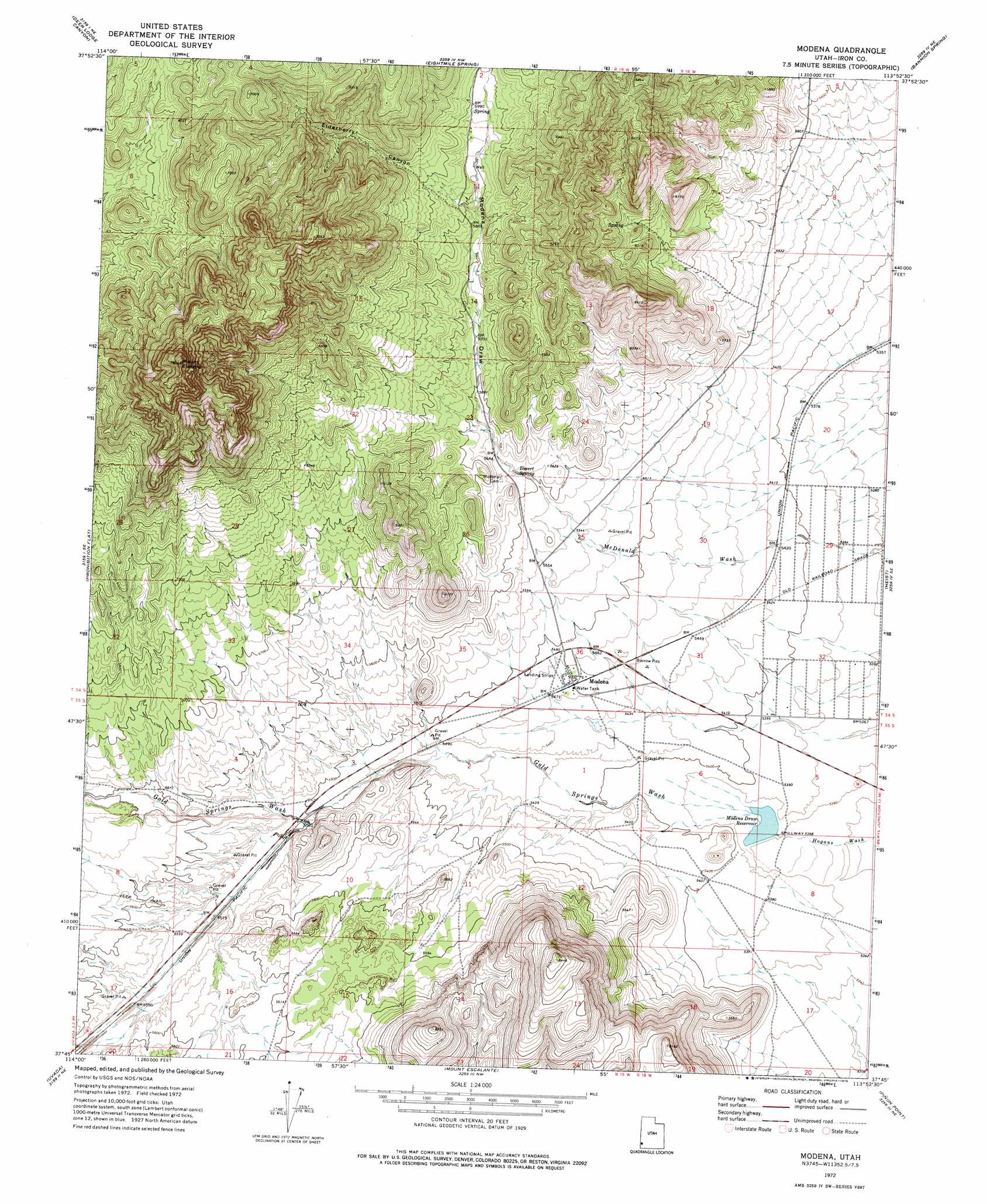
USGS Topo Quad 37113g8 - 1:24,000 scale
| Topo Map Name: | Modena |
| USGS Topo Quad ID: | 37113g8 |
| Print Size: | ca. 21 1/4" wide x 27" high |
| Southeast Coordinates: | 37.75° N latitude / 113.875° W longitude |
| Map Center Coordinates: | 37.8125° N latitude / 113.9375° W longitude |
| U.S. State: | UT |
| Filename: | o37113g8.jpg |
| Download Map JPG Image: | Modena topo map 1:24,000 scale |
| Map Type: | Topographic |
| Topo Series: | 7.5´ |
| Map Scale: | 1:24,000 |
| Source of Map Images: | United States Geological Survey (USGS) |
| Alternate Map Versions: |
Modena UT 1972, updated 1976 Download PDF Buy paper map Modena UT 2011 Download PDF Buy paper map Modena UT 2014 Download PDF Buy paper map |
1:24,000 Topo Quads surrounding Modena
Eagle Valley Reservoir |
Rice Mountain |
Steamboat Mountain Sw |
Steamboat Mountain |
Bible Spring |
Ursine |
Deer Lodge Canyon |
Eightmile Spring |
Bannion Spring |
Beryl |
Panaca Summit |
Prohibition Flat |
Modena |
Heist |
Yale Crossing |
Dow Mountain |
Uvada |
Mount Escalante |
Pinon Point |
Beryl Junction |
Acoma |
Pine Park |
Water Canyon Peak |
Hebron |
Enterprise |
> Back to 37113e1 at 1:100,000 scale
> Back to 37112a1 at 1:250,000 scale
> Back to U.S. Topo Maps home
Modena topo map: Gazetteer
Modena: Dams
Modena Dam elevation 1690m 5544′Modena Draw Dam elevation 1635m 5364′
Modena: Populated Places
Modena elevation 1669m 5475′Modena: Reservoirs
Modena City Reservoir elevation 1767m 5797′Modena Draw Reservoir elevation 1636m 5367′
Modena Reservoir elevation 1690m 5544′
Modena: Springs
Desert Spring elevation 1713m 5620′Modena: Streams
Gold Springs Wash elevation 1640m 5380′Modena: Summits
Mount Elenore elevation 2340m 7677′Modena: Valleys
Elderberry Canyon elevation 1782m 5846′Gold Springs Wash elevation 1640m 5380′
McDonald Wash elevation 1635m 5364′
Modena Draw elevation 1719m 5639′
Modena digital topo map on disk
Buy this Modena topo map showing relief, roads, GPS coordinates and other geographical features, as a high-resolution digital map file on DVD: