Bannion Spring Topo Map Utah
To zoom in, hover over the map of Bannion Spring
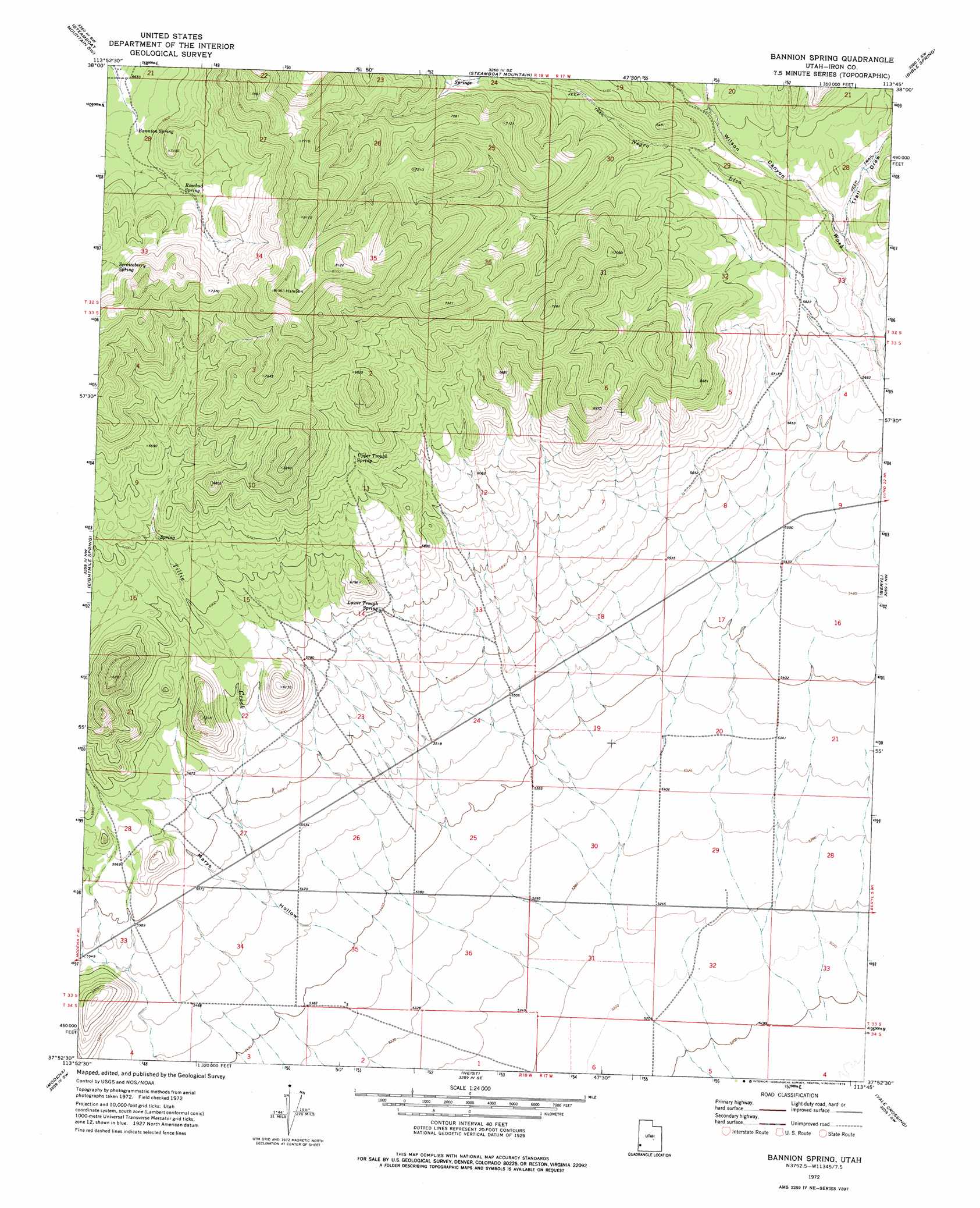
USGS Topo Quad 37113h7 - 1:24,000 scale
| Topo Map Name: | Bannion Spring |
| USGS Topo Quad ID: | 37113h7 |
| Print Size: | ca. 21 1/4" wide x 27" high |
| Southeast Coordinates: | 37.875° N latitude / 113.75° W longitude |
| Map Center Coordinates: | 37.9375° N latitude / 113.8125° W longitude |
| U.S. State: | UT |
| Filename: | o37113h7.jpg |
| Download Map JPG Image: | Bannion Spring topo map 1:24,000 scale |
| Map Type: | Topographic |
| Topo Series: | 7.5´ |
| Map Scale: | 1:24,000 |
| Source of Map Images: | United States Geological Survey (USGS) |
| Alternate Map Versions: |
Bannion Spring UT 1972, updated 1976 Download PDF Buy paper map Bannion Spring UT 2011 Download PDF Buy paper map Bannion Spring UT 2014 Download PDF Buy paper map |
1:24,000 Topo Quads surrounding Bannion Spring
White Rock Peak |
Atchison Creek |
Pinto Spring |
Observation Knoll |
The Tetons |
Rice Mountain |
Steamboat Mountain Sw |
Steamboat Mountain |
Bible Spring |
Mountain Spring Peak |
Deer Lodge Canyon |
Eightmile Spring |
Bannion Spring |
Beryl |
Zane |
Prohibition Flat |
Modena |
Heist |
Yale Crossing |
Clark Farm |
Uvada |
Mount Escalante |
Pinon Point |
Beryl Junction |
Newcastle |
> Back to 37113e1 at 1:100,000 scale
> Back to 37112a1 at 1:250,000 scale
> Back to U.S. Topo Maps home
Bannion Spring topo map: Gazetteer
Bannion Spring: Springs
Bannion Spring elevation 2050m 6725′Lower Trough Spring elevation 1766m 5793′
Rosebud Spring elevation 2097m 6879′
Serviceberry Spring elevation 2169m 7116′
Upper Trough Spring elevation 1936m 6351′
Bannion Spring: Streams
Tillie Creek elevation 1667m 5469′Bannion Spring: Valleys
Marys Hollow elevation 1646m 5400′Trail Draw elevation 1764m 5787′
Wilson Canyon elevation 1778m 5833′
Bannion Spring digital topo map on disk
Buy this Bannion Spring topo map showing relief, roads, GPS coordinates and other geographical features, as a high-resolution digital map file on DVD: