Crescent Spring Topo Map Nevada
To zoom in, hover over the map of Crescent Spring
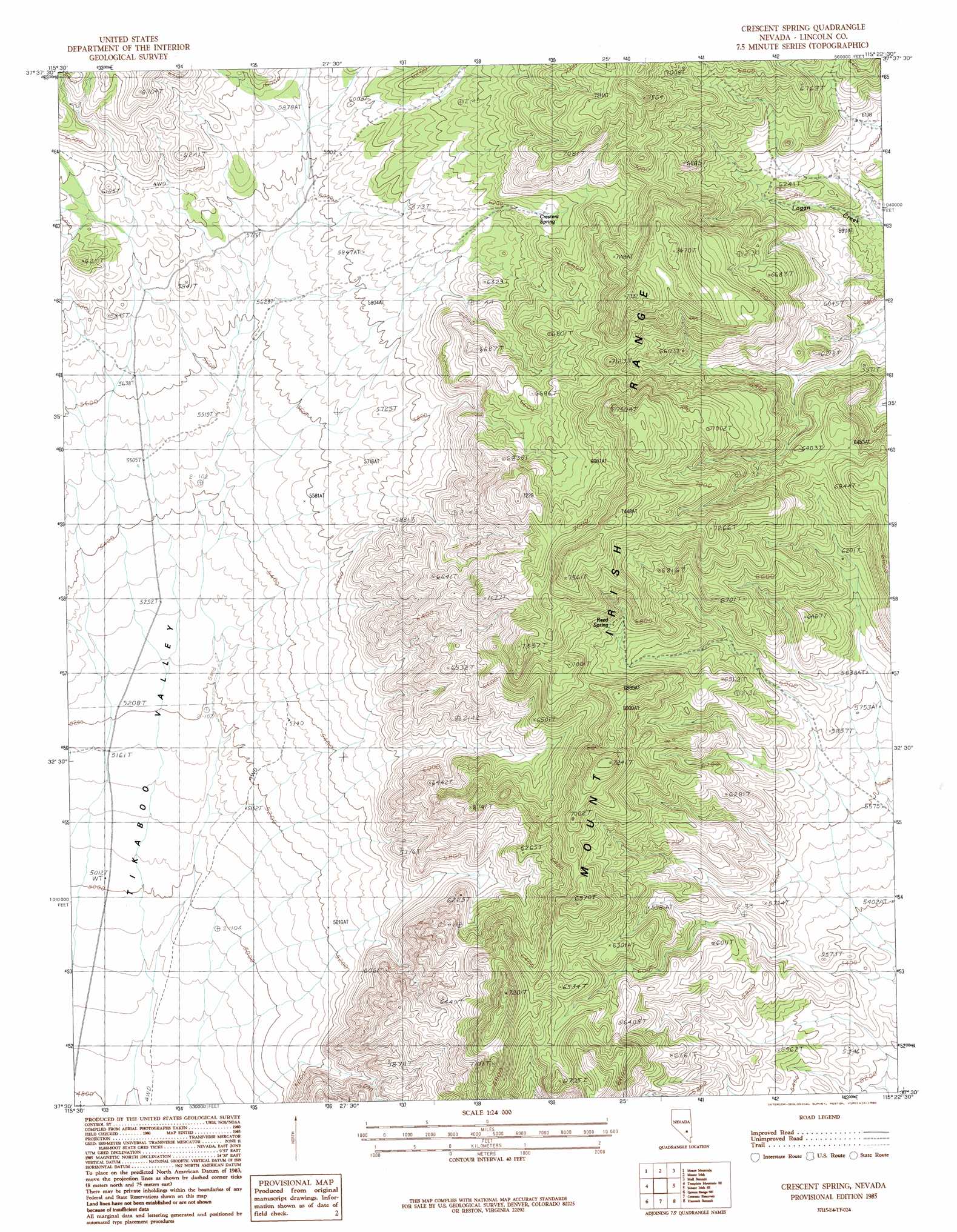
USGS Topo Quad 37115e4 - 1:24,000 scale
| Topo Map Name: | Crescent Spring |
| USGS Topo Quad ID: | 37115e4 |
| Print Size: | ca. 21 1/4" wide x 27" high |
| Southeast Coordinates: | 37.5° N latitude / 115.375° W longitude |
| Map Center Coordinates: | 37.5625° N latitude / 115.4375° W longitude |
| U.S. State: | NV |
| Filename: | o37115e4.jpg |
| Download Map JPG Image: | Crescent Spring topo map 1:24,000 scale |
| Map Type: | Topographic |
| Topo Series: | 7.5´ |
| Map Scale: | 1:24,000 |
| Source of Map Images: | United States Geological Survey (USGS) |
| Alternate Map Versions: |
Crescent Spring NV 1985, updated 1986 Download PDF Buy paper map Crescent Spring NV 2012 Download PDF Buy paper map Crescent Spring NV 2014 Download PDF Buy paper map |
1:24,000 Topo Quads surrounding Crescent Spring
Worthington Peak Sw |
Meeker Peak |
Murphy Gap |
Murphy Gap Se |
Seaman Wash |
Timpiute Mountain North |
Monte Mountain |
Mount Irish |
Mail Summit |
Fossil Peak |
Tempiute Mountain South |
Tempiute Mountain Se |
Crescent Spring |
Mount Irish Se |
Hiko |
Groom Range |
Groom Range Ne |
Crescent Reservoir |
Hancock Summit |
Ash Springs |
Groom Range Sw |
Groom Range Se |
Cutler Reservoir |
Badger Spring |
Alamo |
> Back to 37115e1 at 1:100,000 scale
> Back to 37114a1 at 1:250,000 scale
> Back to U.S. Topo Maps home
Crescent Spring topo map: Gazetteer
Crescent Spring: Mines
Crescent Mine elevation 1928m 6325′Crescent Spring: Populated Places
Logan (historical) elevation 1857m 6092′Crescent Spring: Post Offices
Logan Springs Post Office (historical) elevation 1857m 6092′Crescent Spring: Springs
Crescent Spring elevation 1913m 6276′Logan Spring elevation 2182m 7158′
Reed Spring elevation 2041m 6696′
Rye Grass Spring elevation 1962m 6437′
Tule Spring elevation 1642m 5387′
Crescent Spring digital topo map on disk
Buy this Crescent Spring topo map showing relief, roads, GPS coordinates and other geographical features, as a high-resolution digital map file on DVD: