Bahner Topo Map Missouri
To zoom in, hover over the map of Bahner
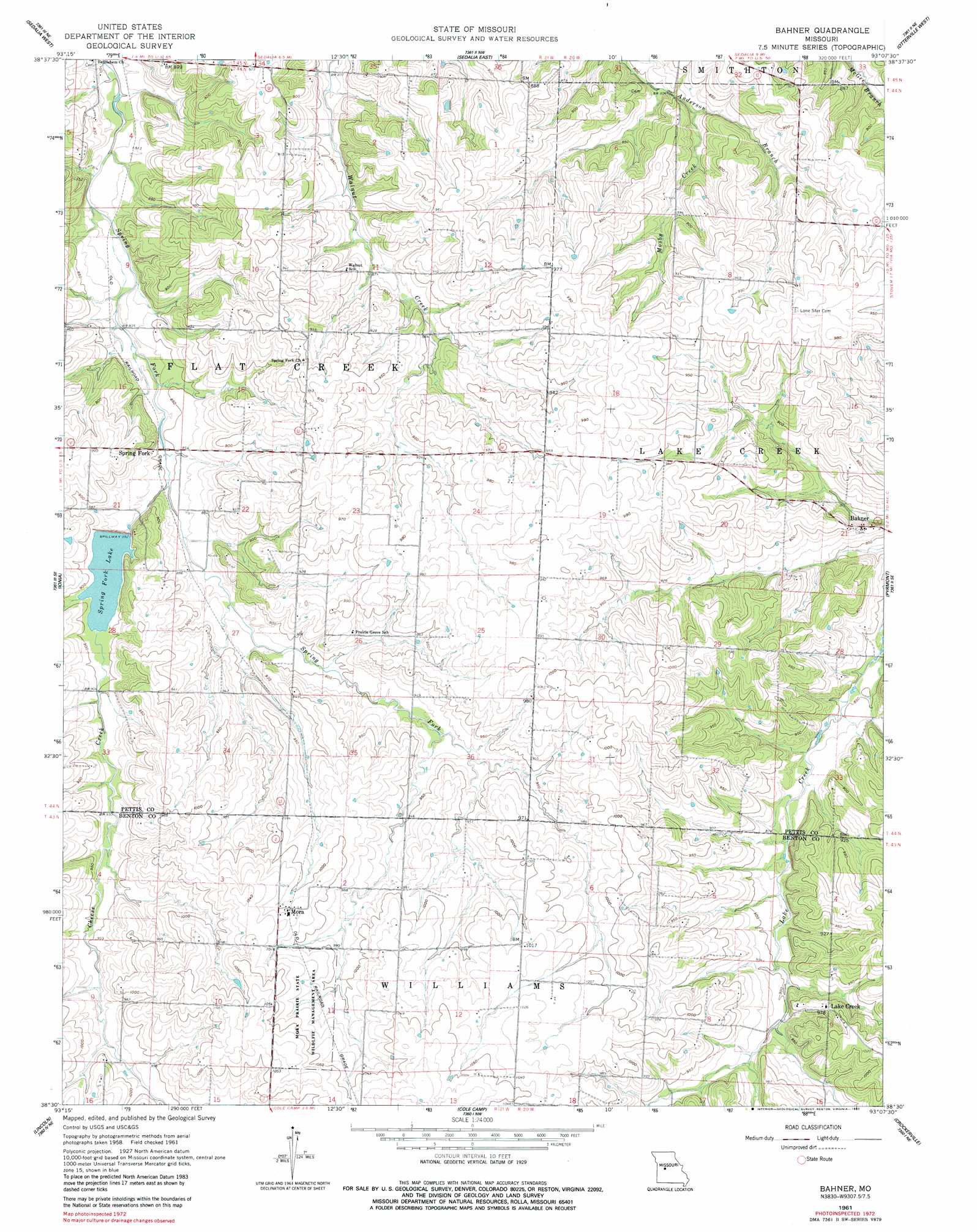
USGS Topo Quad 38093e2 - 1:24,000 scale
| Topo Map Name: | Bahner |
| USGS Topo Quad ID: | 38093e2 |
| Print Size: | ca. 21 1/4" wide x 27" high |
| Southeast Coordinates: | 38.5° N latitude / 93.125° W longitude |
| Map Center Coordinates: | 38.5625° N latitude / 93.1875° W longitude |
| U.S. State: | MO |
| Filename: | o38093e2.jpg |
| Download Map JPG Image: | Bahner topo map 1:24,000 scale |
| Map Type: | Topographic |
| Topo Series: | 7.5´ |
| Map Scale: | 1:24,000 |
| Source of Map Images: | United States Geological Survey (USGS) |
| Alternate Map Versions: |
Bahner MO 1961, updated 1962 Download PDF Buy paper map Bahner MO 1961, updated 1982 Download PDF Buy paper map Bahner MO 2011 Download PDF Buy paper map Bahner MO 2014 Download PDF Buy paper map |
1:24,000 Topo Quads surrounding Bahner
La Monte |
Hughesville |
Beaman |
Clifton City |
Pilot Grove South |
Green Ridge North |
Sedalia West |
Sedalia East |
Otterville West |
Otterville East |
Green Ridge South |
Ionia |
Bahner |
Pyrmont |
Florence |
Lincoln Nw |
Lincoln |
Cole Camp |
Crockerville |
Stover |
Shawnee Bend |
Lincoln Se |
Lakeview Heights |
Boylers Mill |
Proctor Creek |
> Back to 38093e1 at 1:100,000 scale
> Back to 38092a1 at 1:250,000 scale
> Back to U.S. Topo Maps home
Bahner topo map: Gazetteer
Bahner: Dams
Daum Lake Dam elevation 265m 869′Spring Fork Lake Dam elevation 272m 892′
Bahner: Populated Places
Bahner elevation 270m 885′Lake Creek elevation 297m 974′
Mora elevation 310m 1017′
Spring Fork elevation 275m 902′
Bahner: Reservoirs
Spring Fork Lake elevation 272m 892′Bahner: Streams
Cheese Creek elevation 258m 846′Mosby Creek elevation 248m 813′
Bahner digital topo map on disk
Buy this Bahner topo map showing relief, roads, GPS coordinates and other geographical features, as a high-resolution digital map file on DVD: