Green Ridge North Topo Map Missouri
To zoom in, hover over the map of Green Ridge North
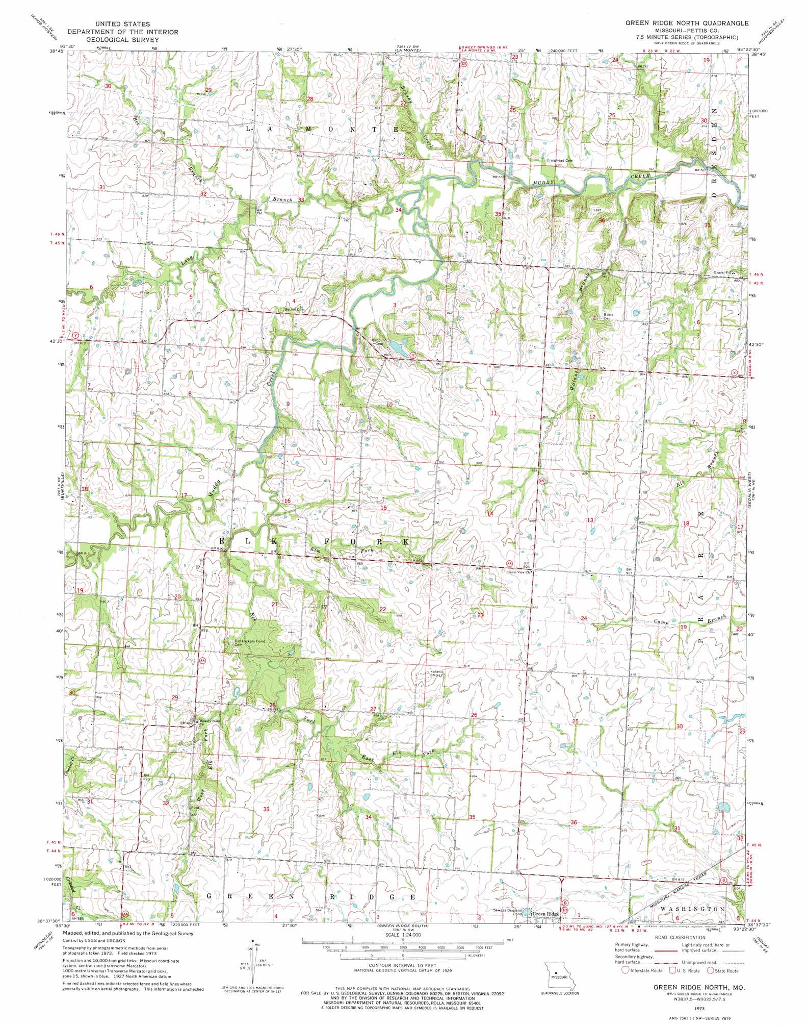
USGS Topo Quad 38093f4 - 1:24,000 scale
| Topo Map Name: | Green Ridge North |
| USGS Topo Quad ID: | 38093f4 |
| Print Size: | ca. 21 1/4" wide x 27" high |
| Southeast Coordinates: | 38.625° N latitude / 93.375° W longitude |
| Map Center Coordinates: | 38.6875° N latitude / 93.4375° W longitude |
| U.S. State: | MO |
| Filename: | o38093f4.jpg |
| Download Map JPG Image: | Green Ridge North topo map 1:24,000 scale |
| Map Type: | Topographic |
| Topo Series: | 7.5´ |
| Map Scale: | 1:24,000 |
| Source of Map Images: | United States Geological Survey (USGS) |
| Alternate Map Versions: |
Green Ridge North MO 1973, updated 1974 Download PDF Buy paper map Green Ridge North MO 2011 Download PDF Buy paper map Green Ridge North MO 2014 Download PDF Buy paper map |
1:24,000 Topo Quads surrounding Green Ridge North
Knob Noster Nw |
Concordia |
Sweet Springs |
Houstonia |
Longwood |
Warrensburg East |
Knob Noster |
La Monte |
Hughesville |
Beaman |
Cornelia |
Burtville |
Green Ridge North |
Sedalia West |
Sedalia East |
Leeton |
Windsor |
Green Ridge South |
Ionia |
Bahner |
Calhoun West |
Calhoun East |
Lincoln Nw |
Lincoln |
Cole Camp |
> Back to 38093e1 at 1:100,000 scale
> Back to 38092a1 at 1:250,000 scale
> Back to U.S. Topo Maps home
Green Ridge North topo map: Gazetteer
Green Ridge North: Dams
Hughes Lake Dam elevation 248m 813′Weston Lake Dam elevation 264m 866′
Green Ridge North: Streams
Bee Branch elevation 238m 780′Brushy Creek elevation 232m 761′
East Elk Fork elevation 253m 830′
Elk Fork elevation 239m 784′
Elm Fork elevation 242m 793′
Long Branch elevation 234m 767′
Walnut Branch elevation 230m 754′
West Elk Fork elevation 247m 810′
Green Ridge North digital topo map on disk
Buy this Green Ridge North topo map showing relief, roads, GPS coordinates and other geographical features, as a high-resolution digital map file on DVD: