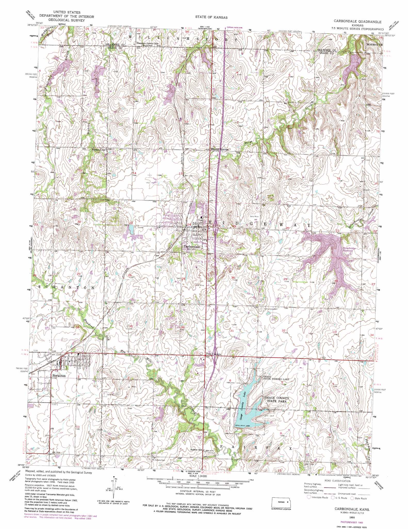
Carbondale Topo Map Kansas
To zoom in, hover over the map of Carbondale
USGS Topo Quad 38095g6 - 1:24,000 scale
| Topo Map Name: | Carbondale |
| USGS Topo Quad ID: | 38095g6 |
| Print Size: | ca. 21 1/4" wide x 27" high |
| Southeast Coordinates: | 38.75° N latitude / 95.625° W longitude |
| Map Center Coordinates: | 38.8125° N latitude / 95.6875° W longitude |
| U.S. State: | KS |
| Filename: | o38095g6.jpg |
| Download Map JPG Image: | Carbondale topo map 1:24,000 scale |
| Map Type: | Topographic |
| Topo Series: | 7.5´ |
| Map Scale: | 1:24,000 |
| Source of Map Images: | United States Geological Survey (USGS) |
| Alternate Map Versions: |
Carbondale KS 1955, updated 1956 Download PDF Buy paper map Carbondale KS 1955, updated 1973 Download PDF Buy paper map Carbondale KS 1955, updated 1983 Download PDF Buy paper map Carbondale KS 2009 Download PDF Buy paper map Carbondale KS 2012 Download PDF Buy paper map Carbondale KS 2015 Download PDF Buy paper map |
1:24,000 Topo Quads surrounding Carbondale
Willard |
Silver Lake |
Topeka |
Grantville |
Perry |
Dover |
Auburn |
Wakarusa |
Richland |
Clinton |
Harveyville |
Burlingame |
Carbondale |
Overbrook |
Globe |
Miller |
Osage City |
Lyndon Nw |
Vassar |
Ottawa Nw |
Reading |
Osage City Se |
Lyndon |
Quenemo |
Pomona |
> Back to 38095e1 at 1:100,000 scale
> Back to 38094a1 at 1:250,000 scale
> Back to U.S. Topo Maps home
Carbondale topo map: Gazetteer
Carbondale: Dams
Osage County State Lake Dam elevation 332m 1089′Scranton City Dam elevation 333m 1092′
Strowbridge Dam elevation 328m 1076′
Carbondale: Parks
Osage County State Park elevation 339m 1112′Osage State Fishing Lake elevation 339m 1112′
Carbondale: Populated Places
Carbondale elevation 343m 1125′Four Corners elevation 335m 1099′
Mineral Springs elevation 327m 1072′
Scranton elevation 342m 1122′
Carbondale: Post Offices
Carbondale Post Office elevation 328m 1076′Carbondale: Reservoirs
Osage County Lake elevation 332m 1089′Strowbridge Reservoir elevation 328m 1076′
Carbondale digital topo map on disk
Buy this Carbondale topo map showing relief, roads, GPS coordinates and other geographical features, as a high-resolution digital map file on DVD: